
Haridwar is a city and municipal corporation in the Haridwar district of Uttarakhand, India. With a population of 228,832 in 2011, it is the second-largest city in the state and the largest in the district.

The Yamuna is the second-largest tributary river of the Ganges by discharge and the longest tributary in India. Originating from the Yamunotri Glacier at a height of about 4,500 m (14,800 ft) on the southwestern slopes of Bandarpunch peaks of the Lower Himalaya in Uttarakhand, it travels a total length of 1,376 kilometres (855 mi) and has a drainage system of 366,223 square kilometres (141,399 sq mi), 40.2% of the entire Ganges Basin. It merges with the Ganges at Triveni Sangam, Allahabad, which is a site of the Kumbh Mela, a Hindu festival held every 12 years.

The Ghaghara River, called Karnali River in Nepal and Mapcha Tsangpo in Tibet, is a perennial trans-boundary river that originates in the northern slopes of the Himalayas in the Tibetan Plateau, cuts through the Himalayas in Nepal and joins the Sharda River at Brahmaghat in India. Together they form the Ghaghara River, a major left bank tributary of the Ganges. With a length of 507 km (315 mi) it is the longest river in Nepal. The total length of Ghaghara River up to its confluence with the Ganges at Revelganj in Bihar is 1,080 km (670 mi). It is the largest tributary of the Ganges by volume and the second largest by length after Yamuna.

The Chambal River is a tributary of the Yamuna River in Central and Northern India, and thus forms part of the drainage system of the Ganges. The river flows north-northeast through Madhya Pradesh, running for a time through Rajasthan then forming the boundary between Rajasthan and Madhya Pradesh before turning southeast to join the Yamuna in Uttar Pradesh state.
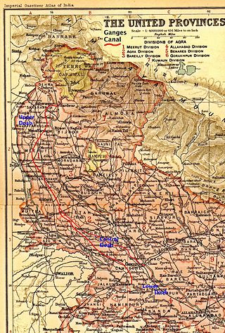
The Ganges Canal or Ganga Canal is a canal system that irrigates the Doab region between the Ganges River and the Yamuna River in India.

Haridwar district also spelled as Hardwar is a district in Garhwal which is a part of Uttarakhand, India. It is headquartered at Haridwar which is also its largest city. The district is ringed by the districts Dehradun in the north and east, Pauri Garhwal in the east and the Uttar Pradesh districts of Muzaffarnagar and Bijnor in the south and Saharanpur in the west.

Nagarjuna Sagar Dam is a masonry dam across the Krishna River at Nagarjuna Sagar which straddles the border between Nalgonda district in Telangana and Palnadu district in Andhra Pradesh. The dam provides irrigation water to the Nalgonda, Suryapet, Krishna, NTR, Bapatla, Eluru, Palnadu, Khammam, West Godavari, Guntur, and Prakasam districts along with electricity generation.

The Asan Barrage is a barrage in the Uttarakhand-Himachal Pradesh border region in Doon Valley,, northern India, situated at the confluence of the Eastern Yamuna Canal and the Asan River and about 11 km (7 mi) from Dakpathar, and 28 km. northwest of Dehradun in Uttarakhand. The barrage is 287.5m long and has water throughout the year which is fed from the river Asan and the discharge channel of the river Yamuna. Since 2020 it has been declared as Uttarakhand's first Ramsar site.

The Rana Pratap Sagar Dam is a gravity masonry dam of 53.8 metres (177 ft) height built on the Chambal River at Rawatbhata in Rajasthan in India. It is part of integrated scheme of a cascade development of the river involving four projects starting with the Gandhi Sagar Dam in the upstream reach in Madhya Pradesh and the Jawahar Sagar Dam on the downstream with a terminal structure of the Kota Barrage in Rajasthan for irrigation.
Bahadrabad is an intermediate Village Panchayat in the Haridwar district of Uttarakhand, India. It is one of the six development blocks in Haridwar district under which many developed villages come, including Atmalpur Bongla, Rohalki-Kishanpur, Alipur, Garhmeerpur, Khedli, Sitapur.
The Ichari Dam is a concrete gravity dam on the Tons River 13 km (8 mi) north of Dakpathar in Uttarakhand, India. The primary purpose of the dam is hydroelectric power production and it is a run-of-the-river-type. It was completed in 1972. The dam diverts water to the Chibro Power Station which is then returned to the Tons River before being fed to the Khodri Power Station.

The Dakpathar Barrage is a concrete barrage across the Yamuna River adjacent to Dakpathar in Uttarakhand, India. In a run-of-the-river scheme, the barrage serves to divert water into the East Yamuna Canal for hydroelectric power production at the Dhakrani and Dhalipur Power Plants. The foundation stone for the dam was laid on 23 May 1949 by India's Prime Minister Jawaharlal Nehru. The barrage is controlled by 25 floodgates and has a length of 516.5 m (1,695 ft).
The Dharasu Power Station is a run-of-the-river hydroelectric power station on the Bhagirathi River located at Dharasu in Uttarkashi district, Uttarakhand, India. The power station was commissioned in 2008 and has a 304 MW capacity.
The Pashulok Barrage is a barrage located on the Ganges River just south of Rishikesh in Dehradun district, Uttarakhand, India.

The Ramganga Dam, also known as the Kalagarh Dam, is an embankment dam on the Ramganga River 3 km (2 mi) upstream of Kalagarh in Pauri Garhwal district, Uttarakhand, India. It is located within the Jim Corbett National Park.
The Maneri Dam is a concrete gravity dam on the Bhagirathi River located at Maneri, 8.5 kilometres (5.3 mi) east of Uttarkashi in Uttarkashi district, Uttarakhand, India. The primary purpose of the dam is to divert water into a tunnel which feeds the 90 megawatts (120,000 hp) run-of-the-river Tiloth Power Plant.

Basava Sagar Dam, previously known as Narayanpura Dam, is a dam constructed across the Krishna River at Yadgir District, Karnataka State, India. The reservoir that it impounds is known as Basava Sagar, and has a total storage capacity of 37.965 tmcft (1.075 km³), with 30.5 tmcft (0.85 km³) live storage. The full reservoir level is 492.25 m MSL and the minimum draw down level is 481.6 m MSL. It was a single purpose project meant only for irrigation, but downstream electrical generation and drinking water considerations enter into its management. The dam is 29 meters high and over 10.637 kilometres (6.610 mi) long, and has 30 gates for water release. 22 Spillway Gates are present in the Dam It took Rs. 50.48 crore to complete.
Lakhwar-Vyasi Dam project on Yamuna River, includes under-construction Lakhwar Dam and Power Station, Vyasi Dam, Hathiari Power Station and Katapathar Barrage, near the Lakhwar town in Kalsi block of Dehradun district of Uttarakhand in India, for the purpose of irrigation of 40,000 hectare land and total 927 MW hydroelectric power generation. "Lakhwar Dam" is a gravity dam near the Lohari village with 300MW power generation capacity. "Vyasi Dam" will be built 5 km downstream along with 120 MW "Hathiari Power Station" further 0.5 km downstream. "Katapathar Barrage", with the maximum ponding water level at 514.5m elevation, will be built further 2.75 km downstream of the Hathiari Power Station to supply the water to stakeholder states. Project will hold 580 million cubic metres water during monsoon and release into Yamuna during dry months.
Uttar Pradesh Power Corporation Limited (UPPCL) is the company responsible for electricity transmission and distribution within the Indian state of Uttar Pradesh. The incumbent chairman is Shri M. Devraj.


