| Kedarnath | |
|---|---|
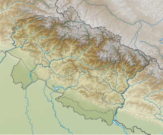 Kedarnath Location in India  Kedarnath Kedarnath (Tibet)  Kedarnath Kedarnath (India) | |
 Interactive map of Kedarnath | |
| Type | Mountain glacier |
| Location | Kumaon Himalayas, Uttarakhand, India |
| Coordinates | 30°48′N79°04′E / 30.8°N 79.07°E |
Kedarnath Glacier is located in Garhwal Himalaya mountain ranges, in the state of Uttarakhand, India. [1] [2]