Milam Glacier

Last updated

Milam
India Uttarakhand relief map.svg
Red pog.svg
Milam
Location in India
India relief location map.jpg
Red pog.svg
Milam
Milam (India)
TypeMountain glacier
Location Kumaon Himalayas, Uttarakhand, India
Coordinates 30°29′N80°6′E / 30.483°N 80.100°E / 30.483; 80.100 Coordinates: 30°29′N80°6′E / 30.483°N 80.100°E / 30.483; 80.100
Milam Glacier

Milam Glacier is a major glacier of the Kumaon Himalaya.

Contents

History

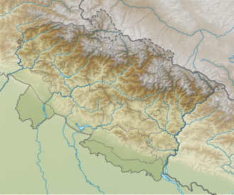
It is located in the tehsil of Munsiyari, part of the Pithoragarh district of Uttarakhand, India, about 15 kilometres (9 mi) northeast of Nanda Devi. It ranges in elevation from about 5,500 metres (18,000 ft) to about 3,870 metres (12,700 ft) at its snout. [1] It covers around 37 km2 (14 sq mi) and is 16 km (10 mi) long. Milam glacier was reopened in the year 1994. It was closed in 1962, so it was inaccessible for trekkers and other visitors. It is a popular destination among trekkers now. [2]

The suitable time to visit the glacier is from mid of March to May. Monsoons set in during the month June which herald the menace of landslides and roadblocks. [2]

The trekking for the Milam glacier commences from Munsiyari. [2]

Milam Glacier is situated on the south facing slope of the main Himalayan range. It originates from the eastern slope of Trishuli and the southern slope of its eastern subsidiary Kohli. The subsidiary glaciers coming off the peaks of Hardeol, Mangraon (6,568 m), Deo Damla (6,637 m), and Sakram (6,254 m) on the eastern rim of the Nanda Devi Sanctuary flow into it from the west, while on the east it is fed by glaciers from Nanda Gond (6,315 m) and Nanda Pal (6,306 m). [1] The glacier is the source of the Goriganga River. The village of Milam lies near the snout of the glacier; Munsiyari, further down the Goriganga valley, is the base for the trek to the glacier.

See also

Related Research Articles

Nanda Devi Second-highest mountain in India

Nanda Devi is the second-highest mountain in India, after Kangchenjunga, and the highest located entirely within the country. It is the 23rd-highest peak in the world.

Munsiari Sub-division in Uttarakhand, India

Munsiyari is the name of the sub-division headquarters, a conglomeration of revenue villages and it also refers to the entire region as Munsiyari Tehsil and Sub Division in the Pithoragarh District in the hill-state of Uttarakhand, India.

Namik Glacier is situated in the Pithoragarh district of Uttarakhand state in India.

Traills Pass

Pindari Kanda Traill's Pass is a mountain pass through the Himalayas located between Nanda Devi and Nanda Kot peaks in the Uttarakhand state in the districts of Pithoragarh and Bageshwar in India.

The Nanda Devi National Park or Nanda Devi Biosphere Reserve, established in 1982 is a national park situated around the peak of Nanda Devi in Chamoli Garhwal district of Uttarakhand, in northern India. The entire park lies at an elevation of more than 3,500 m (11,500 ft) above mean sea level.

Milam is the last village situated in Johar valley of Pithoragarh district in the state of Uttarakhand, India. The river Gori Ganga originates from Milam Glacier and flows past the village to meet with Kali ganga at Jauljibi.

Gori Ganga River in Uttarakhand, India

Gori Ganga is a river in the Munsiari tehsil of the Pithoragarh District, part of the state of Uttarakhand in northern India. Its principal source is the Milam Glacier, just northeast of Nanda Devi along with the Glaciers of the Ralam River, and the Pyunshani and Uttari & Dakshini Balati Glaciers that lie on the western face of the Panchachuli Peaks.

Sunanda Devi

Nanda Devi East, locally known as Sunanda Devi, is the lower of the two adjacent peaks of the highest mountain in Uttarakhand and second highest mountain in India; Nanda Devi is its higher twin peak. Nanda Devi and Nanda Devi East are part of the Garhwal Himalayas, and are located in the state of Uttarakhand. The graceful peaks of twin mountains are visible from almost everywhere in Kumaon. The first ascent to Nanda Devi East peak in recorded history appears to be in 1939 by Jakub Bujak and Janusz Klarner. The elevation of Nanda Devi East is 7,434 m (24,390 ft) and its prominence is 260 m (850 ft).

Vasuki Parbat

Vasuki Parbat or Vasuki Parvat is a mountain range of Garhwal Himalaya in Vasuki Glacier Uttarakhand, India, It has a subsidiary peak Vasuki south. Vasuki Parbat standing majestically at 6792 meter and the south peak 6702 meter. Its the 35th highest located entirely within the uttrakhand India. Nanda Devi, is the highest mountain in this category.

Satopanth South West also called P. 6770 is a mountain of the Garhwal Himalaya in Uttarakhand, India. The elevation of Satopanth south west is 6,770 metres (22,211 ft) and its prominence is 195 metres (640 ft). It is 40th highest located entirely within the Uttrakhand. Nanda Devi, is the highest mountain in this category. It lies in the same connecting ridge that joins Satopanth and Bhagirathi Parbat I. It lies 1.8 km SW of Satopanth. Its nearest higher neighbor Satopanth 7,075 metres (23,212 ft). It is located 3.4 km SE of Vasuki South 6,702 metres (21,988 ft) and 5.2 km NNW lies Bhagirathi I 6,856 metres (22,493 ft).

Devistan II is a mountain of the Garhwal Himalaya located in the Chamoli district of Uttarakhand, India. Devistan means land of Goddess. The elevation of Devistan II is 6,529 metres (21,421 ft) and its prominence is 214 metres (702 ft). It is 81st joint highest located entirely within the Uttrakhand. Nanda Devi, is the highest mountain in this category. It stands on the western rim of the Nanda Devi Sanctuary. It lies 1 km North of Devistan I 6,678 metres (21,909 ft) and 7.5 km NNE of Devtoli 6,788 metres (22,270 ft) its nearest higher neighbor. Trisul 7,120 metres (23,360 ft) lies 10.6 km WSW and 9.2 km ENE lies Nanda Devi 7,816 metres (25,643 ft).

Sakram is a mountain of the Garhwal Himalaya in Uttarakhand India. It's situated on the eastern rim of Nanda Devi Sanctuary on the watershed of Milam Glacier and Nanda Devi basin. The elevation of Sakram is 6,254 metres (20,518 ft) and its prominence is 134 metres (440 ft). It is 129th highest located entirely within the Uttrakhand. Nanda Devi, is the highest mountain in this category. It lies 1.2 km SSW of Lohar Deo 6,267 metres (20,561 ft) its nearest higher neighbor and 3.3 km SSE of Deo Damla 6,620 metres (21,719 ft). Kalanka 6,931 metres (22,740 ft) lies 11.9 km NNW and 8.7 km SW lies Nanda Devi 7,816 metres (25,643 ft).

Bamchu is a mountain of the Garhwal Himalaya in Uttarakhand India. It's situated on the eastern rim of Nanda Devi Sanctuary on the watershed of Milam Glacier and Nanda Devi basin. The elevation of Bamchu is 6,303 metres (20,679 ft) and its prominence is 241 metres (791 ft). It is 124th highest located entirely within the Uttrakhand. Nanda Devi, is the highest mountain in this category. It lies 3.4 km South of Deo Damla 6,620 metres (21,719 ft) its nearest higher neighbor and 3.1 km SSE of Mangraon 6,568 metres (21,549 ft). Kalanka 6,931 metres (22,740 ft) lies 9.8 km NNW and 9.3 km SW lies Nanda Devi 7,816 metres (25,643 ft).

Deo Damla is a mountain of the Garhwal Himalaya in Uttarakhand, India. It is situated in the eastern rim of Nanda Devi Sanctuary on the watershed of Milam Glacier and Nanda Devi basin. The elevation of Deo Damla is 6,620 metres (21,719 ft) and its prominence is 693 metres (2,274 ft). It is 63rd highest located entirely within the Uttrakhand. Nanda Devi, is the highest mountain in this category. It lies 1.8 km SSE of Mangraon 6,568 metres (21,549 ft). Its nearest higher neighbor Rishi Pahar 6,992 metres (22,940 ft) lies 8.3 km NNW and it is 10.6 km SSW of Nanda Devi 7,816 metres (25,643 ft). It lies 1.4 km north of Bamchu 6,303 metres (20,679 ft).

Mangraon is a mountain of the Garhwal Himalaya in Uttarakhand India. It is situated in the eastern rim of Nanda Devi Sanctuary on the watershed of Milam Glacier and Nanda Devi basin. The elevation of Mangraon is 6,568 metres (21,549 ft) and its prominence is 563 metres (1,847 ft). It is joint 71st highest located entirely within the Uttrakhand. Nanda Devi, is the highest mountain in this category. It lies 1.8 km SSE of Deo Damla 6,568 metres (21,549 ft) its nearest higher neighbor. Rishi Pahar 6,992 metres (22,940 ft) lies 6.5 km North and it is 11.8 km NNE of Nanda Devi 7,816 metres (25,643 ft). It lies 9.5 km north of Lhatu Dhura 6,387 metres (20,955 ft).

Lhatu Dhura is a mountain of the Garhwal Himalaya in Uttarakhand, India. It is situated in the eastern rim of the Nanda Devi Sanctuary, on the watershed of the Milam Glacier and the Nanda Devi basin. The elevation of Lhatu Dhura is 6,392 metres (20,971 ft) and its prominence is 229 metres (751 ft). It is joint 103rd highest mountain located entirely within Uttrakhand. It lies 4.6 km south of Sakram 6,254 metres (20,518 ft). Its nearest higher neighbor Nanda Devi East lies 4.5 km to the south west, and Deo Damla lies 7.7 km to the north; it is 6.1 km east-north-east of Nanda Devi, and 9.5 km south of Mangraon.

Lohar Deo is a mountain of the Garhwal Himalaya in Uttarakhand, India. It is situated in the eastern rim of Nanda Devi Sanctuary on the watershed of Milam Glacier and Nanda Devi basin. The elevation of Lohar Deo is 6,245 metres (20,489 ft) and its prominence is 222 metres (728 ft). It is joint 133rd highest located entirely within the Uttrakhand. Nanda Devi, is the highest mountain in this category. Lohar Deo situated between Sakram in the south west and Bamchu on the north west. It lies 1.2 km NNE of Sakram 6,254 metres (20,518 ft). Its nearest higher neighbor Deo Damla 6,620 metres (21,719 ft) lies 2.6 km NW. Bamchu 6,303 metres (20,679 ft) lies 1.8 km NW and it is 9.9 km NE of Nanda Devi 7,816 metres (25,643 ft). It lies 11.6 km SE of Kalanka 6,931 metres (22,740 ft).

Nanda Bhanar Mountain in Uttarakhand, India

Nanda Bhanar is a mountain of the Kumaun Himalaya in Uttarakhand India. The elevation of Nanda Bhanar is 6,236 metres (20,459 ft) and its prominence is 135 metres (443 ft). It is joint 134th highest located entirely within the Uttrakhand. Nanda Devi, is the highest mountain in this category. It lies 1.7 km SSW of Nanda Kot 6,861 metres (22,510 ft) its nearest higher neighbor. Dangthal 6,050 metres (19,849 ft) lies 5.5 km SSE and it is 15.2 km SSE of Nanda Devi 7,816 metres (25,643 ft). It lies 10.8 km north of Panwali Dwar 6,663 metres (21,860 ft).

Ronti Mountain in Uttarakhand, India

Ronti is a mountain of the Garhwal Himalaya in Uttarakhand India. It is situated on the western rim of Nanda Devi Sanctuary. The elevation of Ronti is 6,029 metres (19,780 ft) and its prominence is 435 metres (1,427 ft). It is 164th highest located entirely within the Uttrakhand. Nanda Devi, is the highest mountain in this category. It lies 2.4 km North of Nanda Ghunti 6,272 metres (20,577 ft) its nearest higher neighbor. Bethartoli 6,352 metres (20,840 ft) lies 6.6 km ENE and it is 8.4 km NNW of Trisul I 7,120 metres (23,360 ft). It lies 24.2 km west of Nanda Devi 7,816 metres (25,643 ft).

Ikualari is a mountain of the Kumaon Himalaya in Uttarakhand India. It is situated in the Nanda Devi range. The elevation of Ikualari is 6,059 metres (19,879 ft) and its prominence is 108 metres (354 ft). It is 165th highest located entirely within the Uttrakhand. Nanda Devi, is the highest mountain in this category. It lies 2.7 km NW of Nanda Gond 6,315 metres (20,719 ft). Nital Thaur 6,236 metres (20,459 ft) lies 4.8 km SSE and It lies 3.5 km SSE of Kholi 6,114 metres (20,059 ft). Hardeol 7,151 metres (23,461 ft) lies 8.9 km west of it.

References

  1. 1 2 Garhwal-Himalaya-Ost, 1:150,000 scale topographic map, prepared in 1992 by Ernst Huber for the Swiss Foundation for Alpine Research, based on maps of the Survey of India.
  2. 1 2 3 http://musetheplace.com/milam-glacier/