Airport West is a suburb in Melbourne, Victoria, Australia, 12 km (7.5 mi) north-west of Melbourne's Central Business District, located within the City of Moonee Valley local government area. Airport West recorded a population of 8,173 at the 2021 census.

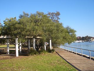
Inglewood is an inner-city suburb of Perth, Western Australia, 4 kilometres (2 mi) north-east of its central business district. It is located within the local government area of the City of Stirling.

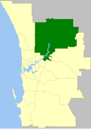
The City of Swan is a local government area of Western Australia. It is in the eastern metropolitan region of Perth and includes the Swan Valley and 42 suburbs. It is centred approximately 20 km north-east of the Perth central business district. The City covers an area of 1,042 km² and had an estimated population of 155,653 in 2020.
Cambridge is a suburb in the greater area of Hobart, capital of Tasmania, Australia. It is in the City of Clarence local government area. The suburb is situated in close proximity with Hobart International Airport and the Cambridge Aerodrome, and is approximately 18 km to Hobart via the Tasman Highway. In recent years Cambridge had developed an Industrial estate and has become a popular commuter town for people working in Hobart.

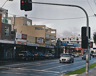
Lilyfield is a suburb in the Inner West of Sydney, in the state of New South Wales, Australia. Lilyfield is located 6 kilometres west of the Sydney central business district, in the local government area of the Inner West Council.

Leeming is a southern suburb of Perth, Western Australia. It is divided between the three local government areas of the City of Melville, the City of Cockburn (south) and the City of Canning (north-east). It is located approximately 17 kilometres (11 mi) south of the Perth central business district and 13 kilometres (8.1 mi) east of Fremantle.

The Shire of Ngaanyatjarraku is a remote local government area in Western Australia near the Northern Territory/South Australian border. It is 1,542 km (958 mi) from Perth.

Floreat is a residential suburb 8 kilometres (5 mi) west-northwest of the central business district of Perth, the capital of Western Australia. It is bordered on Underwood Avenue, Selby Street, Cromarty Road and Durston Road. It is the head of the Town of Cambridge, which has its municipal offices and library in the suburb. The name of the suburb stems from the Latin word for "flourish" or "prosper", which is also the motto of the City of Perth, of which Floreat was a part when it was first built.

Strathfieldsaye is a suburb of the Greater City of Bendigo in Victoria, Australia. It is located 9 kilometres (5.6 mi) south-east of the Bendigo CBD.
North Lake is a suburb located 18 kilometres (11 mi) south of the central business district of Perth, the capital of Western Australia, and 8 kilometres (5 mi) from the Indian Ocean. Named after the eponymous lake, the suburb and lake are located within the City of Cockburn local government area.

North Perth is a suburb of Perth, Western Australia, located within the City of Vincent.
High Wycombe is a suburb of Perth, Western Australia, within the City of Kalamunda. High Wycombe lies east of the Perth CBD at the base of the Darling Scarp. Formerly part of Maida Vale, the suburb was officially declared on 2 June 1978; its name, which was first used in 1958 by a subdivider, Western Agencies, refers to the town in Buckinghamshire where one of the partners in the firm was born.

Campbelltown is a suburb of Adelaide, South Australia. The population of the area was 7,003 in 2006. It is bordered in the north-west by the River Torrens, a river that is surrounded by parks and smaller creeks. Campbelltown is 8.7 km north-east of Adelaide. Lower North East Road crosses the middle of the suburb.

The Shire of Broome is one of the four local government areas in the Kimberley region of northern Western Australia, covering an area of 55,796 square kilometres (21,543 sq mi), most of which is sparsely populated. The Shire's estimated population as at the 2016 census was 16,222 most of whom reside in the town of Broome. Many Aboriginal communities are within the Shire, notably Beagle Bay and Bardi.

The City of Rockingham is a council and local government area, comprising the south coastal suburbs of the Western Australian capital city of Perth.

Bentleigh East is a suburb in Melbourne, Victoria, Australia, 14 km (8.7 mi) south-east of Melbourne's Central Business District, located within the City of Glen Eira local government area. Bentleigh East recorded a population of 30,159 at the 2021 census.
Bluff Point is a northern coastal suburb of Geraldton, Western Australia. Its local government area is the City of Greater Geraldton.

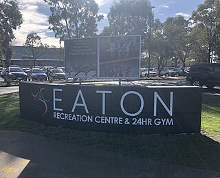
Eaton is a northeastern suburb of Bunbury, Western Australia, 7 km from the centre of Bunbury on the south shore of the Collie River. Its local government area is the Shire of Dardanup, and the offices for the Shire are located within the suburb. Eaton contains a state high school, Eaton Community College, and two state primary schools, Eaton and Glen Huon. The suburb also contains a shopping centre called Eaton Fair, as well as a sporting complex led by Eaton Recreation Centre.
Bilingurr is a northern suburb of Broome, Western Australia within the local government area of the Shire of Broome. Its population has increased from 231 at the 2006 Census to 1,354 at the 2016 census.


