Merseburg is a town in central Germany in southern Saxony-Anhalt, situated on the river Saale, and approximately 14 km south of Halle (Saale) and 30 km west of Leipzig. It is the capital of the Saalekreis district. It had a diocese founded by Archbishop Adalbert of Magdeburg. The University of Merseburg is located within the town. Merseburg has around 35,000 inhabitants.

Leisnig is a small town in the district of Mittelsachsen, in the state of Saxony in Germany, 50 kilometers southeast of Leipzig.

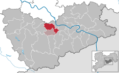
Harzgerode is a town in the district of Harz in Saxony-Anhalt, Germany.

Bad Gottleuba-Berggießhübel is a spa town in the district Sächsische Schweiz-Osterzgebirge in Saxony, Germany. The municipality borders the Czech Republic in the south. The municipality was formed on 1 January 1999 by the merger of the former municipalities Bad Gottleuba, Berggießhübel, Langenhennersdorf, and Bahratal. Surrounded by forests and near a water dam, Bad Gottleuba-Berggießhübel has several facilities including a spa health park, a plant garden, and a heated open air pool.

Reichenbach im Vogtland is a town in the Vogtlandkreis district of Saxony in eastern Germany. With a population of 20,108, it is the second-largest town in the Vogtlandkreis after Plauen. It is located close to the A72 between Plauen and Zwickau.

Bahretal is a municipality in the Sächsische Schweiz-Osterzgebirge district in Saxony, Germany. It is situated in the northeastern foothills of the Erzgebirge, between Bad Gottleuba-Berggießhübel and Dohna. It consists of several small villages, situated in the valleys of the rivers Bahre and Seidewitz as well as on the heights between the valleys.

Pegau is a town in the Leipzig district in Saxony, Germany, situated in a fertile plain, on the White Elster, 18 m. S.W. from Leipzig by the railway to Zeitz.

Königstein is a town on the Elbe river in Saxony in Germany. Königstein lies in the Sächsische Schweiz-Osterzgebirge District and had a population of 2,089 in 2018. It includes land on both banks of the Elbe, but the centre and most of the town lies to the south of the river. The Königstein Fortress is situated above and to the south-west of the town.

Möckern is a town in the Jerichower Land district, in Saxony-Anhalt, Germany. It is situated east of Magdeburg. The Battle of Möckern took place south of the town in 1813.

Flöha is a town in the district of Mittelsachsen, in Saxony, Germany. Flöha is situated on the confluence of the rivers Zschopau and Flöha, 10 km (6.21 mi) east of Chemnitz.

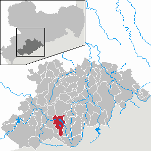
Wolkenstein is a town in the district Erzgebirgskreis, in Saxony, Germany. It is situated in the Ore Mountains, on the river Zschopau, 22 km southeast of Chemnitz.
Grünhainichen is a municipality in the district Erzgebirgskreis, in Saxony, Germany. On 1 March 2009, Grünhainichen and the neighboring municipality Waldkirchen were merged. On 1 January 2015, the former municipality Borstendorf became part of Grünhainichen.

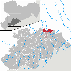
Boxberg is a municipality in the Görlitz district in Saxony, Germany. The place is known for its large Boxberg Power Station, that uses lignite as fuel.

Weischlitz is a municipality in the Vogtlandkreis district, in Saxony, Germany. It absorbed the former municipalities Kloschwitz and Kürbitz in 1999, Burgstein in 2011, and Reuth in 2017.

Hötensleben is a municipality in the Börde district in Saxony-Anhalt, Germany.
Raschau-Markersbach is a municipality in the district of Erzgebirgskreis in Saxony, Germany. It was formed on 1 January 2008, by the merger of the former municipalities Markersbach and Raschau.

Schirgiswalde-Kirschau is a town in the district of Bautzen, in Saxony, Germany. It was formed on January 1, 2011 by the merger of the former municipalities Schirgiswalde, Kirschau and Crostau.

Rosenbach is a municipality in the Vogtlandkreis district, in Saxony, Germany. It was formed on 1 January 2011 by the merger of the former municipalities Leubnitz, Mehltheuer and Syrau.

The Kulmer Steig is a synonym for the transport links from the Elbe valley over the eastern part of the Eastern Ore Mountains to Bohemian Chlumec u Chabařovic, hence the name which means "Kulm Trail". It is an ancient road system of partly derelict and unmetalled historic transport routes. These historic long-distance routes have been uncovered today thanks to archaeological discoveries. The routes all head south from the Elbe valley between Dresden and Pirna and cross the Eastern Ore Mountains over mountain passes on the Saxon side between Fürstenwalde in the west and Oelsen in the east. The lowest crossings are located near Mohelnice from where they continue via Habartice and the Geiersberg as well as Krasný Les and further on over the Nollendorf Pass to Chlumec. The Kulmer Steig was an especially good transport route because the road cut a passage through untamed wilderness and 30 kilometres could be covered in a day.

Dohna Castle on the once important medieval trade route from Saxony to Bohemia was the ancestral castle seat of the Burgraves of Dohna. Of the old, once imposing double castle only a few remnants of the walls remain. The ruins of the old castle are located on the hill of Schlossberg near the subsequent suburb of the town of the same name, Dohna, in the district of Sächsische Schweiz-Osterzgebirge in Saxony, Germany.