
Dolenje Grčevje is a dispersed settlement in the hills northwest of Otočec in the Municipality of Novo Mesto in southeastern Slovenia. The entire municipality lies in the traditional region of Lower Carniola and is now included in the Southeast Slovenia Statistical Region.
Dolenje Kamenje is a small settlement in the hills north of Novo Mesto in southeastern Slovenia. The entire Municipality of Novo Mesto lies in the traditional region of Lower Carniola and is now included in the Southeast Slovenia Statistical Region.
Dolenje Karteljevo is a settlement in the hills north of Novo Mesto in southeastern Slovenia. The entire Municipality of Novo Mesto lies in the traditional region of Lower Carniola and is now included in the Southeast Slovenia Statistical Region.
Dolenje Lakovnice is a settlement in the hills south of Novo Mesto in southeastern Slovenia. The entire Municipality of Novo Mesto lies in the traditional region of Lower Carniola and is now included in the Southeast Slovenia Statistical Region.
Vrhpolje pri Kamniku is a settlement in the Municipality of Kamnik in the Upper Carniola region of Slovenia. Urban expansion has turned it into a single continuous settlement with the neighbouring settlement of Nevlje. The main road from Kamnik into the Tuhinj Valley runs through Vrhpolje.
Apnenik is a settlement in the foothills of the Gorjanci range in the Municipality of Šentjernej in southeastern Slovenia. The area was traditionally part of Lower Carniola. It is now included in the Southeast Slovenia Statistical Region.
Dolenje Gradišče pri Šentjerneju is a settlement in the Municipality of Šentjernej in southeastern Slovenia. The area was traditionally part of Lower Carniola. It is now included in the Southeast Slovenia Statistical Region.
Dolenje Mokro Polje is a settlement in the Municipality of Šentjernej in southeastern Slovenia. The area was traditionally part of Lower Carniola. It is now included in the Southeast Slovenia Statistical Region. The village was first mentioned in 1227 as Unter Nassenfeld. Due to flooding, the villagers began to settle at a nearby location, where it still stands. Only a few ruins have survived at the old location. According to the 2003 census, there are 36 houses in the village. Villagers attend Saint Sigismund's Church in the neighboring village of Polhovica.
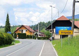
Gorenje Vrhpolje is a settlement southwest of Šentjernej in southeastern Slovenia. The area was traditionally part of Lower Carniola. It is now included in the Southeast Slovenia Statistical Region.
Žerjavin is a small settlement in the hills west of Dolenje Mokro Polje in the Municipality of Šentjernej in southeastern Slovenia. The entire municipality was traditionally part of Lower Carniola and is now included in the Southeast Slovenia Statistical Region.
Dolenje Kališče is a small abandoned settlement in the Municipality of Velike Lašče in Slovenia. It no longer has any permanent residents or a proper access road. The area is part of the traditional region of Lower Carniola and is now included in the Central Slovenia Statistical Region.

Vrhpolje pri Moravčah is a village in the Municipality of Moravče in central Slovenia. Traditionally the area was part of the Upper Carniola region. It is now included with the rest of the municipality in the Central Slovenia Statistical Region.
Dolenje Kamenje pri Dobrniču is a small settlement west of Dobrnič in the Municipality of Trebnje in eastern Slovenia. The area is part of the historical region of Lower Carniola. The Municipality of Trebnje is now included in the Southeast Slovenia Statistical Region.
Dolenje Medvedje Selo is a small settlement on the northern outskirts of Trebnje in eastern Slovenia. The area is part of the historical region of Lower Carniola and the Municipality of Trebnje is now included in the Southeast Slovenia Statistical Region.
Dolenje Ponikve is a settlement in the Municipality of Trebnje in eastern Slovenia. It lies on the road leading south from Dolenja Nemška Vas towards Mirna Peč and Novo Mesto. The area is part of the historical region of Lower Carniola. The municipality is now included in the Southeast Slovenia Statistical Region.
Dolenje Selce is a village in the Municipality of Trebnje in eastern Slovenia. The area is part of the historical region of Lower Carniola. The municipality is now included in the Southeast Slovenia Statistical Region.
Vrhpolje pri Šentvidu is a settlement east of Ivančna Gorica in the Lower Carniola region of Slovenia. The area is now included in the Central Slovenia Statistical Region.
Dolenje Gradišče may refer to the following places in Slovenia:
Gorenje Gradišče may refer to the following places in Slovenia:


