Ledeča Vas

Last updated
Ledeča Vas
Slovenia location map.svg
Red pog.svg
Ledeča Vas
Location in Slovenia
Coordinates: 45°50′38.43″N15°22′1.36″E / 45.8440083°N 15.3670444°E / 45.8440083; 15.3670444 Coordinates: 45°50′38.43″N15°22′1.36″E / 45.8440083°N 15.3670444°E / 45.8440083; 15.3670444
Country Flag of Slovenia.svg Slovenia
Traditional region Lower Carniola
Statistical region Southeast Slovenia
Municipality Šentjernej
Area
  Total 1.09 km2 (0.42 sq mi)
Elevation 171.3 m (562.0 ft)
Population (2002)
  Total 73
[1]

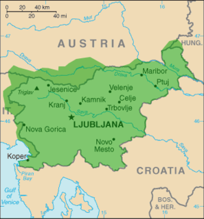
Ledeča Vas (pronounced  [lɛˈdeːtʃa ˈʋaːs] ; Slovene : Ledeča vas, German : Ladendorf [2] ) is a village east of Šentjernej, at the foot of the Gorjanci Hills in southeastern Slovenia. The area was traditionally part of Lower Carniola. It is now included in the Southeast Slovenia Statistical Region. [3]
Slovene language language spoken in Slovenia

Slovene or Slovenian belongs to the group of South Slavic languages. It is spoken by approximately 2.5 million speakers worldwide, the majority of whom live in Slovenia. It is the first language of about 2.1 million Slovenian people and is one of the 24 official and working languages of the European Union.

German language West Germanic language

German is a West Germanic language that is mainly spoken in Central Europe. It is the most widely spoken and official or co-official language in Germany, Austria, Switzerland, South Tyrol (Italy), the German-speaking Community of Belgium, and Liechtenstein. It is also one of the three official languages of Luxembourg and a co-official language in the Opole Voivodeship in Poland. The languages which are most similar to German are the other members of the West Germanic language branch: Afrikaans, Dutch, English, the Frisian languages, Low German/Low Saxon, Luxembourgish, and Yiddish. There are also strong similarities in vocabulary with Danish, Norwegian and Swedish, although those belong to the North Germanic group. German is the second most widely spoken Germanic language, after English.

Village Small clustered human settlement smaller than a town

A village is a clustered human settlement or community, larger than a hamlet but smaller than a town, with a population ranging from a few hundred to a few thousand. Though villages are often located in rural areas, the term urban village is also applied to certain urban neighborhoods. Villages are normally permanent, with fixed dwellings; however, transient villages can occur. Further, the dwellings of a village are fairly close to one another, not scattered broadly over the landscape, as a dispersed settlement.

The local church, built on a slight elevation next to a forest outside the main settlement, is dedicated to Saint Anne and belongs to the Parish of Šentjernej. It was mentioned in written documents dating to 1367, but was extensively rebuilt in the 17th and early 20th centuries. [4]

Church (building) building constructed for Christian worship

A church building or church house, often simply called a church, is a building used for Christian religious activities, particularly for Christian worship services. The term is often used by Christians to refer to the physical buildings where they worship, but it is sometimes used to refer to buildings of other religions. In traditional Christian architecture, the church is often arranged in the shape of a Christian cross. When viewed from plan view the longest part of a cross is represented by the aisle and the junction of the cross is located at the altar area.

Saint Anne mother of Virgin Mary in Christian and Islamic traditions; unnamed in the New Testament or Quran

According to apocryphal Christian and Islamic tradition, Saint Anne was the mother of Mary and grandmother of Jesus. Mary's mother is not named in the canonical gospels nor in the Qur'an. In writing, Anne's name and that of her husband Joachim come only from New Testament apocrypha, of which the Gospel of James seems to be the earliest that mentions them.

A parish is a territorial entity in many Christian denominations, constituting a division within a diocese. A parish is under the pastoral care and clerical jurisdiction of a parish priest, who might be assisted by one or more curates, and who operates from a parish church. Historically, a parish often covered the same geographical area as a manor. Its association with the parish church remains paramount.

Related Research Articles

Šentjernej Town and Municipality in Slovenia

Šentjernej is a small town and a municipality in southeastern Slovenia. The area was traditionally part of Lower Carniola. It is now included in the Southeast Slovenia Statistical Region.

Breška Vas Place in Lower Carniola, Slovenia

Breška Vas is a small settlement on the right bank of the Krka River in the Municipality of Šentjernej in southeastern Slovenia. The area was traditionally part of Lower Carniola. It is now included in the Southeast Slovenia Statistical Region.

Cerov Log Place in Lower Carniola, Slovenia

Cerov Log is a small settlement in the Gorjanci Hills in the Municipality of Šentjernej in southeastern Slovenia. Its territory extends right to the border with Croatia. The area was traditionally part of Lower Carniola. It is now included in the Southeast Slovenia Statistical Region.

Čadraže Place in Lower Carniola, Slovenia

Čadraže is a village on the right bank of the Krka River in the Municipality of Šentjernej in southeastern Slovenia. The area was traditionally part of Lower Carniola. It is now included in the Southeast Slovenia Statistical Region.

Dolenja Stara Vas Place in Lower Carniola, Slovenia

Dolenja Stara Vas is a settlement immediately southeast of the town of Šentjernej in southeastern Slovenia. The area was traditionally part of Lower Carniola. It is now included in the Southeast Slovenia Statistical Region. The village belongs to the Village Community of Grmovlje.

Gorenja Stara Vas Place in Lower Carniola, Slovenia

Gorenja Stara Vas is a village in the Municipality of Šentjernej in southeastern Slovenia. The area was traditionally part of Lower Carniola. It is now included in the Southeast Slovenia Statistical Region.

Gorenje Mokro Polje Place in Lower Carniola, Slovenia

Gorenje Mokro Polje is a settlement west of Šentjernej in southeastern Slovenia. The area was traditionally part of Lower Carniola. It is now included in the Southeast Slovenia Statistical Region.

Gorenje Vrhpolje Place in Lower Carniola, Slovenia

Gorenje Vrhpolje is a settlement southwest of Šentjernej in southeastern Slovenia. The area was traditionally part of Lower Carniola. It is now included in the Southeast Slovenia Statistical Region.

Groblje pri Prekopi in Lower Carniola, Slovenia

Groblje pri Prekopi is a settlement northeast of Šentjernej in southeastern Slovenia. The area was traditionally part of Lower Carniola. It is now included in the Southeast Slovenia Statistical Region.

Hrastje, Šentjernej Place in Lower Carniola, Slovenia

Hrastje is a small settlement in the foothills of the Gorjanci Hills in the Municipality of Šentjernej in southeastern Slovenia. The area was traditionally part of Lower Carniola. It is now included in the Southeast Slovenia Statistical Region.

Mihovica Place in Lower Carniola, Slovenia

Mihovica is a settlement on the right bank of the Krka River in the Municipality of Šentjernej in southeastern Slovenia. Traditional 19th-century farmhouses and outbuildings are preserved in the village core and it has been included on the Slovenian Ministry of Culture's register of national heritage. The area was traditionally part of Lower Carniola. It is now included in the Southeast Slovenia Statistical Region.

Mršeča Vas Place in Lower Carniola, Slovenia

Mršeča Vas is a settlement on the left bank of the Krka River in the Municipality of Šentjernej in southeastern Slovenia. The area was traditionally part of Lower Carniola. It is now included in the Southeast Slovenia Statistical Region.

Polhovica Place in Lower Carniola, Slovenia

Polhovica is a village in the Municipality of Šentjernej in southeastern Slovenia. Its territory extends to the woods west of the main settlement up to the banks of the Krka River. The entire municipality was traditionally part of Lower Carniola. It is now included in the Southeast Slovenia Statistical Region.

Rakovnik, Šentjernej Place in Lower Carniola, Slovenia

Rakovnik is a small settlement in the Municipality of Šentjernej in southeastern Slovenia. It lies in the foothills of the Gorjanci range. The entire municipality was traditionally part of Lower Carniola. It is now included in the Southeast Slovenia Statistical Region.

Šmalčja Vas Place in Lower Carniola, Slovenia

Šmalčja Vas is a settlement immediately north of the town of Šentjernej in southeastern Slovenia. The Municipality of Šentjernej was traditionally part of Lower Carniola. It is now included in the Southeast Slovenia Statistical Region.

Šmarje, Šentjernej Place in Lower Carniola, Slovenia

Šmarje is a settlement in the Municipality of Šentjernej in southeastern Slovenia. It was traditionally part of Lower Carniola and is now included in the Southeast Slovenia Statistical Region.

Tolsti Vrh, Šentjernej Place in Lower Carniola, Slovenia

Tolsti Vrh is a settlement in the foothills of the Žumberak/Gorjanci range in the Municipality of Šentjernej in southeastern Slovenia. It was traditionally part of Lower Carniola and is now included in the Southeast Slovenia Statistical Region.

Volčkova Vas Place in Lower Carniola, Slovenia

Volčkova Vas is a small settlement in the foothills of the Žumberak/Gorjanci range, southeast of Šentjernej in southeastern Slovenia. The entire Municipality of Šentjernej was traditionally part of Lower Carniola and is now included in the Southeast Slovenia Statistical Region.

Dobrava pri Škocjanu Place in Lower Carniola, Slovenia

Dobrava pri Škocjanu is a settlement in the Municipality of Škocjan in southeastern Slovenia. It lies on the left bank of the Krka River on the regional road leading south from Škocjan to Šentjernej. Within the municipality, it belongs to the Village Community of Dobrava pri Škocjanu and Tomažja Vas. The area is part of the historical region of Lower Carniola. The municipality is now included in the Southeast Slovenia Statistical Region.

Dobruška Vas Place in Lower Carniola, Slovenia

Dobruška Vas is a village in the Municipality of Škocjan in southeastern Slovenia. Within the municipality, it belongs to the Village Community of Grmovlje. It lies on the regional road leading south from Škocjan to Šentjernej. The A2 motorway runs just east of the settlement. The area is part of the historical region of Lower Carniola. The municipality is now included in the Southeast Slovenia Statistical Region. The settlement includes the hamlets of Cesta and Zatreb.

References

  1. Statistical Office of the Republic of Slovenia
  2. Leksikon občin kraljestev in dežel zastopanih v državnem zboru, vol. 6: Kranjsko. 1906. Vienna: C. Kr. Dvorna in Državna Tiskarna, p. 72.
  3. Šentjernej municipal site
  4. Slovenian Ministry of Culture register of national heritage reference number ešd 2438