Hrastje, Šentjernej

Last updated
Hrastje
Slovenia location map.svg
Red pog.svg
Hrastje
Location in Slovenia
Coordinates: 45°48′51.61″N15°17′54.68″E / 45.8143361°N 15.2985222°E / 45.8143361; 15.2985222 Coordinates: 45°48′51.61″N15°17′54.68″E / 45.8143361°N 15.2985222°E / 45.8143361; 15.2985222
Country Flag of Slovenia.svg Slovenia
Traditional region Lower Carniola
Statistical region Southeast Slovenia
Municipality Šentjernej
Area
  Total 1.14 km2 (0.44 sq mi)
Elevation 238.2 m (781.5 ft)
Population (2002)
  Total 95
[1]

Hrastje (pronounced  [ˈxɾaːstjɛ] ) is a small settlement in the foothills of the Gorjanci Hills in the Municipality of Šentjernej in southeastern Slovenia. The area was traditionally part of Lower Carniola. It is now included in the Southeast Slovenia Statistical Region. [2]

Municipality An administrative division having corporate status and usually some powers of self-government or jurisdiction

A municipality is usually a single administrative division having corporate status and powers of self-government or jurisdiction as granted by national and regional laws to which it is subordinate. It is to be distinguished (usually) from the county, which may encompass rural territory or numerous small communities such as towns, villages and hamlets.

Šentjernej Town and Municipality in Slovenia

Šentjernej is a small town and a municipality in southeastern Slovenia. The area was traditionally part of Lower Carniola. It is now included in the Southeast Slovenia Statistical Region.

Slovenia republic in Central Europe

Slovenia, officially the Republic of Slovenia, is a sovereign state located in southern Central Europe at a crossroads of important European cultural and trade routes. It is bordered by Italy to the west, Austria to the north, Hungary to the northeast, Croatia to the southeast, and the Adriatic Sea to the southwest. It covers 20,273 square kilometers (7,827 sq mi) and has a population of 2.07 million. One of the successor states of the former Yugoslavia, Slovenia is a parliamentary republic and a member of the United Nations, of the European Union, and of NATO. The capital and largest city is Ljubljana.

Contents

Name

The name Hrastje is derived from the Slovene common noun hrast 'oak', referring to the local vegetation. [3]

Castle

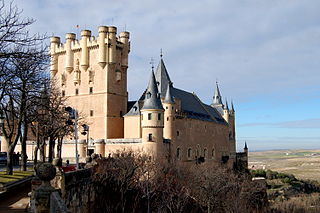
Gracar Turn is a 14th-century castle on the northern outskirts of the village. [4]

Gracar Turn is a 14th-century castle on the northern outskirts of Hrastje in the Municipality of Šentjernej in the traditional region of Lower Carniola in southeastern Slovenia.

Castle Fortified residential structure of medieval Europe

A castle is a type of fortified structure built during the Middle Ages by predominantly the nobility or royalty and by military orders. Scholars debate the scope of the word castle, but usually consider it to be the private fortified residence of a lord or noble. This is distinct from a palace, which is not fortified; from a fortress, which was not always a residence for royalty or nobility; and from a fortified settlement, which was a public defence – though there are many similarities among these types of construction. Usage of the term has varied over time and has been applied to structures as diverse as hill forts and country houses. Over the approximately 900 years that castles were built, they took on a great many forms with many different features, although some, such as curtain walls and arrowslits, were commonplace.

Related Research Articles

Hrastje, Maribor Place in Styria, Slovenia

Hrastje is a settlement southwest of Maribor in northeastern Slovenia. It belongs to the City Municipality of Maribor.

Hrastje–Mota Place in Styria, Slovenia

Hrastje–Mota is a settlement in the Municipality of Radenci in northeastern Slovenia. As its compound name indicates, it is made up of two settlements: the hamlets of Hrastje and Mota, both lying on the right bank of the Mura River.

Hrastje pri Cerkljah in Lower Carniola, Slovenia

Hrastje pri Cerkljah is a small village northwest of Cerklje ob Krki in the Municipality of Brežice in eastern Slovenia. The area was traditionally part of Lower Carniola. It is now included in the Lower Sava Statistical Region.

Apnenik, Šentjernej in Lower Carniola, Slovenia

Apnenik is a settlement in the foothills of the Gorjanci range in the Municipality of Šentjernej in southeastern Slovenia. The area was traditionally part of Lower Carniola. It is now included in the Southeast Slovenia Statistical Region.

Dobravica, Šentjernej Place in Lower Carniola, Slovenia

Dobravica is a settlement immediately west of the town of Šentjernej in southeastern Slovenia. The area was traditionally part of Lower Carniola. It is now included in the Southeast Slovenia Statistical Region.

Dolenja Brezovica, Šentjernej Place in Lower Carniola, Slovenia

Dolenja Brezovica is a settlement immediately to the south of Šentjernej in southeastern Slovenia. The area was traditionally part of Lower Carniola. It is now included in the Southeast Slovenia Statistical Region.

Gorenji Maharovec in Lower Carniola, Slovenia

Gorenji Maharovec is a settlement west of Šentjernej in southeastern Slovenia. The area was traditionally part of Lower Carniola and is now included in the Southeast Slovenia Statistical Region.

Orehovica, Šentjernej in Lower Carniola, Slovenia

Orehovica is a village southwest of Šentjernej in southeastern Slovenia. The area was traditionally part of Lower Carniola. It is now included in the Southeast Slovenia Statistical Region.

Pristava pri Šentjerneju in Lower Carniola, Slovenia

Pristava pri Šentjerneju is a settlement in the Municipality of Šentjernej in southeastern Slovenia. The entire Municipality of Šentjernej was traditionally part of Lower Carniola. It is now included in the Southeast Slovenia Statistical Region.

Pristavica, Šentjernej in Lower Carniola, Slovenia

Pristavica is a small settlement in the Municipality of Šentjernej in southeastern Slovenia. It lies on a slight elevation above the right bank of the Krka River southwest of Gorenja Gomila. The entire municipality was traditionally part of Lower Carniola. It is now included in the Southeast Slovenia Statistical Region.

Sela pri Šentjerneju in Lower Carniola, Slovenia

Sela pri Šentjerneju is a settlement south of Šentjernej in southeastern Slovenia. The Municipality of Šentjernej was traditionally part of Lower Carniola. It is now included in the Southeast Slovenia Statistical Region.

Šmalčja Vas Place in Lower Carniola, Slovenia

Šmalčja Vas is a settlement immediately north of the town of Šentjernej in southeastern Slovenia. The Municipality of Šentjernej was traditionally part of Lower Carniola. It is now included in the Southeast Slovenia Statistical Region.

Vratno in Lower Carniola, Slovenia

Vratno is a settlement in the Žumberak/Gorjanci Hills in the Municipality of Šentjernej in southeastern Slovenia. It was traditionally part of Lower Carniola and is now included in the Southeast Slovenia Statistical Region.

Vrh pri Šentjerneju in Lower Carniola, Slovenia

Vrh pri Šentjerneju is a small settlement west of Šentjernej in southeastern Slovenia. The entire Municipality of Šentjernej was traditionally part of Lower Carniola and is now included in the Southeast Slovenia Statistical Region.

Zameško in Lower Carniola, Slovenia

Zameško is a small settlement on the right bank of the Krka River in the Municipality of Šentjernej in southeastern Slovenia. The entire municipality was traditionally part of Lower Carniola and is now included in the Southeast Slovenia Statistical Region.

Hrastje, Šentjur in Styria, Slovenia

Hrastje is a settlement east of Dobrina in the Municipality of Šentjur in eastern Slovenia. Traditionally the entire area was part of the region of Styria. The Municipality of Šentjur is now included in the Savinja Statistical Region.

Hrastje pri Mirni Peči in Lower Carniola, Slovenia

Hrastje pri Mirni Peči is a small settlement in the Municipality of Mirna Peč in southeastern Slovenia. The area is part of the traditional region of Lower Carniola and is now included in the Southeast Slovenia Statistical Region.

Hrastje pri Grosupljem in Lower Carniola, Slovenia

Hrastje pri Grosupljem is a settlement between Grosuplje and Šmarje-Sap in central Slovenia. The Slovenian A2 motorway runs across the settlement's territory. The area is part of the historical region of Lower Carniola. The Municipality of Grosuplje is now included in the Central Slovenia Statistical Region.

Hrastje may refer to:

References

  1. Statistical Office of the Republic of Slovenia
  2. Šentjernej municipal site
  3. Snoj, Marko. 2009. Etimološki slovar slovenskih zemljepisnih imen. Ljubljana: Modrijan and Založba ZRC, p. 163.
  4. Slovenian Ministry of Culture register of national heritage reference number ešd 158