Javorovica

Last updated
Javorovica
Slovenia location map.svg
Red pog.svg
Javorovica
Location in Slovenia
Coordinates: 45°48′22.49″N15°21′27.58″E / 45.8062472°N 15.3576611°E / 45.8062472; 15.3576611 Coordinates: 45°48′22.49″N15°21′27.58″E / 45.8062472°N 15.3576611°E / 45.8062472; 15.3576611
Country Flag of Slovenia.svg Slovenia
Traditional region Lower Carniola
Statistical region Southeast Slovenia
Municipality Šentjernej
Area
  Total 8.58 km2 (3.31 sq mi)
Elevation 549.5 m (1,802.8 ft)
Population (2002)
  Total 38
[1]

Javorovica (pronounced  [ˈjaːʋɔɾɔʋitsa] ) is a village in the Gorjanci Hills in the Municipality of Šentjernej in southeastern Slovenia. Its territory extends southwards right to the border with Croatia. The area was traditionally part of Lower Carniola. It is now included in the Southeast Slovenia Statistical Region. [2]

Village Small clustered human settlement smaller than a town

A village is a clustered human settlement or community, larger than a hamlet but smaller than a town, with a population ranging from a few hundred to a few thousand. Though villages are often located in rural areas, the term urban village is also applied to certain urban neighborhoods. Villages are normally permanent, with fixed dwellings; however, transient villages can occur. Further, the dwellings of a village are fairly close to one another, not scattered broadly over the landscape, as a dispersed settlement.

Municipality An administrative division having corporate status and usually some powers of self-government or jurisdiction

A municipality is usually a single administrative division having corporate status and powers of self-government or jurisdiction as granted by national and regional laws to which it is subordinate. It is to be distinguished (usually) from the county, which may encompass rural territory or numerous small communities such as towns, villages and hamlets.

Šentjernej Town and Municipality in Slovenia

Šentjernej is a small town and a municipality in southeastern Slovenia. The area was traditionally part of Lower Carniola. It is now included in the Southeast Slovenia Statistical Region.

A former chapel dedicated to Saint Oswald has now been converted into a memorial to Partisans that died in the Gorjanci Hills during the Second World War. [3]
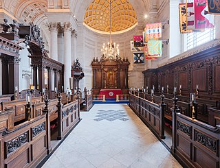
Chapel Religious place of fellowship attached to a larger institution

The term chapel usually refers to a Christian place of prayer and worship that is attached to a larger, often nonreligious institution or that is considered an extension of a primary religious institution. It may be part of a larger structure or complex, such as a college, hospital, palace, prison, funeral home, church, synagogue or mosque, located on board a military or commercial ship, or it may be an entirely free-standing building, sometimes with its own grounds. Chapel has also referred to independent or nonconformist places of worship in Great Britain—outside the established church.

Oswald of Northumbria King of Northumbria

Oswald was King of Northumbria from 634 until his death, and is venerated as a saint, of whom there was a particular cult in the Middle Ages.

Related Research Articles

Pangrč Grm Place in Lower Carniola, Slovenia

Pangrč Grm is a settlement in the foothills of the Gorjanci range in the Municipality of Novo Mesto in southeastern Slovenia. The area is part of the traditional region of Lower Carniola and is now included in the Southeast Slovenia Statistical Region.

Laze, Brežice in Lower Carniola, Slovenia

Laze is a small settlement in the eastern Gorjanci Hills in the Municipality of Brežice in eastern Slovenia. The area was traditionally part of Lower Carniola. It is now included in the Lower Sava Statistical Region.

Apnenik, Šentjernej Place in Lower Carniola, Slovenia

Apnenik is a settlement in the foothills of the Gorjanci range in the Municipality of Šentjernej in southeastern Slovenia. The area was traditionally part of Lower Carniola. It is now included in the Southeast Slovenia Statistical Region.

Brezje pri Šentjerneju in Lower Carniola, Slovenia

Brezje pri Šentjerneju is a small village at the foothills of the Gorjanci range in the Municipality of Šentjernej in southeastern Slovenia. The area was traditionally part of Lower Carniola and is now included in the Southeast Slovenia Statistical Region.

Cerov Log Place in Lower Carniola, Slovenia

Cerov Log is a small settlement in the Gorjanci Hills in the Municipality of Šentjernej in southeastern Slovenia. Its territory extends right to the border with Croatia. The area was traditionally part of Lower Carniola. It is now included in the Southeast Slovenia Statistical Region.

Dolenja Stara Vas Place in Lower Carniola, Slovenia

Dolenja Stara Vas is a settlement immediately southeast of the town of Šentjernej in southeastern Slovenia. The area was traditionally part of Lower Carniola. It is now included in the Southeast Slovenia Statistical Region. The village belongs to the Village Community of Grmovlje.

Dolenje Vrhpolje in Lower Carniola, Slovenia

Dolenje Vrhpolje is a settlement south of Šentjernej at the foot of the Gorjanci Hills in southeastern Slovenia. The area was traditionally part of Lower Carniola. It is now included in the Southeast Slovenia Statistical Region.

Drča in Lower Carniola, Slovenia

Drča is a village in the foothills of the Gorjanci Hills in the Municipality of Šentjernej in southeastern Slovenia. The area was traditionally part of Lower Carniola. It is now included in the Southeast Slovenia Statistical Region.

Hrastje, Šentjernej Place in Lower Carniola, Slovenia

Hrastje is a small settlement in the foothills of the Gorjanci Hills in the Municipality of Šentjernej in southeastern Slovenia. The area was traditionally part of Lower Carniola. It is now included in the Southeast Slovenia Statistical Region.

Imenje, Šentjernej in Lower Carniola, Slovenia

Imenje is a small settlement in the foothills of the Gorjanci Hills in the Municipalityof Šentjernej in southeastern Slovenia. The area was traditionally part of Lower Carniola. It is now included in the Southeast Slovenia Statistical Region.

Ledeča Vas Place in Lower Carniola, Slovenia

Ledeča Vas is a village east of Šentjernej, at the foot of the Gorjanci Hills in southeastern Slovenia. The area was traditionally part of Lower Carniola. It is now included in the Southeast Slovenia Statistical Region.

Mali Ban in Lower Carniola, Slovenia

Mali Ban is a small settlement in the foothills of the Gorjanci Hills in the Municipality of Šentjernej in southeastern Slovenia. The area was traditionally part of Lower Carniola. It is now included in the Southeast Slovenia Statistical Region.

Mihovo in Lower Carniola, Slovenia

Mihovo is a settlement in the Gorjanci Hills in the Municipality of Šentjernej in southeastern Slovenia. Its territory extends southwards right to the border with Croatia. The area was traditionally part of Lower Carniola. It is now included in the Southeast Slovenia Statistical Region.

Rakovnik, Šentjernej Place in Lower Carniola, Slovenia

Rakovnik is a small settlement in the Municipality of Šentjernej in southeastern Slovenia. It lies in the foothills of the Gorjanci range. The entire municipality was traditionally part of Lower Carniola. It is now included in the Southeast Slovenia Statistical Region.

Tolsti Vrh, Šentjernej Place in Lower Carniola, Slovenia

Tolsti Vrh is a settlement in the foothills of the Žumberak/Gorjanci range in the Municipality of Šentjernej in southeastern Slovenia. It was traditionally part of Lower Carniola and is now included in the Southeast Slovenia Statistical Region.

Veliki Ban in Lower Carniola, Slovenia

Veliki Ban is a settlement in the Žumberak/Gorjanci Hills in the Municipality of Šentjernej in southeastern Slovenia. To the south its territory extends right to the border with Croatia. It was traditionally part of Lower Carniola and is now included in the Southeast Slovenia Statistical Region.

Volčkova Vas Place in Lower Carniola, Slovenia

Volčkova Vas is a small settlement in the foothills of the Žumberak/Gorjanci range, southeast of Šentjernej in southeastern Slovenia. The entire Municipality of Šentjernej was traditionally part of Lower Carniola and is now included in the Southeast Slovenia Statistical Region.

Vratno in Lower Carniola, Slovenia

Vratno is a settlement in the Žumberak/Gorjanci Hills in the Municipality of Šentjernej in southeastern Slovenia. It was traditionally part of Lower Carniola and is now included in the Southeast Slovenia Statistical Region.

Vrbovce, Šentjernej Place in Lower Carniola, Slovenia

Vrbovce is a settlement in the foothills of the Žumberak/Gorjanci range in the Municipality of Šentjernej in southeastern Slovenia. It was traditionally part of Lower Carniola and is now included in the Southeast Slovenia Statistical Region.

Žerjavin in Lower Carniola, Slovenia

Žerjavin is a small settlement in the hills west of Dolenje Mokro Polje in the Municipality of Šentjernej in southeastern Slovenia. The entire municipality was traditionally part of Lower Carniola and is now included in the Southeast Slovenia Statistical Region.

References