
The Saale, also known as the Saxon Saale and Thuringian Saale, is a river in Germany and a left-bank tributary of the Elbe. It is not to be confused with the smaller Franconian Saale, a right-bank tributary of the Main, or the Saale in Lower Saxony, a tributary of the Leine.

Hildburghausen is a town in Thuringia in central Germany, capital of the Hildburghausen district.
Stadtroda is a town of 6,653 people (2017), located in Thuringia, Germany. Stadtroda lies on the river Roda, a tributary of the Saale. The former municipalities Bollberg and Quirla were merged into Stadtroda in January 2019.
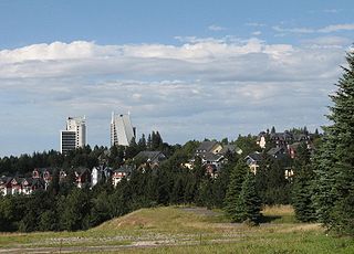
Oberhof is a town in the Schmalkalden-Meiningen district of Thuringia, Germany. Located in the Thuringian Forest mountain range, it is a winter sports center and health resort. With 1,625 inhabitants, it is visited by 144,000 tourists every year (2016). The town obtained its official city status in 1985.

Lucka is a town in the Thuringian landkreis of Altenburger Land.
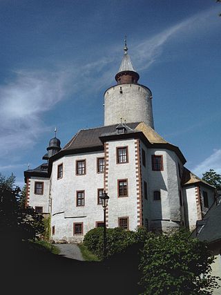
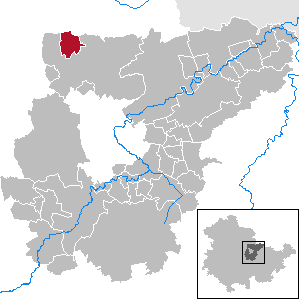
Dornburg is a town in the Saale-Holzland district, in Thuringia, Germany. It sits atop a small hill of 400 ft above the Saale. Since 1 December 2008, it is part of the town Dornburg-Camburg.
Posterstein is a German municipality in the Thuringian Landkreis of Altenburger Land.

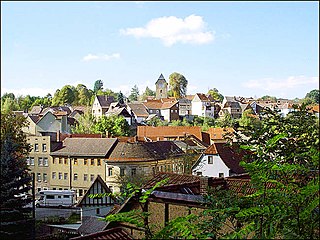
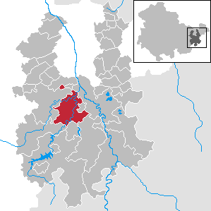
Bürgel is a town in the Saale-Holzland district, in Thuringia, Germany. It is situated 12 km east of Jena. It contains the Benedictine monastery of Bürgel Abbey.

Kaltennordheim is a town in the Schmalkalden-Meiningen district, in Thuringia, Germany. It is situated in the Rhön Mountains, 22 km southwest of Bad Salzungen, and 35 km east of Fulda. The former municipalities Aschenhausen, Kaltensundheim, Kaltenwestheim, Melpers, Oberkatz und Unterweid were merged into Kaltennordheim in January 2019. At the same time, Kaltennordheim passed from the Wartburgkreis to Schmalkalden-Meiningen.
Kranichfeld is a town in the Weimarer Land district, in Thuringia. It is situated on the river Ilm, 18 km southeast of Erfurt, and 16 km southwest of Weimar.
Neumark is a town in the Weimarer Land district, in Thuringia, Germany. It is situated 20 km northeast of Erfurt, and 12 km northwest of Weimar. Neumark is the second-least populous town (Stadt) in Germany, and is the least populous in what was formerly East Germany.

Rastenberg is a town in the district of Sömmerda, in Thuringia, Germany. It is situated 22 km east of Sömmerda, and 23 km northeast of Weimar.

Ronneburg is a town in the district of Greiz, in Thuringia, Germany. It is situated 7 km east of Gera.

Triptis is a town in the Saale-Orla-Kreis district, in Thuringia, Germany. It is situated 22 km southwest of Gera. The town is the seat of the municipal association Triptis.
Weida is a town in the district of Greiz, in Thuringia, Germany, situated 12 km south of Gera on the river Weida.

Hohenfelden is a municipality in the Weimarer Land district of Thuringia, Germany.

Dornburg is a municipality in the Westerwald in Limburg-Weilburg district in Hesse, Germany.

Nobitz is a municipality in the district Altenburger Land, in Thuringia, Germany. The nearby Nobitz airfield was used by Ryanair for flights to and from London Stansted between 2003 and 2011.

Dorndorf-Steudnitz is a former municipality in the district Saale-Holzland, in Thuringia, Germany. Since 1 December 2008, it is part of the town Dornburg-Camburg.
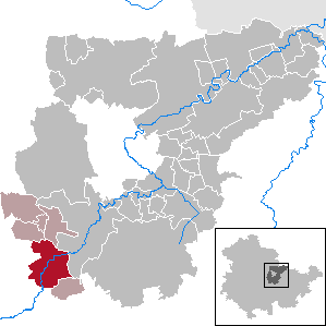
Saale-Holzland-Kreis II is an electoral constituency represented in the Landtag of Thuringia. It elects one member via first-past-the-post voting. Under the current constituency numbering system, it is designated as constituency 36. It covers the northern part of Saale-Holzland-Kreis.


