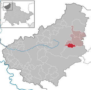
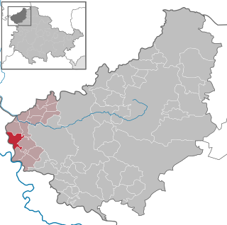
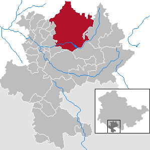
Greiz is a Kreis (district) in the east of Thuringia, Germany. Neighboring districts are Saale-Holzland, Saale-Orla, district-free city Gera, the Burgenlandkreis in Saxony-Anhalt, Altenburger Land, and the two Saxon districts Zwickau and Vogtlandkreis.
Sonneberg is a Kreis (district) in the south of Thuringia, Germany. Neighboring districts are the districts Hildburghausen, Saalfeld-Rudolstadt, and the Bavarian districts Kronach and Coburg.
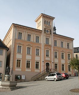
Saalfeld is a town in Germany, capital of the Saalfeld-Rudolstadt district of Thuringia. It is best known internationally as the ancestral seat of the Saxe-Coburg and Gotha branch of the Saxon House of Wettin.
Gernrode is a municipality in the district of Eichsfeld in Thuringia, Germany. Its agricultural land is some of the most productive in the district and it therefore does not have any wooded areas.
Bornhagen is a municipality in the district of Eichsfeld in Thuringia, Germany, located at the foot of the ruins of Hanstein Castle. The town district Rimbach is positioned directly south of the castle citadel at an elevation of 370 m. Bornhagen is located 22 km south of Göttingen, 85 km northwest of the state capital Erfurt and 270 km southwest of Berlin. It is the westernmost settlement in Thuringia but does not contain the westernmost point which is 75 km south near Geisa.

Steinheuterode is a small municipality in the district of Eichsfeld in Thuringia, in the center of Germany.

Mühlhausen is a city in the north-west of Thuringia, Germany, 5 km north of Niederdorla, the country's geographical centre, 50 km north-west of Erfurt, 65 km east of Kassel and 50 km south-east of Göttingen.

Arnstadt is a town in Ilm-Kreis, Thuringia, Germany, on the river Gera about 20 kilometres (12 mi) south of Erfurt, the capital of Thuringia. Arnstadt is one of the oldest towns in Thuringia, and has a well-preserved historic centre with a partially preserved town wall. The town is nicknamed Das Tor zum Thüringer Wald because of its location on the northern edge of that forest. Arnstadt has a population of some 27,000.

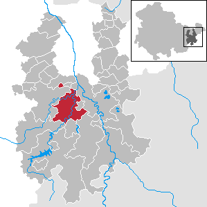
Apolda is a town in central Thuringia, Germany, the capital of the Weimarer Land district. It is situated in the center of the triangle Weimar–Jena–Naumburg near the river Ilm, c. 15 kilometres east by north from Weimar. Apolda station lies on the Halle–Bebra railway, which is part of the main line from Berlin to Frankfurt.
Pößneck is a town in the Saale-Orla-Kreis district, in Thuringia, Germany. It is situated 19 km east of Rudolstadt, and 26 km south of Jena.

Geisa is a town in the Wartburgkreis district, in Thuringia, Germany. It is situated in the Rhön Mountains, 26 km northeast of Fulda. The near border with Hesse was the border between West Germany and the GDR during the Cold War. Thus, Geisa was in the East German border restriction area of the former inner German border, which meant that until reunification access to the town was limited. The town is the westernmost municipality in what was formerly East Germany.
Gräfenthal is a town in the district of Saalfeld-Rudolstadt in Thuringia, Germany.

Lauscha is a town in the district of Sonneberg, in Thuringia, Germany. It is situated 13 km north of Sonneberg, and 24 km southwest of Saalfeld. Lauscha is known for its glassblowing, especially for Christmas tree decorations like baubles.

Orlamünde is a small town in the Saale-Holzland district, in Thuringia, Germany. It is part of the Verwaltungsgemeinschaft Südliches Saaletal.
Schleusingen is a town in the district of Hildburghausen, in Thuringia, Germany. It is situated 10 km north of Hildburghausen, and 12 km southeast of Suhl.
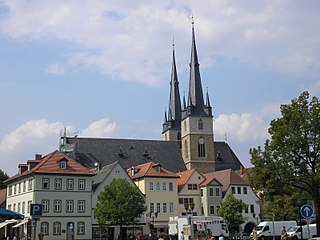
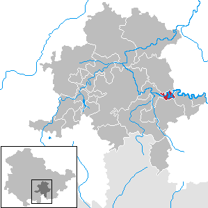
Weida is a town in the district of Greiz, in Thuringia, Germany, situated 12 km south of Gera on the river Weida.

Bad Hindelang is a municipality in the district of Oberallgäu in Bavaria in Germany. As of 2008 it has a population of 4,915. Its sulphur spring was used for cures in the 19th century and today the municipality is a major health resort.

Oechsen is a municipality in the Wartburgkreis district of Thuringia, Germany.
Hohenwarte is a municipality in the district Saalfeld-Rudolstadt, in Thuringia, Germany.
Saale-Holzland-Kreis I is an electoral constituency represented in the Landtag of Thuringia. It elects one member via first-past-the-post voting. Under the current constituency numbering system, it is designated as constituency 35. It covers the southern part of Saale-Holzland-Kreis.


 Gothic church
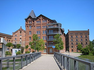
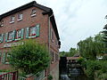 Lower mill
