Dreistelzberg

Last updated
Dreistelzberg

Dreistelzberg.JPG

View of the climb from Wernarz
Highest point
Elevation 660.4 m above  sea level (NHN) (2,167 ft)
Coordinates 50°16′36″N9°46′09″E / 50.27667°N 9.76917°E / 50.27667; 9.76917 Coordinates: 50°16′36″N9°46′09″E / 50.27667°N 9.76917°E / 50.27667; 9.76917
Geography
Parent range Rhön

The Dreistelzberg, [1] also called the Dreistelzkopf [2] and frequently shortened to Dreistelz, [3] is a mountain, 660.4 m above  sea level (NHN) , [4] in the Bavarian part of the Rhön Mountains.

<i>Normalhöhennull</i> standard reference level, the equivalent of sea level, used in Germany to measure height

Normalhöhennull or NHN is a vertical datum used in Germany.

Rhön Mountains low mountain range in Germany

The Rhön Mountains are a group of low mountains in central Germany, located around the border area where the states of Hesse, Bavaria and Thuringia come together. These mountains, which are at the extreme southeast end of the East Hesse Highlands, are partly a result of ancient volcanic activity. They are separated from the Vogelsberg Mountains by the river Fulda and its valley. The highest mountain in the Rhön is the Wasserkuppe which is in Hesse. The Rhön Mountains are a popular tourist destination and walking area.

Contents

The mountain is not one of the highest Rhön peaks, but thanks to its rather isolated location on the southwestern edge of the range it has a striking appearance, rising prominently above its surroundings.

Location

As the highest summit in the Brückenau Kuppenrhön the Dreistelzberg rises in the area where the range transitions to the Spessart mountains to the southwest, lying within the Rhön Biosphere Reserve and the Bavarian Rhön Nature Park. It is located in the county of Bad Kissingen around four kilometres south-southwest of the town of Bad Brückenau, immediately north-northwest of the village of Modlos and immediately west-southwest of the mountainside village of Dreistelz, both within the municipality of Oberleichtersbach.

Spessart low mountain range in Germany

Spessart is a Mittelgebirge, a range of low wooded mountains, in the States of Bavaria and Hesse in Germany. It is bordered by the Vogelsberg, Rhön and Odenwald. The highest elevation is the Geiersberg at 586 metres NN.

Rhön Biosphere Reserve

The Rhön Biosphere Reserve includes the entire central area of the Rhön Mountains, a low mountain range in the German states of Hesse, Bavaria and Thuringia.

Bavarian Rhön Nature Park nature park in Bavaria, Germany

The Bavarian Rhön Nature Park straddles the junction of the German states of Bavaria, Hesse and Thuringia. 70 km² of the total 125 km² area of the nature park has been recognised by UNESCO as part of the Rhön Biosphere Reserve.
The organisation for the promotion of the Bavarian Rhön Nature Park was founded in 1967. On 26 November 1982 the regulation for the Naturpark Bayerische Rhön was issued and, in 1997, the Zweckverband became the Society for the Bavarian Rhön Nature Park and Biosphere Reserve.

Observation tower

In the western part of the summit region of the Dreistelzberg, which is accessible on woodland paths, stands an observation tower, which is architecturally interesting and extremely open, but nevertheless made in a sturdy, steel design. The tower comprises five, roughly 3 metre high steel lattice cuboids with a square cross-section of 4 metres per side. On the top is a viewing platform with a diameter of 4.5 metres. In 2002, the tower was completely renovated. It was dismantled and the individual components transported to a steel workshop where they were cleaned and hot-dip galvanized. The tower was then rebuilt.

Observation tower structure used to view events from a long distance

An observation tower is a structure used to view events from a long distance and to create a full 360 degree range of vision to conduct the long distance observations. They are usually at least 20 metres (66 ft) tall and made from stone, iron, and wood. Many modern towers are also used as TV towers, restaurants, or churches. The towers first appeared in Germany at the end of the 18th century, and their numbers steadily increased, especially after the invention of the lift.

There is an almost complete all-round view from the top of the tower. On clear days there are views to the west as far as the Großer Feldberg in the Taunus. To the southwest can be seen the hills of the Spessart. To the south the views extend as far as the heights of the Steigerwald. To the east, views of the Kreuzberg and the Black Hills (both part of the Rhön) are blocked by trees, but to the northeast can be seen the Dammersfeldkuppe and the town of Bad Brückenau in the valley of the Sinn below. To the north there is a view of the Knüll, and to the northwest the Vogelsberg can clearly be seen behind the Landrücken.

Großer Feldberg highest mountain in the Taunus mountains, Germany

The Großer Feldberg is, at a height of 879.5 metres, the highest elevation of the Taunus mountains, and of the entire Rhenish Massif. It is situated in the Hochtaunuskreis district in Hessen, Germany.

Taunus low mountain range in Germany

The Taunus is a mountain range in Hesse, Germany located north of Frankfurt. The tallest peak in the range is Großer Feldberg at 878 m; other notable peaks are Kleiner Feldberg and Altkönig.

Steigerwald low mountain range in Bavaria in Germany

The Steigerwald is a hill region up to 498.5 m above sea level (NHN) in the Bavarian-Franconian part of the South German Scarplands between Würzburg and Nuremberg. It is part of the Keuper Uplands, and within it, it is continued to the north-northeast and right of the River Main, by the Haßberge, and to the south-southwest by the Franconian Heights. Part of the region is a designated as the Steigerwald Nature Park.

Zeitlofs Place in Bavaria, Germany

Zeitlofs is a municipality in the district of Bad Kissingen in Bavaria in Germany.

Stiftes is a mountain of Hesse, Germany.

Legend

According to legend the Dreistelz is named after three haughty young women (die drei Stolzen) whose castle was cursed by a pilgrim who visited them at night, but was turned away. The castle was swallowed up in the depths of the mountain. [5]

Related Research Articles

Bad Kissingen (district) District in Bavaria, Germany

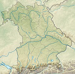
Bad Kissingen is a Landkreis (district) in Bavaria, Germany. It is bounded by the district Main-Kinzig and Fulda in Hesse, and the districts of Rhön-Grabfeld, Schweinfurt and Main-Spessart.

Dammersfeldkuppe mountain

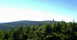
At 927.9 m above sea level (NN) the Dammersfeldkuppe in Bavaria is the second highest mountain after the Wasserkuppe in the Rhön, a low mountain range straddling the states of Bavaria, Hesse and Thuringia in Germany.

Badener Höhe mountain

The Badener Höhe is a mountain in the Northern Black Forest in the German state of Baden-Württemberg. It lies within the borough of Baden-Baden and municipality of Forbach. With a height of 1,002.5 m above sea level (NHN), it is the highest point in the borough of Baden-Baden.

Einödriegel mountain

The Einödriegel is a mountain, 1,120.6 m above sea level (NHN), in the Bavarian Forest in Germany. It rises southwest of the Lower Bavarian county town of Regen and northeast of the county town of Deggendorf. It is the highest point in the Danube Hills and the county of Deggendorf and lies in the municipality of Grafling.

Enzian (Bavarian Forest) mountain

The Enzian is a mountain, 1,285 m above sea level (NHN), in the Bavarian Forest in Germany. It rises from the ridge northwest of the Arber and its summit lies on the boundary between the counties of Cham and Regen, with the municipality of Lohberg in the north and Drachselsried in the west-southwest.

Blättersberg mountain

The Blättersberg near Rhodt unter Rietburg in the Rhenish-Palatine county of Südliche Weinstraße is a mountain, 613.2 m above sea level (NHN), in the Palatine Forest in the German state of Rhineland-Palatinate.

Gebaberg mountain

The Gebaberg, also called the Hohe Geba or Die Geba, near Geba in the county of Schmalkalden-Meiningen in southern Thuringia, Germany, is 750.7 m above sea level (NHN), and thus the highest point of the Anterior Rhön.

Hohe Schule (hill) mountain in Germany

The Hohe Schule, formerly also the Aalhauck, near Völkershausen in the Bavarian county of Rhön-Grabfeld is, at about 538 m above sea level (NHN), the second highest hill in the Eastern Rhön Foreland after the Wurmberg . The area includes ramparts and finds from the Hallstatt culture and the Latene Culture, section of the Landwehr, and the Rhine-Weser Watershed.

Pleß (mountain) mountain

The Pleß is a mountain, 645.4 m above sea level (NHN), in the county of Schmalkalden-Meiningen in the Salzungen Werra Highland in the German state of Thuringia.

Wasserkuppen Rhön mountains in Germany

The Wasserkuppen Rhön or Wasserkuppenrhön, named after its highest peak, also the highest summit in the entire Rhön Mountains, the Wasserkuppe, is an exposed highland ridge and natural region in the Hessian county of Fulda and Bavarian county of Rhön-Grabfeld. Together with the Long Rhön and its eastern flank it forms the Central Rhön. The Red Moor lies within this natural region.

Long Rhön mountains in Germany

The Long Rhön is a ridge in the Central Rhön which forms part of the High Rhön within the Rhön Mountains. The Long Rhön is an elongated basalt plateau in the centre, roughly 800 metres above sea level, which is only occasional interrupted by mountain peaks. Its highest mountain is the Heidelstein. A majority of the area is part of the Long Rhön Nature Reserve. In this area of the Rhön is the Black Moor.

Gleichberge German mountain range

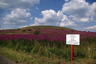
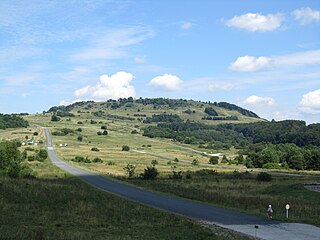
The Gleichberge, which mainly comprise the Großer and Kleiner Gleichberg, are a small, inselberg-like mountain range, up to 679 m above sea level (NHN), in the southwestern part of the German state of Thuringia. They rise just east of the little ancient town of Römhild in the county of Hildburghausen.

Schneekopf mountain in Germany

The Schneekopf near Gehlberg in the Thuringian county of Ilm-Kreis is 978 m above sea level (NHN) and thus the second highest peak in the Thuringian Forest after its western neighbour, the Großer Beerberg. The Adler Saddle between them is only about 59.4 metres lower than the two summits. To the east some distance away is its subpeak, the Sachsenstein, to the south are the Teufelskreise and Fichtenkopf. The Goldlauterberg further south marks the transition to the mountain of Großer Finsterberg.

Limpurg Hills mountains in Germany

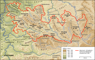
The Limpurg Hills are a hill range, up to 564.7 m above sea level (NHN), in the Swabian-Franconian Forest in the counties of Schwäbisch Hall and Ostalbkreis in the German state of Baden-Württemberg. The majority of the region belonged formerly to Limpurg Land owned by the family of Schenken von Limpurg, whose name was derived from their family home, Limpurg Castle near Schwäbisch Hall.

Kleiner Auersberg mountain

The Kleiner Auersberg is a mountain, 808 m above sea level (NN), in the Bavarian part of the Rhön mountains. It is situated five kilometres southwest of the centre of Wildflecken in the county of Bad Kissingen on the watershed between the Sinn and Kleiner Sinn.

Kellerberg (Meulenwald)

The Kellerberg is a hill, 448.8 m above sea level (NHN), and the highest point of the Eifel part of the Meulenwald and of the collective municipality of Wittlich-Land. It rises near Dierscheid in the county of Bernkastel-Wittlich in the German state of Rhineland-Palatinate. At the top is the Kellerberg Observation Tower.

Simmersberg mountain in Germany

The Simmersberg is a mountain, 780.8 m above sea level (NHN), near Schnett in the municipality of Masserberg) in the county of Hildburghausen in Germany. It is the main summit of a forked mountain chain, which runs along the boundary between the Thuringian Forest and the Thuringian Highland from Masserberg towards the southwest and is bounded by the valleys of the Schleuse and its tributary, the Biber.

Köppel (Westerwald) mountain in Germany

The Köppel, at 540.2 m above sea level (NHN), is the second highest point in the Montabaur Heights, an elongated hill ridge in the Lower Westerwald in Germany. It is second only to the nearby Alarmstange and lies on the boundary between Montabaur and Dernbach in the county of Westerwaldkreis in the state of Rhineland-Palatinate. At the summit is the Köppel viewing tower.

References

  1. Bavarian State Survey Department: Topographic map 1:50,000, 1999 edition
  2. BayernAtlas: depending on the scale, it is either called the Dreistelzberg or Dreistelzkopf.
  3. rhoenline.de
  4. Map services of the Federal Agency for Nature Conservation
  5. Verwünschtes Schloß Dreistelz in: Ludwig Bechstein, Deutsches Sagenbuch. Leipzig, 1853, Reprint im Georg Olms Verlag 2003. ISBN   3-487-12501-3

See also