Related Research Articles

Dubuque is a city in and the county seat of Dubuque County, Iowa, United States, located along the Mississippi River. At the time of the 2020 census, the population of Dubuque was 59,667. The city lies at the junction of Iowa, Illinois, and Wisconsin, a region locally known as the Tri-State Area. It serves as the main commercial, industrial, educational, and cultural center for the area. Geographically, it is part of the Driftless Area, a portion of North America that escaped all three phases of the Wisconsin Glaciation.

Grant County is the most southwestern county in the U.S. state of Wisconsin. As of the 2020 census, the population was 51,938. Its county seat is Lancaster and its largest city is Platteville. The county is named after the Grant River, in turn named after a fur trader who lived in the area when Wisconsin was a territory. Grant County comprises the Platteville Micropolitan Statistical Area. It is in the tri-state area of Wisconsin, Illinois, and Iowa, and is crossed by travelers commuting to Madison, Wisconsin, from a number of eastern Iowan cities, and by residents of northern Illinois traveling to the Twin Cities or La Crosse, Wisconsin.

Dubuque County is a county located in the U.S. state of Iowa. As of the 2020 census, the population was 99,266, making it the eighth-most populous county in Iowa. The county seat is Dubuque. The county is named for Julien Dubuque, the first European settler of Iowa.

Jo Daviess County is the northwesternmost county in the U.S. state of Illinois. According to the 2020 census, it had a population of 22,035. Its county seat is Galena. Jo Daviess County is part of the Tri-State Area and is located near Dubuque, Iowa and Platteville, Wisconsin. As part of the Driftless Area, Jo Daviess County contains rugged terrain compared to the rest of the state. Within Jo Daviess County lies Charles Mound, the highest natural point in Illinois, as well as eight of the ten highest points in Illinois.

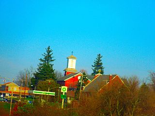
East Dubuque is a city in Jo Daviess County, Illinois, United States. The population was 1,505 at the 2020 census, down from 1,704 in 2010. East Dubuque is located alongside the Mississippi River. Across the river is the city of Dubuque, Iowa. The city limits extend along the river to the Illinois-Wisconsin border.

Galena is the largest city in and the county seat of Jo Daviess County, Illinois, United States. It had a population of 3,308 at the 2020 census. A 581-acre (235 ha) section of the city is listed on the National Register of Historic Places as the Galena Historic District. The city is named for the mineral galena, which was in the ore that formed the basis for the region's early lead mining economy.

Dyersville is a city in eastern Delaware County and western Dubuque County in the U.S. state of Iowa. It is part of the Dubuque, Iowa, Metropolitan Statistical Area. The population was 4,477 at the time of the 2020 census, up from 4,035 in 2000.

Balltown is a city in Dubuque County, Iowa, United States. It is part of the Dubuque, Iowa Metropolitan Statistical Area. The population was 79 at the 2020 census, up from 73 in 2000. Balltown is home to Breitbach's Country Dining, Iowa's oldest restaurant and bar, which was founded in 1852 and twice rebuilt by the community, following its destruction by fire in 2007 and 2008.

Centralia is a city in Dubuque County, Iowa, United States. It is part of the Dubuque, Iowa Metropolitan Statistical Area. The population was 116 at the 2020 census, up 15 persons since the 2000 census and down 18 from the 2010.
Epworth is a city in Dubuque County, Iowa, United States. It is part of the Dubuque, Iowa Metropolitan Statistical Area. The population was 2,023 at the 2020 census, up from 1,428 in 2000.

Farley is a city in Dubuque County, Iowa, United States. It is part of the Dubuque, Iowa Metropolitan Statistical Area. The population was 1,766 at the time of the 2020 census, up from 1,334 in 2000. Farley is the seventh-largest town in Dubuque County, recently passed by Peosta, Iowa.

Peosta is a city in Dubuque County, Iowa, United States, and an exurb of the city of Dubuque. It is part of the Dubuque, Iowa Metropolitan Statistical Area. The population was 1,908 in the 2020 census, an increase of 193% from 651 in 2000. Peosta experienced a 70% increase in population (estimated) from 2000 to 2007, making it the state's 10th fastest-growing city during that period. Peosta is currently the sixth-largest city in Dubuque County. The community is home to the 2015 ASA D Northern Nationals Men's Slow Pitch Champions, Kass & Company, a large industrial park, the largest campus of Northeast Iowa Community College, and a handful of new commercial businesses. However, the city is increasingly becoming a bedroom community, much like nearby Asbury, made up of suburban subdivisions.

Platteville is the largest city in Grant County, Wisconsin, United States. The population was 11,836 at the 2020 census.

Dodgeville is a city in and the county seat of Iowa County, Wisconsin, United States. The population was 4,984 at the 2020 census, making it the county's most populous city. Dodgeville is part of the Madison metropolitan area.

U.S. Highway 151 (US 151) is a United States Numbered Highway that runs through the states of Iowa and Wisconsin. The southern terminus for US 151 is at a junction with Interstate 80 (I-80) in Iowa County, Iowa, and its northern terminus is at Manitowoc, Wisconsin. The route, from south to north follows a northeasterly path through the two states.

Catfish Creek is a 21.2-mile-long (34.1 km) tributary of the upper Mississippi River in Dubuque County, Iowa. The governments within the watershed have a say in the managing body of the creek, the Catfish Creek Watershed Management Authority. The authority's goal is to promote education on managing the system and fixing issues like the environment.

Dunleith Township is one of 23 townships in Jo Daviess County, Illinois, United States. As of the 2010 census, its population was 3,820 and it contained 1,713 housing units. It was formed from Menominee Township on March 2, 1865.

Menominee Township is one of 23 townships in Jo Daviess County, Illinois, United States. As of the 2010 census, its population was 1,122 and it contained 419 housing units.

Western Dubuque High School is a four-year public high school located in Epworth, Iowa. It is one of two high schools in the Western Dubuque Community School District, and enrolls 935 students in grades 9-12. The school's mascot is the Bobcat, and it competes in class 3A of the Mississippi Valley Conference.
The Galena and Southern Wisconsin Railroad Company was a railroad company in the United States. It constructed and operated a narrow gauge line between Galena, Illinois, and near Rewey, Wisconsin, via Platteville, Wisconsin. The railroad went through multiple reorganizations in the early 1880s before becoming part of the Chicago and North Western Railway system. The line was unified with that of the Chicago and Tomah Railroad and rebuilt as a 4 ft 8+1⁄2 in line. As the Platteville Subdivision of the Chicago and North Western, it was eventually abandoned in 1980.
References
- ↑ "2020 Census State Redistricting Data". census.gov. United states Census Bureau. Retrieved August 11, 2020.
- ↑ Jonjack, Donald (14 August 1994). "Dubuque Dreams". chicagotribune.com. Retrieved 2021-09-25.
- ↑ Survey (U.S.), Geological (1906). Bulletin - United States Geological Survey. The Survey.
- ↑ Field operations of the Bureau of Soils, 1902 - General review of the work: 1902. USDA. 1903.