Dulnain Bridge

Last updated

Dulnain Bridge
The Dulnain Bridge.jpg
The Dulnain Bridge
Badenoch and Strathspey UK location map.svg
Red pog.svg
Dulnain Bridge
Location within the Badenoch and Strathspey area
Population129 (2001 Census)
OS grid reference NH995245
Council area
Country Scotland
Sovereign state United Kingdom
Post town Grantown-on-Spey
Postcode district PH26
Dialling code 01479
Police Scotland
Fire Scottish
Ambulance Scottish
List of places
UK
Scotland
57°18′16″N3°39′54″W / 57.3045°N 3.6651°W / 57.3045; -3.6651

Dulnain Bridge (Scottish Gaelic : Drochaid Thulnain) is a village in Strathspey, next to the meeting of the River Dulnain and the River Spey, three miles south-west of Grantown-on-Spey, in the Scottish Highlands and the Highland council area.

Contents

History

The bridge was swept away in a flood in 1829, but was re-built. The population is estimated at less than two hundred, [1] and the surrounding area is popular with tourists, as it is surrounded by mountains. The traditional counties of Inverness-shire and Morayshire are separated by the bridge, which has existed for centuries.

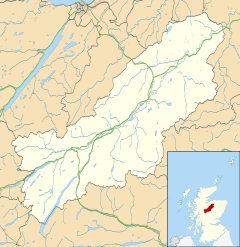
The village lies near to the A95, in the Cairngorms National park. The village comprises two communities. Dulnain Bridge itself is centred to the north of the bridge, and this particular part of the village lies in Morayshire. The crofting community of Skye-of-Curr stretches for a mile to the south, and this is in Inverness-shire.

Attractions

There are two hotels: Tigh-na-Sgaith and the Muckrach Country House Hotel and Restaurant. [2] The village hall and church are located on the main road in Dulnain Bridge, next to the village shop and garage. On the other side of the main road is the river, with Dulnain Bridge over it. On the other side of the bridge is a park and children's playground.

There are several golf courses in the area around Dulnain Bridge, including the Boat of Garten course.

Archie is a highland cow who resides in the front field at Muckrach Country House Hotel. [2] He has made a picture-postcard setting for nearly ten years.

Antiquated Farm Machinery Project

In the north of the village and next to the roches moutonnees (see above), is the display of farm machinery, This was the conception of George Rae Manager of Ballintomb Farm, Muckrach Estate. It was designed to enhance the road into the village from the east as a task set by his employer for the Year 2000. Working along with Tom Goss, the then Community Council Chairman, the land, dykestone and some of the antiquated machinery was acquired from Muckrach estate. The project was adopted by the Dulnain Bridge & Vicinity Community Council. It features farming machinery that has been used for decades in the fields around the Dulnain Bridge area.

The council describe it as a 'collection of implements from a bygone age' and the machinery is donated by local residents. Moray, Badenoch and Strathspey Enterprise assisted the creation of the project.

Strathspey Railway

Dulnain Bridge is the current terminus of the famous Strathspey Railway, a steam train that runs to Broomhill (Dulnain Bridge) through part of the Highlands from Aviemore and a whole trip takes around an hour and a half, and is run primarily by volunteers. The society has plans to extend the railway beyond Broomhill to Grantown on Spey, another 4 miles north, and so to provide a service for locals as well as tourists.

Historical attractions

Roches Moutonnees Roches Moutonnees.jpg
Roches Moutonnees

There are Pictish carved stones nearby and two Stone Age coffins were found in the 1880s in a burial cairn in Curr Wood. [3]

At the north end of the village sit a display of glaciated rocks called the roche moutonnées . Around 18,000 years ago Dulnain Bridge was covered by a sheet of glacier ice. As the ice moved along it ground down and shaped the rock. As the ice melted, it left smooth, exposed rock in some places and a mixture of boulder and clay in other areas.[ citation needed ]

Muckrach Castle is also nearby. [4]

2007 Protest

In 2007, nearly two hundred people from Dulnain Bridge and more from the surrounding area gathered to watch or take part in a protest march from the Dulnain Bridge village hall, across the bridge and through much of the village, before returning to the village hall. [5] The protest took place on 5 July 2007.

The march was the result of a number of villagers' concerns about Dulnain Bridge's absence on official tourist literature and maps. The village was compared to fictional village Brigadoon, a story about a village that appears just once every one hundred years. Organisers of the march spoke of how they thought Dulnain Bridge disappears from people's minds. The march was to raise awareness of the village.

The march was the start of a campaign to get Dulnain Bridge 'on the map'. "The problem for residents is that, like the mythical village of Brigadoon, Dulnain Bridge keeps disappearing from the map," opined one resident. Villagers were disappointed by the village's absence from the map of the Outsider Festival that took place in the Highlands.

Notable personalities

The village has had a few well known residents including Charlie Whelan, who worked as an assistant to Gordon Brown for several years, before opting to move north. [6]

Wildlife

Village Hall (l) and Church (r) 216 The village hall (l) and church (r).jpg
Village Hall (l) and Church (r)

The surrounding forests of Caledonian pines contain many rare species, including birds such as the endangered capercaillie and the main population of twinflower - Linnaea borealis is found in Curr Wood on the southern side of the village. There are Scottish crossbills, crested tits, buzzards, golden eagles and, most famously in the Dulnain Bridge area, ospreys. Red squirrels also reside in the woods.[ citation needed ]

Related Research Articles

<span class="mw-page-title-main">Highland (council area)</span> Council area of Scotland

Highland is a council area in the Scottish Highlands and is the largest local government area in the United Kingdom. It was the 7th most populous council area in Scotland at the 2011 census. It shares borders with the council areas of Aberdeenshire, Argyll and Bute, Moray and Perth and Kinross. Their councils, and those of Angus and Stirling, also have areas of the Scottish Highlands within their administrative boundaries.

<span class="mw-page-title-main">Grantown-on-Spey</span> Human settlement in Scotland

Grantown-on-Spey is a town in the Highland Council Area, historically within the county of Moray. It is located on a low plateau at Freuchie beside the river Spey at the northern edge of the Cairngorm mountains, about 20 miles (32 km) south-east of Inverness.

<span class="mw-page-title-main">County of Moray</span> Historic county in Scotland

Moray; or Morayshire, called Elginshire until 1919, is a historic county, registration county and lieutenancy area of Scotland, bordering Nairnshire to the west, Inverness-shire to the south, and Banffshire to the east. It was a local government county, with Elgin the county town, until 1975. The county was officially called Elginshire, sharing the name of the Elginshire parliamentary constituency, so named since 1708.

<span class="mw-page-title-main">Badenoch and Strathspey</span> Local government ward in Scotland

Badenoch and Strathspey is a former district of Highland region in Scotland.

<span class="mw-page-title-main">Cairngorms National Park</span> National park in Scotland

Cairngorms National Park is a national park in northeast Scotland, established in 2003. It was the second of two national parks established by the Scottish Parliament, after Loch Lomond and The Trossachs National Park, which was set up in 2002. The park covers the Cairngorms range of mountains, and surrounding hills. Already the largest national park in the United Kingdom, in 2010 it was expanded into Perth and Kinross.

<span class="mw-page-title-main">River Spey</span> River in Scotland

The River Spey is a river in the northeast of Scotland. At 98 mi (158 km) it is the ninth longest river in the United Kingdom, as well as the third longest and fastest-flowing river in Scotland. It is important for salmon fishing and whisky production.

<span class="mw-page-title-main">Strathspey, Scotland</span> Region of Scotland

Strathspey is the region around the strath of the River Spey, Scotland, split between the Moray council area and the Badenoch and Strathspey committee area of Highland.

The Strathspey Railway (SR) in Badenoch and Strathspey, Highland, Scotland, operates a ten-mile (16 km) heritage railway from Aviemore to Broomhill, Highland via Boat of Garten, part of the former Inverness and Perth Junction Railway which linked Aviemore with Forres. It is one of only a handful of former primary/secondary main lines to be preserved in Britain today.

<span class="mw-page-title-main">Boat of Garten</span> Village in Scotland

Boat of Garten is a small village and post town in Badenoch and Strathspey, Highland, Scotland. In 1951, the population was less than 400; in 1971, it was almost 500; in 1981, it was almost 700, and the same in 2001.

<span class="mw-page-title-main">Carrbridge</span> Village in Badenoch and Strathspey, Scotland

Carrbridge is a village in Badenoch and Strathspey in the Scottish Highlands. It lies off the A9 on the A938, west of Skye of Curr and southeast of Tomatin, near Bogroy. It has the oldest stone bridge in the Highlands and the nearby ancient pine forest contains the Landmark Forest Adventure Park.

<span class="mw-page-title-main">Cromdale</span> Human settlement in Scotland

Cromdale is a village in Strathspey, in the Highland council area of Scotland, and one of the ancient parishes which formed the combined ecclesiastical parish of Cromdale, Inverallan and Advie in Morayshire.

<span class="mw-page-title-main">Abernethy and Kincardine</span> Human settlement in Scotland

Abernethy and Kincardine is a civil parish, and former registration district and ecclesiastical parish, in the Highland council area of Scotland. The name is not in use for any modern administrative entity, but remains as the usual description for historical purposes, in the case of the registration district being only a name change.

<span class="mw-page-title-main">Nethy Bridge</span> Human settlement in Scotland

Nethy Bridge is a small village in Strathspey in the Highland council area of Scotland. The village lies 5 miles (8 km) south of Grantown-on-Spey within the historical parish of Abernethy and Kincardine, and the Cairngorms National Park.

<span class="mw-page-title-main">Achnahannet, Strathspey</span> Human settlement in Scotland

Achnahannet is a hamlet located northwest of Dulnain Bridge, and three and a half miles west-south-west of Grantown-on-Spey, in the historical county of Morayshire, now in the Highland Council area, Scotland. Historically it belonged to the parish of Cromdale.

The Strathspey & Badenoch Welfare Football Association is the governing body overseeing amateur Scottish Welfare football in the Badenoch and Strathspey area of Scotland. It is affiliated to Scottish Welfare Football Association and Scottish Football Association and has been running intermittently since its inaugural season in 1929–30. The winners on that occasion were the now-defunct Nethy Bridge F.C.

Bogroy is a small crofting village, located 0.5 miles northwest of Carrbridge, in Strathspey, in the county of Inverness-shire, Scottish Highlands and is in the Scottish council area of Highland. It lies off the A9 road on the A938 road, west of Skye of Curr, east of Findhom Bridge and northwest of Boat of Garten. The Dulnain river passes close to Bogroy.

<span class="mw-page-title-main">Broomhill railway station</span>

Broomhill railway station or Broomhill for Nethy Bridge railway station is a reconstructed railway station on the former Highland Railway main line which was originally built to serve the small villages of Nethy Bridge and Dulnain Bridge in Strathspey. It is at present the eastern terminus of the Strathspey Steam Railway.

<span class="mw-page-title-main">Strathspey Camanachd</span>

Strathspey Camanachd is a shinty club based in Grantown-on-Spey, Strathspey, Scotland, currently competing in the Marine Harvest North Division Two.

<span class="mw-page-title-main">Badenoch and Strathspey (ward)</span>

Badenoch and Strathspey is one of the 21 wards used to elect members of the Highland Council. It encompasses the towns and villages of Aviemore, Boat of Garten, Carrbridge, Cromdale, Dulnain Bridge, Grantown-on-Spey, Kingussie, Newtonmore and Nethy Bridge. It elects four Councillors.

<span class="mw-page-title-main">Muckrach Castle</span> Tower house, Scotland

Muckrach Castle, also known as Muchrach or Muckerach Castle, is a tower house near the Scottish town of Dulnain Bridge in the Highland council area. It was built in 1598 as the original seat of Grants of Rothiemurchus, with timber used as part of the stone walls. It was unroofed in 1739 and remained runious until the 20th century. In 1971 the building was added to the Scottish monument lists in the highest monument category A, before being restored by the architect Ian Begg in 1978–85. It is since used as holiday apartments.

References

  1. "Dulnain Bridge" Gazetteer for Scotland. Retrieved 20 July 2008.
  2. 1 2 www.muckrach.com. Retrieved 30 March 2015.
  3. "Dulnain Bridge ...the TwinFlower Village" dulnainbridge.com. Retrieved 19 July 2008
  4. Coventry, Martin (1997). The Castles of Scotland (2nd ed.). Edinburgh: Goblinshead. p. 263. ISBN   978-1-899874-10-1.
  5. Musgrove, Gavin "Villagers Fight to get on the map" Archived July 26, 2008, at the Wayback Machine (6 June 2007) Strathspey and Badenoch Herald. Retrieved 20 July 2008.
  6. "Scottish property in brief: Charlie Whelan; Adrian Pocock" (23 March 2008) London. The Sunday Times. Retrieved 13 December 2008.

Commons-logo.svg Media related to Dulnain Bridge at Wikimedia Commons
Wikivoyage-Logo-v3-icon.svg Dulnain Bridge travel guide from Wikivoyage