Dunoon, New South Wales

Last updated

Dunoon
New South Wales
Dunoon arial pano (26729662280).jpg
Dunoon in May 2016
Australia New South Wales relief location map.png
Red pog.svg
Dunoon
Coordinates 28°41′S153°19′E / 28.683°S 153.317°E / -28.683; 153.317
Population
LGA(s) City of Lismore
Region Northern Rivers
State electorate(s) Lismore
Federal division(s) Page

Dunoon is a small village within the City of Lismore LGA in the Northern Rivers region of New South Wales, Australia. At the 2006 census, Dunoon had a population of 372 people and, in the 2011 census, the population was 824. [2] [3] It is self-proclaimed as the Macadamia capital of Australia and has a macadamia processing plant on its outskirts. [4]

Contents

The village's local newspaper is The Dunoon and District Gazette, with past copies available at the Richmond Tweed Regional Library and the Richmond River Historical Society. [5] [6]

Services

Like the other small villages dotted along the ridges in the hills heading north out of Lismore, it is a quiet town, but the community and sports facilities available give it a strong community spirit. There is a post office, primary school, mechanic and general store/ bottle shop. Dunoon has a community hall with a variety of activities including the Dunoon Film Club, exercise classes, social events and church services. Many community gatherings occur at the Sports Club. The popular sports are cricket and football, although there are other sports such as Little Athletics and tennis. The Dunoon sports club also has a restaurant, a playground, a tennis court and football fields with lights.

Dunoon also has two actively used church buildings; one Catholic and the other Anglican. The Anglican church building was destroyed during the 2007 tornado and has since been rebuilt. The other two former church buildings have been / are being converted to residential use, with both retaining many of the original features.

Development

Dunoon is currently predominantly a unilinear development, but a major land release has expanded off the main ridge. Community concerns over the social impact on the town of a second development were allayed in February 2009 when developers withdrew their application to develop a new subdivision from Lismore City Council. [7]

Rous County Council, which is the authority responsible for the water supply for most of the Ballina, Byron, Lismore and Richmond Valley council areas, published its draft water strategy in June 2020, which includes a 50-gigalitre (1.8×10⁹ cu ft) dam at Dunoon. The council has been aware of Indigenous concerns since the matter was first considered in the 1990s, and was committed to working with local communities to mitigate concerns. An impact assessment of the site had identified various artefacts and burial sites in the area. [8]

2007 Tornado

On 26 October 2007, a tornado struck Dunoon (mainly the southern part of the village), and it was captured on video as it struck a direct hit on an electrical transformer station. [9] The tornado also completely destroyed one house, severely damaged a church and two classrooms at a school, with other houses in the village also having roofs torn off and windows smashed. [10] The rebuilding of the school classrooms and church has been an opportunity to modernise and revitalise.

Related Research Articles

<span class="mw-page-title-main">Lismore, New South Wales</span> City in New South Wales, Australia

Lismore is a city located in the Northern Rivers region of New South Wales, Australia and the main population centre in the City of Lismore local government area, it is also a regional centre in the Northern Rivers region of the state. Lismore is 734 km (456 mi) north of Sydney and 200 km (120 mi) south of Brisbane. It is situated on a low floodplain on the banks of the Wilsons River near the latter's junction with Leycester Creek, both tributaries of the Richmond River which enters the Pacific Ocean at Ballina, 30 km (19 mi) to the east.

<span class="mw-page-title-main">Gympie</span> City in Queensland, Australia

Gympie is a city and a locality in the Gympie Region, Queensland, Australia. Located in the Greater Sunshine Coast, Gympie is about 170.7 kilometres (110 mi) north of the state capital, Brisbane. The city lies on the Mary River, which floods Gympie occasionally. The locality of Gympie is the central business district for the city of Gympie and also the administrative centre for the Gympie Region local government area. In the 2021 census, Gympie had an urban population of 22,424 people.

<span class="mw-page-title-main">Northern Rivers</span> Region in New South Wales, Australia

Northern Rivers is the most northeasterly region of the Australian state of New South Wales, located between 590 and 820 kilometres north of the state capital, Sydney, and encompasses the catchments and fertile valleys of the Clarence, Richmond, and Tweed rivers. It extends from Tweed Heads in the north to the southern extent of the Clarence river catchment which lies between Grafton and Coffs Harbour, and includes the main towns of Tweed Heads, Byron Bay, Ballina, Kyogle, Lismore, Casino and Grafton. At its most northern point, the region is 102 kilometres (63 mi) south-southeast of the Queensland capital, Brisbane.

<span class="mw-page-title-main">Ballina, New South Wales</span> Town in New South Wales, Australia

Ballina is a town in the Northern Rivers region of New South Wales, Australia, and the seat of the Ballina Shire local government area. It lies 740 km (460 mi) north of Sydney and 185 km (115 mi) south of Brisbane. Ballina's urban population at the end of 2021 was 46,190.

<span class="mw-page-title-main">Longford, Tasmania</span> Town in Tasmania, Australia

Longford is a town in the northern midlands of Tasmania, Australia. It lies 145 m above sea level at the convergence of the Macquarie River and the South Esk River, 21 km south of Launceston and a 15-minute drive from the airport. It is just south of the Illawarra Road, a road connecting the Bass and Midland Highways. It has a population of 3,863 and is part of the Northern Midlands Council area. The region is predominantly agricultural, noted for wool, dairy produce and stock breeding.

<span class="mw-page-title-main">Nimbin, New South Wales</span> Town in Australia

Nimbin is a town in the Northern Rivers area of the Australian state of New South Wales, approximately 30 km (19 mi) north of Lismore, 33 km (21 mi) northeast of Kyogle, and 70 km (43 mi) west of Byron Bay.

<span class="mw-page-title-main">Casino, New South Wales</span> Town in New South Wales, Australia

Casino is a town in the Northern Rivers area of New South Wales, Australia, with a population of 12,298 people at the 2021 census. It lies on the banks of the Richmond River and is situated at the junction of the Bruxner Highway and the Summerland Way.

<span class="mw-page-title-main">City of Hawkesbury</span> Local government area in New South Wales, Australia

The City of Hawkesbury is a local government area of New South Wales, Australia, located on the northern and north-western fringe of the Greater Sydney area, about 50 kilometres (31 mi) north-west of the Sydney central business district. Hawkesbury City is named after the Hawkesbury River. Major suburbs in the City of Hawkesbury are Windsor, Richmond and Pitt Town.

<span class="mw-page-title-main">Clunes, New South Wales</span> Town in New South Wales, Australia

Clunes is a small town in the Northern Rivers region of New South Wales, Australia. It is located approximately 18 km northeast of Lismore. In 2011 census, Clunes had a population of 559 people.
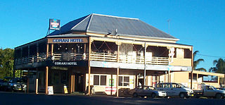
<span class="mw-page-title-main">Coraki, New South Wales</span> Town in New South Wales, Australia

Coraki is a small town that sits on the confluence of the Richmond and Wilsons Rivers in northern New South Wales, Australia in Richmond Valley Shire. At the 2021 census, Coraki had a population of 1,277 people.
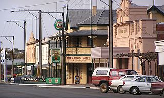
<span class="mw-page-title-main">Pinnaroo, South Australia</span> Town in South Australia

Pinnaroo is a town in the Murray Mallee region of South Australia, near the border with Victoria, 243 km east of Adelaide. Pinnaroo is on the north side of the Mallee Highway, and on the railway line between Tailem Bend and Ouyen. The roadhouse on the highway at Pinnaroo is the first "food and leg-stretch" stop on the bus route from Adelaide to Sydney.

Modanville is a scattered community in New South Wales, Australia, situated 14 kilometres (9 mi) north of the city of Lismore. At the 2006 census, it had a population of 515 people.
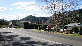
<span class="mw-page-title-main">Yarramalong, New South Wales</span> Suburb of Central Coast, New South Wales, Australia

Yarramalong(cedar country) is a township and suburb of the Central Coast region of New South Wales, Australia, located 20 kilometres (12 mi) upstream from Wyong along the Wyong River. It is part of the Central Coast Council local government area.

<span class="mw-page-title-main">Alstonville, New South Wales</span> Town in New South Wales, Australia

Alstonville is a town in northern New South Wales, Australia, part of the region known as the Northern Rivers. Alstonville is on the Bruxner Highway between the town of Ballina and city of Lismore. The village of Wollongbar is 4 km to the west of Alstonville. Alstonville is the service centre of the area known as the Alstonville Plateau.

<span class="mw-page-title-main">City of Lismore</span> Local government area in New South Wales, Australia

The City of Lismore is a local government area in the Northern Rivers region of New South Wales, Australia. The seat of the local government area is Lismore, a major regional centre of the state.
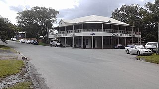
<span class="mw-page-title-main">Kin Kin</span> Town in Queensland, Australia

Kin Kin is a rural town and locality in the Shire of Noosa, Queensland, Australia. In the 2021 census, the locality of Kin Kin had a population of 844 people.

<span class="mw-page-title-main">Jugiong</span> Town in New South Wales, Australia

Jugiong is a locality and town on the banks of the Murrumbidgee River near its confluence with Jugiong Creek. in the Hilltops Council Local Government area, New South Wales, Australia. It is situated just off the Hume Highway, by road, about 30 kilometres southwest from Bookham and 40 kilometres northeast from Gundagai.

<span class="mw-page-title-main">Rous County</span> Cadastral in New South Wales, Australia

Rous County is one of the 141 cadastral divisions of New South Wales. It is located at the north-east tip of the state. It is bordered on the north by the border with Queensland and on the south by the Richmond River. It contains Lismore, Byron Bay and Murwillumbah.

Richmond River High Campus, part of The Rivers Secondary College, is a dual-campus government-funded co-educational comprehensive secondary day school campus, located in North Lismore, in the Northern Rivers region of New South Wales, Australia.

Rappville is a small village in northern New South Wales, Australia. At the 2016 census, Rappville recorded a population of 169 people.

References

  1. Australian Bureau of Statistics (31 October 2012). "Dunoon (State Suburb)". 2011 Census QuickStats. Retrieved 16 February 2014. OOjs UI icon edit-ltr-progressive.svg
  2. 1 2 Australian Bureau of Statistics (25 October 2007). "Dunoon (L) (Urban Centre/Locality)". 2006 Census QuickStats. Retrieved 21 July 2009.
  3. Dunoon census statistics
  4. www.australianexplorer.com. "Dunoon". Australian Explorer Pty Ltd. Retrieved 17 June 2024.
  5. "Dunoon and District Gazette | $0.00 Whinge free (Mostly)". dunoongazette.com. Retrieved 17 June 2024.
  6. "Publisher: The Dunoon and District Gazette, Australia - Publishing company profile | PublishersGlobal.com". www.publishersglobal.com. Retrieved 17 June 2024.
  7. "The Northern Rivers Echo - news". Archived from the original on 2 March 2009. Retrieved 18 September 2009.
  8. MacKenzie, Bruce (19 June 2020). "Indigenous heritage sites could be underwater if new dam is built on New South Wales north coast". ABC News. Australian Broadcasting Corporation. Retrieved 5 July 2020.
  9. Australian Tornadoes tornado DVD DVDs footage photos photographs pictures video videos movie movies Australian tornado pictures storm chasing waterspouts funnels supercells su...
  10. "The Dunoon and District Gazette | December 09/January 10". Archived from the original on 25 January 2010. Retrieved 18 September 2009.