Dâmbovița River

Last updated
Râul Dâmbovița
Dambovita near Ciurel Bridge in Bucharest .jpg
The Dâmbovița River in Bucharest
Location
Country Romania
Counties Argeș, Dâmbovița, Ilfov, Bucharest, Călărași
Cities Bucharest
Physical characteristics
SourceCurmătura Oticu
 - location Făgăraș Mountains
 - coordinates 45°29′54″N24°56′14″E / 45.49833°N 24.93722°E / 45.49833; 24.93722
 - elevation1,800 m (5,900 ft)
Mouth Argeș River
 - location
Budești
 - coordinates
44°13′40″N26°28′16″E / 44.22778°N 26.47111°E / 44.22778; 26.47111 Coordinates: 44°13′40″N26°28′16″E / 44.22778°N 26.47111°E / 44.22778; 26.47111
 - elevation
43 m (141 ft)
Length286 km (178 mi)
Basin size2,824 km2 (1,090 sq mi)
Basin features
Progression ArgeșDanubeBlack Sea
Tributaries 
 - left Colentina, Ilfov
Official River CodeX.1.25

Dâmbovița (Romanian pronunciation:  [ˈdɨmbovit͡sa] ( Loudspeaker.svg listen )) is a river in Romania. It has its sources in the Făgăraș Mountains, on the Curmătura Oticu. The upper reach of the rivers, upstream of the confluence with the Boarcășu River is also known as Izvorul Oticului River or Oticu River.

Romania Sovereign state in Europe

Romania is a country located at the crossroads of Central, Eastern, and Southeastern Europe. It borders the Black Sea to the southeast, Bulgaria to the south, Ukraine to the north, Hungary to the west, Serbia to the southwest, and Moldova to the east. It has a predominantly temperate-continental climate. With a total area of 238,397 square kilometres (92,046 sq mi), Romania is the 12th largest country and also the 7th most populous member state of the European Union, having almost 20 million inhabitants. Its capital and largest city is Bucharest, and other major urban areas include Cluj-Napoca, Timișoara, Iași, Constanța, Craiova, and Brașov.

Făgăraș Mountains mountain range

Făgăraș Mountains, are the highest mountains of the Southern Carpathians, in Romania. The highest peaks are:

The Boarcășu River is a tributary of the Dâmboviţa River in Romania.

Contents

It passes through Bucharest and flows into the Argeș River 286 kilometres from its source, near Budești, in Călărași County. Its drainage basin area is 2,824 km2. [1] Dâmbovița County is named after the river.

Bucharest Capital of Romania

Bucharest is the capital and largest city of Romania, as well as its cultural, industrial, and financial centre. It is located in the southeast of the country, at 44°25′57″N26°06′14″E, on the banks of the Dâmbovița River, less than 60 km (37.3 mi) north of the Danube River and the Bulgarian border.

Budești Town in Călărași County, Romania

Budești is a small provincial town in Călărași County, approximately 30 km south-east of Bucharest, the capital of Romania. Three villages are administered by the town: Aprozi, Buciumeni and Gruiu. Budești was the birthplace of famous Romanian violin player Ion Voicu. It has a population of 7,024 people. Near Budești, the Dâmbovița river flows into the Argeș River.

Călărași County County in Sud, Romania

Călărași is a county (județ) of Romania on the border with Bulgaria, in Muntenia, with the county seat at Călărași.

Name

The name of the Dâmbovița is of Slavic origin, derived from Common Slavic dǫbŭ (дѫбъ), meaning "oak", as it once flowed through the oak forests of the Wallachian Plain. [2]

Slavic languages languages of the Slavic peoples

The Slavic languages are the Indo-European languages spoken by the Slavic peoples. They are thought to descend from a proto-language called Proto-Slavic, spoken during the Early Middle Ages, which in turn is thought to have descended from the earlier Proto-Balto-Slavic language, linking the Slavic languages to the Baltic languages in a Balto-Slavic group within the Indo-European family.

Oak genus of plants

An oak is a tree or shrub in the genus Quercus of the beech family, Fagaceae. There are approximately 600 extant species of oaks. The common name "oak" also appears in the names of species in related genera, notably Lithocarpus, as well as in those of unrelated species such as Grevillea robusta and the Casuarinaceae (she-oaks). The genus Quercus is native to the Northern Hemisphere, and includes deciduous and evergreen species extending from cool temperate to tropical latitudes in the Americas, Asia, Europe, and North Africa. North America contains the largest number of oak species, with approximately 90 occurring in the United States, while Mexico has 160 species of which 109 are endemic. The second greatest center of oak diversity is China, which contains approximately 100 species.

Wallachian Plain

The Romanian Plain is located in southern Romania and the easternmost tip of Serbia, where it is known as the Wallachian Plain. Part of the historical region of Wallachia, it is bordered by the Danube River in the east, south and west, and by the Getic Plateau in the north. Bucharest, the capital of Romania, is located in the central part of the Romanian Plain. It is contiguous to the south with the Danubian Plain, in Bulgaria. This area is also sometimes referred to as the Danubian Plain(Câmpia Dunării) in Romanian, though this designation is not specific, because the Danube flows through a number of plains along its course, such as the Hungarian Plain as well as the Bavarian Lowland, also called Danubian plain.

Dâmbovița in Bucharest

For centuries, Dâmbovița was the main source of drinking water for the city of Bucharest. While there were a few dozen water wells, most of the water in Bucharest was distributed by water-carriers. [3]

Bucharest folklore mentions the waters of Dâmbovița as "sweet", and even at the beginning of the 18th century, Anton Maria del Chiaro considered it "light and clean". However, toward the end of the 18th century, as the population of Bucharest increased, the river ceased to be as clean, and hence the need of the aqueducts. The earliest aqueducts with public fountains (cișmele) were built during the rule of Prince Alexander Ypsilantis. [3]

Aqueduct (water supply) any system of pipes, ditches, canals, tunnels, and other structures used to convey water supply

An aqueduct is a watercourse constructed to carry water from a source to a distribution point far away. In modern engineering, the term aqueduct is used for any system of pipes, ditches, canals, tunnels, and other structures used for this purpose. The term aqueduct also often refers specifically to a bridge on an artificial watercourse. The word is derived from the Latin aqua ("water") and ducere. Aqueducts were used in ancient Greece, ancient Egypt, and ancient Rome. In modern times, the largest aqueducts of all have been built in the United States to supply the country's biggest cities. The simplest aqueducts are small ditches cut into the earth. Much larger channels may be used in modern aqueducts. Aqueducts sometimes run for some or all of their path through tunnels constructed underground. Modern aqueducts may also use pipelines. Historically, agricultural societies have constructed aqueducts to irrigate crops and supply large cities with drinking water.

Many watermills were built on the Dâmbovița, most of them owned by the prince, the monasteries or boyars.

Watermill structure that uses a water wheel or turbine to drive a mechanical process

A watermill or water mill is a mill that uses hydropower. It is a structure that uses a water wheel or water turbine to drive a mechanical process such as milling (grinding), rolling, or hammering. Such processes are needed in the production of many material goods, including flour, lumber, paper, textiles, and many metal products. These watermills may comprise gristmills, sawmills, paper mills, textile mills, hammermills, trip hammering mills, rolling mills, wire drawing mills.

Boyar

A boyar was a member of the highest rank of the feudal Bulgarian, Kievan, Moscovian, Serbian, Wallachian, Moldavian, and later Romanian aristocracies, second only to the ruling princes from the 10th century to the 17th century. The rank has lived on as a surname in Russia, Ukraine and Romania, and in Finland, where it is spelled Pajari.

Dâmbovița used to have two tributaries in Bucharest:

Additionally, there was a branch, Gârlița, which formed an island, Ostrovu.

The Dâmbovița often flooded Bucharest, especially the left bank, which was lower. After the great 1775 flood, Ypsilantis ordered a branch canal to be built, in order to prevent, or at least diminish the effects of such flooding; in 1813, Prince Jean Georges Caradja decided to clean up the river bed. [3] The portion of the river flowing through the capital was channelled twice: in 1883 (to combat regular floods), and in the late 1970s, to aid in the replanning of the Central area and the construction of the Bucharest Metro. To prevent floods, in 1986 a dam was built between Crângași and Militari quarters, and Morii Lake artificial lake was created. [4]

Dâmbovița has never been navigable, but there has been an unsuccessful attempt in 1902 to introduce boats on the river. [5]

Early in its history, Bucharest had few bridges over the Dâmbovița, as the right bank was only sparsely populated. The estates of some boyars used to extend on both banks of the river and they had footbridges. [3] Currently, there are sixteen bridges over Dâmbovița River in central Bucharest.

Glina Wastewater Station

The Dâmbovița was polluted before the opening in 2011 of the Glina Wastewater Station, the biggest ecological project in Romania, which treats the sewage waters that pour into the channel which is built below the river floor. Before entering Bucharest, the river's water is already treated by the company "Compania de Apă Târgoviște". [6] After exiting Bucharest, the Dâmbovița waters were polluted, due to the hundreds of millions of cubic meters of raw sewage which are dumped every year directly in the channel below the river, but now the quality of water is much improved. [7] [8]

In Bucharest, the river is vertically divided into 2 separated parts. The lower part, under Dâmbovița river floor, is a channel which contains the sewage from the city, which combines when exiting Bucharest with the upper, cleaner part. There are river plants and fish that live in the upper side of the river and sometimes one can even see some fishers on the sides.

The quality of the waters is improved as of October 10, 2011 opening of Glina Wastewater Station which is the first sewage treatment plant of Bucharest (with a capacity of 10 m3/s), while a second one, which will clean all the water (with a capacity of 12 m3/s) should be ready by 2015. [8]

Tributaries

The following rivers are tributaries to the river Dâmbovița:

Left: Valea Vladului, Berevoescu, Luțele Mari, Luțele Mici, Valea lui Aron, Valea Comisului, Valea Nemțoaicelor, Răchita, Valea lui Stanciu, Valea Turcilor, Tămașul, Valea Dragoslăvenilor, Valea lui Ivan, Valea Largă, Valea Seacă, Valea Speriatei, Valea Gruiului, Berila, Dâmbovicioara, Valea Orățiilor, Cheia, Ghimbav, Valea Luncii, Valea Caselor, Valea Hotarului, Olăneasca, Valea Runcului, Valea Jocii, Bădeni, Valea Grecului, Pârâul lui Coman, Valea Chiliilor, Valea Pleșei, Valea Măgurii, Valea Vlazilor, Valea Ulmului, Valea Largă, Râul Alb, Gârlița Satului, Ilfov, Colentina, Pasărea

Right: Boarcășu, Colții lui Andrei, Izvorul Foișorului, Valea Barbului, Izvorul Hotarului, Cuza, Pârâul Larg, Sântinica, Valea lui Aron, Bălțatul, Dracsin, Cascue, Râul Căciulelor, Valea Șaului, Clăbucet, Suta, Oncioaia, Valea Jugii, Valea Arșiței, Râușorul, Frasinu, Stoeneasca, Valea Cheii, Muscel, Aninoasa, Câlnău, Grui

Localities

The river flows through the following communes, towns and cities: Rucăr, Dragoslavele, Stoenești, Malu cu Flori, Cândești, Vulcana-Băi, Voinești, Mănești, Dragomirești, Lucieni, Nucet, Conțești, Lungulețu, Chiajna, Bucharest (city), Plătărești, Vasilați, Budești (town).

Related Research Articles

Ilfov County County in București-Ilfov, Romania

Ilfov is the county that surrounds Bucharest, the capital of Romania. It used to be largely rural, but, after the fall of communism, many of the county's villages and communes developed into high-income commuter towns, which act like suburbs or satellites of Bucharest. The gentrification of the county is continuing, with many towns in Ilfov, such as Otopeni, having some of the highest GDP per capita levels in the country.

Bistrița (Siret) river in Romania, tributary to Siret River

The Bistrița is a river in the Romanian regions of Maramureș, Bukovina and Moldavia. It is a right tributary of the river Siret. Near Bacău it flows into the Siret. Its source is in the Rodna Mountains, at the foot of the Gârgalău peak. It flows through the counties Bistrița-Năsăud, Suceava, Neamț and Bacău. The towns Vatra Dornei, Bicaz, Piatra Neamț, Roznov, Buhuși and Bacău lie along the Bistrița. The Bistrița is 283 km long, and its basin area is 7039 km².

Olt River river in Romania

The Olt is a river in Romania. It is 615 km (382 mi) long, and its basin area is 24,050 km2 (9,290 sq mi). It is the longest river flowing exclusively through Romania. Its source is in the Hășmaș Mountains of the eastern Carpathian Mountains, near Bălan, rising close to the headwaters of the Mureș River. It flows through the Romanian counties Harghita, Covasna, Brașov, Sibiu, Vâlcea and Olt. The river was known as Alutus or Aluta in Roman antiquity. Olt County and the historical province of Oltenia are named after the river.

Argeș (river) Romanian river

The Argeș is a river in Southern Romania. It is 350 km (220 mi) long, and its basin area is 12,550 km2 (4,850 sq mi). Its source is in the Făgăraș Mountains, in the Southern Carpathians and it flows into the Danube at Oltenița.

Prahova River river in Romania

The Prahova River is a river of Southern Romania, which rises from the Bucegi Mountains, in the Southern Carpathians. It flows into the Ialomița near Adâncata. The upper reach of the river, upstream of the junction with the Azuga River is sometimes called the Prahovița River.

Arieș River (Mureș) tributary of Mureș River in Transylvania, Romania

The Arieș is a left tributary of the river Mureș in Transylvania, Romania. It discharges into the Mureș in Gura Arieșului, 11 km southwest of Luduș. Its total length is 166 km (103 mi), and its drainage basin area is 3,005 km2 (1,160 sq mi).

King Michael I Park public park in Bucharest

King Michael I Park, formerly Herăstrău Park, is a large park on the northern side of Bucharest, Romania, around Lake Herăstrău, one of the lakes formed by the Colentina River.

Buzău (river) river in Romania

The Buzău is a river in eastern Romania, tributary of the river Siret. Its total length is 302 km, and its drainage basin area is 5,264 km2. Its source is in the south-eastern Carpathian Mountains, east of Brașov. The Buzău flows through the Romanian counties Brașov, Covasna, Buzău and Brăila. It flows into the Siret close to its confluence with the Danube, west of Galați.

Cibin river in Romania

Cibin is a river in central Romania, in the south part of Transylvania. Its source is in the Cindrel Mountains of the Southern Carpathian Mountains. The river is formed at the confluence of two headwaters: Râul Mare and Râul Mic. The river flows entirely in Sibiu County. The source is close to the highest peak in the Cibin Mountains.

Râul Doamnei river in Romania

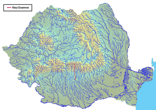
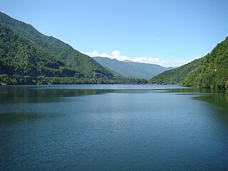
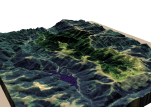
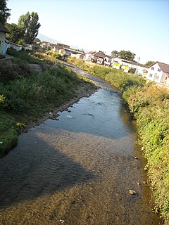
Râul Doamnei is a left tributary of the river Argeș in Romania. It discharges into the Argeș just north of Pitești. It is formed at the confluence of headwaters Valea Rea and Zârna River. It is 98 kilometers in length and frequently dries up in summer, owing to the works upstream that have redirected part of its water supply toward a reservoir serving the hydroelectric plant on the Argeș.

Calea Victoriei is a major avenue in central Bucharest. It leads from Splaiul Independenței to the north and then northwest up to Piața Victoriei, where Șoseaua Kiseleff continues north.

Lotru river in Romania

The Lotru is a right tributary of the Olt River in Romania. Its source is in the Parâng Mountains. It flows into the Olt near the town Brezoi. It passes through the communes Voineasa, Malaia, and Brezoi.

Latorița river in Romania

The Latorița is a right tributary of the river Lotru in Romania. It discharges into the Lotru near Valea Măceșului.

Gilort river in Romania

The Gilort is a river in southern Romania, a left tributary of the river Jiu. The Gilort flows through the villages and towns Novaci, Bălcești, Bengești, Târgu Cărbunești, Jupânești, Turburea and Capu Dealului.

Lăpuș River river in Romania

The Lăpuș River is a right tributary of the river Someș in Romania. It is formed at the confluence of the headwaters Izvorul Alb and Izvorul Negru. It discharges into the Someș in Bușag, west of Baia Mare. It flows through the communes Băiuț, Lăpuș, Târgu Lăpuș, Vima Mică, Șomcuta Mare, Remetea Chioarului, Coaș, Săcălășeni, Groși, Coltău, Recea and Tăuții-Măgherăuș.

The Suciu River is a left tributary of the river Lăpuș in Maramureș County, Romania. It discharges into the Lăpuș near Copalnic-Mănăștur. The upper reach is sometimes referred to as Groși River or Minghet River or Jijia River.

The Șușița River is a right tributary of the river Siret in Romania. It discharges into the Siret in Doaga. It flows through the following towns and villages, from source to mouth: Rucăreni, Dragosloveni, Rotileștii Mari, Câmpuri, Gogoiu, Răcoasa, Varnița, Repedea, Panciu, Satu Nou, Tișița and Doaga.

Orăștie River river in Romania

The Orăștie River is a left tributary of the river Mureș in Romania. It discharges into the Mureș near the town Orăștie.

Izvorul may refer to:

As a result of snowmelt, Bucharest, the capital of Romania, was hit by the worst flooding in its history. Although the death toll is unknown, documents attest a large number of dead and displaced people. At people's pressure, Prince Alexandru Ioan Cuza started a project of sewering the Dâmbovița River, which concretized only in 1880, after the plans of engineer Grigore Cerkez. Modern facilities were built to supply water to the city and 12 bridges.

References

  1. 2017 Romanian Statistical Yearbook, p. 13
  2. Constantin C. Giurescu, Istoria Bucureștilor. Din cele mai vechi timpuri pînă în zilele noastre, Bucharest, 1966, p.38
  3. 1 2 3 4 Ștefan Ionescu, Bucureștii în vremea fanarioților, Editura Dacia, Cluj, 1974. p. 28-30
  4. Kadinsky, Sergey "Dâmbovița River, Bucharest" Hidden Waters Blog December 28, 2016
  5. Florian Georgescu et al. Istoria Orașului București, Muzeul de Istorie al Orașului București, 1965, p.392
  6. "CE a aprobat proiectul major pentru sistemul de alimentare cu apă, canalizare și epurare din județul Dâmbovița", Fonduri Structurale, retrieved on October 27, 2011
  7. "Dâmbovița, râul ucis de deversările Capitalei", Evenimentul Zilei, April 8, 2009
  8. 1 2 "Sorin Oprescu: "Dâmbovița e mai curată de ieri", Jurnalul Național, October 11, 2011