A waterfall is an area where water flows over a vertical drop or a series of steep drops in the course of a stream or river. Waterfalls also occur where meltwater drops over the edge of a tabular iceberg or ice shelf.
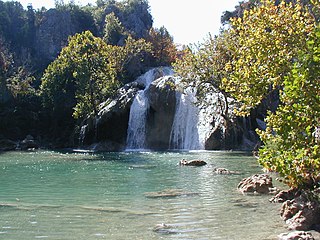
Turner Falls, an American waterfall, at 77 feet (23 m), is locally considered Oklahoma's tallest waterfall, although its height matches one in Natural Falls State Park. The falls are located on Honey Creek in the Arbuckle Mountains in south central Oklahoma, 6 miles (9.7 km) south of Davis.

Eagle Creek is a tributary of the Columbia River in Multnomah and Hood River counties in the U.S. state of Oregon. It cuts through a narrow canyon in its 3,200 feet (980 m) descent to the Columbia River Gorge and is known for its concentration of 13 waterfalls in about 5 miles (8.0 km) distance. Eight major falls are on Eagle Creek and the East Fork Eagle Creek itself, while five are on its tributaries.
The Paradise River is known for having a total of 8 major waterfalls.
Achness Falls, also known as the Achness Waterfall or Cassley Falls, is a waterfall located on the River Cassley in Sutherland, Scotland, near Rosehall and Invercassley. Its name is derived from the Scottish Gaelic Ach-an-eas, the "field of the waterfall".

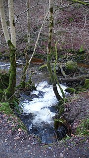
Avich Falls near Dalavich in Argyll and Bute is a waterfall in Scotland.
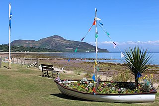
Eas Bàn is a waterfall on the island of Arran, Scotland. It lies on the Garbh Allt, a tributary of the Machrie Water.

Victoria Falls is a waterfall on the southern side of Loch Maree in Wester Ross in the north-west of Scotland. It is on the Abhainn Garbhaig, a short river that flows from Loch Garbhaig to Loch Maree. The falls are within Slattadale Forest, owned by the Forestry Commission.

Plodda Falls is a waterfall, situated 5 km south-west of the village of Tomich, near Glen Affric, in the Highlands of Scotland. The falls are 46 m high, and are on the Allt na Bodachan, near where it flows into the Abhainn Deabhag, which in turn joins with the River Affric to form the River Glass.
Eas Mor is a waterfall on the island of Arran, Scotland. It is located on the Allt Mor north of Auchenhew Bridge near the village of Kildonan.

Eas na Dabhaich is a waterfall on the island of Mull in Scotland. The falls lie on a burn that flows from Loch Fraing on the Ross of Mull over high cliffs above Carsaig Bay. There are several more unnamed waterfalls above and along the 200 metres (660 ft) cliffs that stretch from east of Carsaig along to Malcolm's Point and the Carsaig Arches 5 kilometres (3.1 mi) to the west where they are called Aoineadh Mòr and beyond where the height is reduced to about 130 metres (430 ft) and they are known as Aoineadh Beag.

Falls of Barvick is a waterfall of Scotland. It is 492 feet (150 m) at the highest, and has an average width of 20 feet (6.1 m). It is a cascades type waterfall.
Falls of Camserney is a waterfall of Scotland.

The falls of Edinample is a waterfall near the village of Craggan in the district of Stirling in Scotland.
Falls of Glas Allt is a 50-metre (160 ft) waterfall near the head of Loch Muick, Aberdeenshire, Scotland. Queen Victoria liked to take walks here beside the stream flowing from Lochnagar down to Loch Muick. After the death of Prince Albert she had a cottage, Glas-allt-Shiel, rebuilt for her on the delta where the stream flows into the loch.
Spectacle E’e Falls is a waterfall of Scotland.

Stinchar Falls is a waterfall of Scotland. It is located on the Stinchar Burn, east of Barr in Ayrshire.
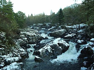
Stonebyres Falls is a waterfall of the River Clyde in Scotland. It is located on the former Stonebyres estate at the site of Stonebyres Castle.
Javornik Falls is a series of three waterfalls near the settlement of Javorniški Rovt, part of the municipality of Jesenice in northern Slovenia.