Sannox

Last updated

Sannox
Sannox Bay - geograph.org.uk - 2358965.jpg
Sannox Bay in 2011
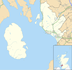
North Ayrshire UK location map.svg
Red pog.svg
Sannox
Location within North Ayrshire
OS grid reference NS015455
Civil parish
  • Kilbride
Council area
Lieutenancy area
Country Scotland
Sovereign state United Kingdom
Post town ISLE OF ARRAN
Postcode district KA27
Dialling code 01770
Police Scotland
Fire Scottish
Ambulance Scottish
UK Parliament
Scottish Parliament
List of places
UK
Scotland
55°39′47″N5°09′22″W / 55.663°N 5.156°W / 55.663; -5.156

Sannox (Scottish Gaelic : Sannaig) is a village on the Isle of Arran, Scotland. The village is within the parish of Kilbride. [1] The name comes from the name the Vikings gave to the area, Sandvik, meaning the Sandy Bay.
Contents

History

Within North Glen Sannox it is possible to find an Iron Age fort and the remains of a village, abandoned in 1829 as part of the process of the Highland clearances. Most of the inhabitants of this village emigrated to Canada where they built a replica of the church that was constructed in Sannox in 1822. The replica church in Inverness, Quebec, is no longer there (since the 1950s) and only the cemetery remains. Remains of the houses and runrigs - a type of farming common in western Scotland at the time - are visible throughout North Glen Sannox.

Mining was a source of employment in the area, when in 1840 a mine was opened in Glen Sannox. However operations only lasted around two decades. Operations ended when in 1862 the 11th Duke of Hamilton closed the mine, claiming that it spoiled the local area. However, the mine was reopened after the close of the First World War, and a railway and pier were built to transport the barytes that was mined there.

The source of barytes ran out in 1938 and the mine closed. The railway and pier to which it ran were removed in the 1940s, though the remains of the latter can still be seen on Sannox beach.

A small boat yard used to operate at the village jetty.

The cemetery in Glen Sannox used to house a small chapel. It is the burial site of Edwin Muir, who was murdered on Goatfell in 1889 by John Laurie.

Glen Sannox viewed from Sannox Beach Sannox Beach and Glen.jpg
Glen Sannox viewed from Sannox Beach

Geography

Sannox sits on the east coast of the Isle of Arran, with a stunning backdrop of scenery in the shape of Glen Sannox. To the north lies North Glen Sannox. The A841 road passes through to Lochranza, on a stretch of road known locally as the Boguille.

Community

Sannox is the location of the Corrie Golf Club, [2] a nine-hole golf course, named after the locally twinned village of Corrie. It is also the location of Sannox Cricket Club.

Related Research Articles

<span class="mw-page-title-main">Firth of Clyde</span> Inlet on the west coast of Scotland

The Firth of Clyde, is the estuary of the River Clyde, on the west coast of Scotland. The Firth has some of the deepest coastal waters of the British Isles. The Firth is sheltered from the Atlantic Ocean by the Kintyre Peninsula. The Firth lies between West Dunbartonshire in the north, Argyll and Bute in the west and Inverclyde, North Ayrshire and South Ayrshire in the east. The Kilbrannan Sound is a large arm of the Firth, separating the Kintyre Peninsula from the Isle of Arran. The Kyles of Bute separates the Isle of Bute from the Cowal Peninsula. The Sound of Bute separates the islands of Bute and Arran.

<span class="mw-page-title-main">Brodick</span> Village in Scotland

Brodick is the main village on the Isle of Arran, in the Firth of Clyde, Scotland. It is halfway along the east coast of the island, in Brodick Bay below Goat Fell, the tallest mountain on Arran. The name is derived from the Norse "breda-vick" meaning "Broad Bay".

<span class="mw-page-title-main">Lamlash</span> Town in Scotland

Lamlash is a village on the Isle of Arran, in the Firth of Clyde, Scotland. It lies three miles south of the island's main settlement and ferry port Brodick, in a sheltered bay on the island's east coast, facing the Holy Isle. Lamlash is the seat of Arran's local government offices, and is also the location of the island's police station, secondary school and hospital. In common with the rest of the island, the village's main industry is tourism and the public sector is also an important employer. Lamlash has an RNLI Lifeboat station with a B class Atlantic 75 lifeboat, covering the inshore waters around the coast of Arran, and in summer, there is a regular ferry service from Lamlash harbour to Holy Isle. The village has several buildings of historical interest, including Hamilton Terrace, which consists of two rows of single storey-and-attic cottages on the Lamlash seafront, arranged in pairs.

<span class="mw-page-title-main">Blackwaterfoot</span> Human settlement in Scotland

Blackwaterfoot is a village on the Isle of Arran in the Firth of Clyde, Scotland. The village is within the parish of Kilmory. It is located in the Shiskine valley in the south-west of the island. It is one of the smaller villages of Arran and home to one of Europe's two 12-hole golf courses. Nearby Drumadoon Point is home to the largest Iron Age fort on Arran. Further north is the King's Cave, reputed to be a hiding place of Robert the Bruce.

<span class="mw-page-title-main">Lochranza</span> Village in Scotland

Lochranza is a village located on the Isle of Arran in the Firth of Clyde, Scotland. The population, somewhat in decline, is around 200 people.

<span class="mw-page-title-main">Whiting Bay</span> Village in Scotland

Whiting Bay is a village located on the Isle of Arran in the Firth of Clyde, Scotland four miles south of Lamlash and eight miles south of Brodick. With more than 600 inhabitants it’s the third largest village on the island of Arran, behind Lamlash and Brodick.

<span class="mw-page-title-main">Goat Fell</span> Mountain in Scotland

Goat Fell is the highest point on the Isle of Arran. At 874 metres (2,867 ft), it is one of four Corbetts on the island. The mountain, along with nearby Brodick Castle, is now owned by the National Trust for Scotland.

<span class="mw-page-title-main">Lochwinnoch</span> Human settlement in Scotland

Lochwinnoch is a village in the council area and historic county of Renfrewshire in the west central Lowlands of Scotland. Lying on the banks of Castle Semple Loch and the River Calder, Lochwinnoch is chiefly a residential dormitory village serving nearby urban centres such as Glasgow and Paisley. Its population in 2001 was 2628 and in 2022 was 2769.

<span class="mw-page-title-main">Ardrossan</span> Town and sea port in Scotland

Ardrossan is a town on the North Ayrshire coast in southwestern Scotland. The town has a population of 10,670 and forms part of a conurbation with Saltcoats and Stevenston known as the 'Three Towns'. Ardrossan is located on the east shore of the Firth of Clyde.

<span class="mw-page-title-main">Port Bannatyne</span> Human settlement in Scotland

Port Bannatyne, is a coastal village on the Isle of Bute, Firth of Clyde, Scotland that is home to many steamers. Port Bannatyne developed into the 1900s as a quieter alternative to Rothesay. It is a popular harbour, with a small yacht marina and boatyard and an unusual 13-hole golf course rather than the standard 18.

<span class="mw-page-title-main">West Kilbride</span> Village in North Ayrshire, Scotland

West Kilbride is a village and historic parish in North Ayrshire, Scotland, on the west coast by the Firth of Clyde, looking across the Firth of Clyde to Goat Fell and the Isle of Arran. West Kilbride and adjoining districts of Seamill and Portencross are generally considered to be a small town, having a combined population of 4,393 at the 2001 census.

MV <i>Caledonian Isles</i> Scottish ferry ship, built 1993

MV Caledonian Isles, usually referred to locally as Caley Isles, is one of the largest ships operated by Caledonian MacBrayne (CalMac), which runs ferries to the Hebridean and Clyde Islands of Scotland. Caledonian Isles serves the Isle of Arran on the Ardrossan to Brodick route. As its CalMac's busiest route, Caledonian Isles has the largest passenger capacity in the fleet, and can carry up to 1000 passengers and 110 cars, with a crossing time of 55 minutes. She is used extensively by day-trippers to the Isle of Arran during the summer.

<span class="mw-page-title-main">Corrie, Arran</span> Human settlement in Scotland

Corrie is a village on the north east coast of the Isle of Arran in Scotland, 6 miles north of Brodick. It lies 2 mi (3 km) due east under the island's highest mountain, Goat Fell. A path from High Corrie 34 mi (1.2 km) to the south, provides access to the hillside. Corrie, and its northern neighbour, Sannox, lie approximately halfway between Brodick and Lochranza.

<span class="mw-page-title-main">Shiskine</span> Village on the Isle of Arran, Scotland

Shiskine is a small village on the Isle of Arran in the Firth of Clyde, Scotland. The village is within the parish of Kilmory. Sitting further up the "Shiskine Valley" from the village of Blackwaterfoot, the village takes its name from a corruption of the Gaelic for "marshy place". Much of the area was essentially a swamp years ago, but now comprises farm land.

<span class="mw-page-title-main">Clyde Muirshiel Regional Park</span>

Clyde Muirshiel Regional Park is the collective name for areas of countryside set aside for conservation and recreation on the South Clyde estuary in Scotland.

<span class="mw-page-title-main">A841 road</span> Road in North Ayrshire, Scotland, UK

The A841 road is the only A-road on the Isle of Arran and forms the island's primary transport route. Until 2009, the road circumnavigated the island around a 55-mile route. However, in 2009 the section between Dippen, just south of Whiting Bay and Lochranza via Blackwaterfoot was downgraded, leaving a truncated A841 to run between Whiting Bay and Lochranza via Brodick. At only one point does it venture inland, and this is to climb the 600-foot (180-metre) pass at Boguillie between Creag Ghlas Laggan and Caisteal Abhail in the north east of the island.

<span class="mw-page-title-main">Oban</span> Coastal town in Scotland

Oban is a resort town within the Argyll and Bute council area of Scotland. Despite its small size, it is the largest town between Helensburgh and Fort William. During the tourist season, the town can have a temporary population of up to over 24,000 people. Oban occupies a setting in the Firth of Lorn. The bay forms a near perfect horseshoe, protected by the island of Kerrera; and beyond Kerrera, the Isle of Mull. To the north are the long low island of Lismore and the mountains of Morvern and Ardgour.

<span class="mw-page-title-main">Isle of Arran</span> Island off the coast of Scotland

The Isle of Arran or simply Arran is an island off the west coast of Scotland. It is the largest island in the Firth of Clyde and the seventh-largest Scottish island, at 432 square kilometres (167 sq mi). Historically part of Buteshire, it is in the unitary council area of North Ayrshire. In the 2011 census it had a resident population of 4,629. Though culturally and physically similar to the Hebrides, it is separated from them by the Kintyre peninsula. Often referred to as "Scotland in Miniature", the Island is divided into highland and lowland areas by the Highland Boundary Fault and has been described as a "geologist's paradise".

<span class="mw-page-title-main">Glenmavis</span> Human settlement in Scotland

Glenmavis is a village in the North Lanarkshire area of Scotland. It is about two miles northwest of Airdrie on the B802 road. It has a population of around 2,200 (2022)

MV <i>Arran</i>

MV Arran was a pioneering Firth of Clyde vehicle ferry introduced by Caledonian Steam Packet Company in 1953. She spent fifteen years on the Upper Clyde crossings, followed by five years at Islay. Initially hoist-loading, via side ramps, these were replaced by a stern ramp in 1973. During her final years with CalMac, she relieved across the network. Several unsuccessful attempts were made to turn her into a floating restaurant, before she was scrapped in 1993.

References

  1. "Details of Sannox". Scottish Places. Retrieved 30 December 2014.
  2. "Arran, Mid Sannox, Corrie Golf Course". Canmore. Royal Commission on the Ancient and Historical Monuments of Scotland . Retrieved 30 December 2014.