
Orange County is a county located in the Los Angeles metropolitan area in Southern California, United States. As of the 2020 census, the population was 3,186,989, making it the third-most-populous county in California, the sixth-most-populous in the United States, and more populous than 19 American states and Washington, D.C. Although largely suburban, it is the second-most-densely-populated county in the state behind San Francisco County. The county's three most-populous cities are Anaheim, Santa Ana, and Irvine, each of which has a population exceeding 300,000. Santa Ana is also the county seat. Six cities in Orange County are on the Pacific coast: Seal Beach, Huntington Beach, Newport Beach, Laguna Beach, Dana Point, and San Clemente.
Volusia County is a county located in the east-central part of the U.S. state of Florida between the St. Johns River and the Atlantic Ocean. As of the 2020 census, the county was home to 553,543 people, an increase of 11.9% from the 2010 census. It was founded on December 29, 1854, from part of Orange County, and was named for the community of Volusia, located in northwestern Volusia County. Its first county seat was Enterprise. Since 1887, its county seat has been DeLand.
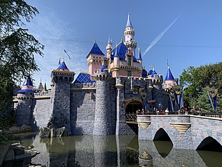
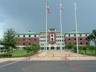
Anaheim is a city in northern Orange County, California, United States, part of the Greater Los Angeles area. As of the 2020 census, the city had a population of 346,824, making it the most populous city in Orange County, the tenth-most populous city in California, and the 55th-most populous city in the United States. The second largest city in Orange County in terms of land area, Anaheim is known for being the home of the Disneyland Resort, the Anaheim Convention Center, and two professional sports teams: the Los Angeles Angels of Major League Baseball (MLB) and the Anaheim Ducks of the National Hockey League (NHL). It also served as the home of the Los Angeles Rams of the National Football League (NFL) from 1980 through 1994.

Orange County is a county located in the Piedmont region of the U.S. state of North Carolina. As of the 2020 census, the population was 148,696. Its county seat is Hillsborough.

Buena Park is a city in northern Orange County, California, United States. As of the 2020 census its population was 84,034. It is the location of several tourist attractions, including Knott's Berry Farm. It is about 12 miles (19 km) northwest of downtown Santa Ana, the county seat, and is within the Los Angeles metropolitan area.

Fullerton is a city located in northern Orange County, California, United States. As of the 2020 census, the city had a total population of 143,617.

Pine Hills is a census-designated place (CDP) and unincorporated subdivision in Orange County, Florida, United States, west of Orlando. Per the 2020 U.S. Census, the population was 66,111. It is a part of the Orlando–Kissimmee–Sanford, Florida Metropolitan Statistical Area.

Coyote Valley is an area located in a narrowing of the southern Santa Clara Valley, in Northern California. Coyote Valley is approximately 7,400 acres (2,995 ha) in size and largely composed of farmland, orchards, open space preserves, and homes. Coyote Valley is generally divided into three sections: North Coyote Valley, the unincorporated village of Coyote, California, and South Coyote Valley.

Saddleback Valley refers to the flat and foothill areas west-southwest of the Saddleback double peak of the Santa Ana Mountains and east-northeast of the hilly Crystal Cove State Park in southern Orange County, California. The region primarily encompasses the cities of Mission Viejo, Lake Forest, and Rancho Santa Margarita, as well as the communities of Coto de Caza and Ladera Ranch. The cities of Aliso Viejo, Laguna Woods, Laguna Hills, and Laguna Niguel, as well as some of Orange County's eastern canyon communities, partially reside within the valley. The southeastern portion of Irvine also encroaches upon the area, but the two are not typically associated with each other.

Coyote Creek is a river that flows through the Santa Clara Valley in Northern California. Its source is on Mount Sizer, in the mountains east of Morgan Hill. It eventually flows into Anderson Lake in Morgan Hill and then northwards through Coyote Valley to San Jose, where it empties into San Francisco Bay.

The Orange County Zoo is a small 8-acre (3.2 ha) zoo located within the 477-acre (193 ha) Irvine Regional Park in the city of Orange, California, United States. The zoo is mainly home to animals and plants that are native to the Southwestern United States.
Ralph B. Clark Regional Park is an urban park located in the cities of Fullerton and Buena Park, California. The park is maintained by Orange County Regional Parks, the government division that controls the regional parks in Orange County. The park is south of Rosecrans Avenue at the southern edge of the West Coyote Hills in Buena Park, but both a small section named Camel Hill next to the main park area south of Rosecrans and another small section of the park with six softball fields and a trail located north of Rosecrans Avenue are within Fullerton city limits. The park was originally opened as Los Coyotes Regional Park in 1981, and was renamed in 1987 after then-retiring Orange County Supervisor Ralph B. Clark (1917–2009).

Coyote is an unincorporated community in Santa Clara Valley astride Coyote Creek and between San Jose and Morgan Hill's Madrone district in Santa Clara County. Part of Coyote is inside the city limits of San Jose. Its ZIP Code is 95013, and there is a small U.S. Post Office. It is inside telephone area codes 408 and 669.
Coyote Hills may refer to:

The Coyote Mountains are a small mountain range in San Diego and Imperial Counties in southern California. The Coyotes form a narrow ESE trending 2 mi (3.2 km) wide range with a length of about 12 mi (19 km). The southeast end turns and forms a 2 mi (3.2 km) north trending "hook". The highest point is Carrizo Mountain on the northeast end with an elevation of 2,408 feet (734 m). Mine Peak at the northwest end of the range has an elevation of 1,850 ft (560 m). Coyote Wash along I-8 along the southeast margin of the range is 100 to 300 feet in elevation. Plaster City lies in the Yuha Desert about 5.5 mi (8.9 km) east of the east end of the range.
The West Coyote Hills is the area surrounding a ridge in northern Orange County, California. It contains one of the last large open-space area in north Orange County. Parts of it lie within the city limits of La Habra, Buena Park, and La Mirada, with most of it sprawling across western Fullerton between Ralph B. Clark Regional Park and Euclid Street north of Rosecrans Avenue. The foothill region to the east and south is known as Sunny Hills. There is also an East Coyote Hills area, on the east side of Fullerton, that has been almost completely developed for residential real estate.

Anderson Lake, also known as Anderson Reservoir, is an artificial lake in Morgan Hill, located in southern Santa Clara County, California. The reservoir is formed by the damming of Coyote Creek just below its confluence with Las Animas Creek. A 4,275-acre (1,730 ha) county park surrounds the reservoir and provides limited fishing, picnicking, and hiking activities. Although swimming is prohibited, boating, water-skiing, and jet-skiing are permitted in the reservoir.

Coyote Creek is a principal tributary of the San Gabriel River in northwest Orange County and southeast Los Angeles County, California. It drains a land area of roughly 41.3 square miles (107 km2) covering eight major cities, including Brea, Buena Park, Fullerton, Hawaiian Gardens, La Habra, Lakewood, La Palma, and Long Beach. Some major tributaries of the creek in the highly urbanized watershed include Brea Creek, Fullerton Creek, and Carbon Creek. The mostly-flat creek basin is separated by a series of low mountains, and is bounded by several small mountain ranges, including the Chino Hills, Puente Hills, and West Coyote Hills.
Brea Creek is one of four principal tributaries of Coyote Creek, which is a lower tributary of the San Gabriel River in California. It drains parts of Orange, Riverside, and San Bernardino counties. The creek flows 11.7 miles (18.8 km) from the cities of Brea and Anaheim to Whittier, where its mouth is on the left bank of Coyote Creek, at a point 481 feet (147 m) lower in elevation.

The 2014 La Habra earthquake was a magnitude 5.1 earthquake that occurred on March 28, 2014, at 9:09:42 p.m. PDT. Although given the name "La Habra" it was centered in Brea, a city in northern Orange County. Despite its moderate magnitude, it had a maximum Mercalli intensity of VII, and caused a total of $10.8 million in damage. Thirteen water mains broke in Fullerton, forcing roughly 70 families to be displaced from their homes after they were declared temporarily uninhabitable.

