Related Research Articles

Woolsthorpe by Belvoir, also known as Woolsthorpe is a village and civil parish in the South Kesteven district of Lincolnshire, England. The population of the civil parish at the 2011 census was 415. It is situated approximately 5 miles (8 km) west from Grantham, and adjoins the county border with Leicestershire. The neighbouring village of Belvoir lies on the other side of the border. Grantham Canal is situated 1 mile (1.6 km) to the north-east at its closest point.
Scaldwell is a village and civil parish in the West, Northamptonshire, England.
Lamport is a village and civil parish in West Northamptonshire, England. The village is on the A508, about 8 miles (13 km) south of Market Harborough and 8 miles (13 km) north of Northampton. Nearby is Lamport Hall. At the time of the 2001 census, the parish's population was 207 people, including Hanging Houghton and increasing to 225 at the 2011 Census.

Ab Kettleby is a village and civil parish in the Melton district of Leicestershire, England, located 3 miles (4.8 km) north of Melton Mowbray, on the A606 road. It had a population of 501 in 2001; at the 2011 census this had increased to 529.

Waltham on the Wolds is an English village in the civil parish of Waltham on the Wolds and Thorpe Arnold, in the Melton borough of Leicestershire. It lies about 5 miles (8.0 km) north-east of Melton Mowbray and 11 miles (17.7 km) south-west of Grantham on the main A607 road. The parish population was 967 in 2011.

Sproxton is a village and civil parish within the Borough of Melton in Leicestershire, England, close to the border with Lincolnshire. It has approximately 80 occupied dwellings (2021) and a population of 480, rising to 658 at the 2011 census.

Eaton is a village and civil parish in Leicestershire, England, situated in the Vale of Belvoir. The population at the 2011 census was 648. The civil parish includes nearby Eastwell to the west of the village. Eaton has a church, a village hall and a children's park, but the public house called The Castle and its adjacent shop have closed.
The Hook Norton ironstone quarries (Brymbo) were ironstone quarries near Hook Norton in Oxfordshire, England. The quarries were in operation from 1899 to 1946 supplying ironstone to the Brymbo Steelworks in Wrexham and were served by the Brymbo Ironworks Railway, an extensive, 2 ft narrow gauge industrial railway.
Knipton is a small English village in the civil parish of Belvoir, in the county of Leicestershire. It lies about 6 miles (10 km) from the town of Grantham, just off the A607, and 10 miles (16 km) from Melton Mowbray. It borders the Duke of Rutland's estate at Belvoir Castle. Although the village is in Leicestershire, it has a Nottinghamshire postcode and a Lincolnshire (Grantham) STD code.
Waltham on the Wolds railway station was a railway station at the end of The Waltham Branch serving the village of Waltham on the Wolds, Leicestershire. The Waltham Branch was built by the Great Northern Railway from the Great Northern and London and North Western Joint Railway at Scalford to exploit ironstone deposits in the area.
The Great Northern and London and North Western Joint Railway was a British railway line, almost entirely within Leicestershire. Authorised by the same Act of Parliament, the Great Northern Railway Leicester Branch was built, branching from the Joint Line; on the same basis the Newark to Bottesford Line was built. The lines opened progressively between 1879 and 1883. The dominant traffic was iron ore, and the agricultural produce of the area served also generated considerable business. The passenger usage was never considerable, although some unusual through services were attempted at first.
Hook Norton railway station served the village of Hook Norton in northern Oxfordshire, England.
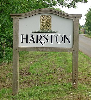
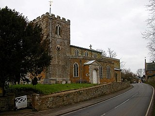
Harston is a crossroads village in Leicestershire, England, near the border with Lincolnshire. The nearest town is Grantham, about 6 miles (10 km) to the north-east. It forms part of the civil parish of Belvoir, in the district of Melton. It once contained several quarries for iron ore. Part of the village borders Lincolnshire.

Eastwell is a village and ecclesiastical parish in Leicestershire, England.
The Hook Norton Ironstone Partnership was the first company to quarry ironstone at Hook Norton on a large scale. Although only in operation for twelve years, its quarries subsequently became part of the Brymbo Steelworks quarries and relics of the Partnership's railways and tramways can still be seen today.

Branston is a village in the civil parish of Croxton Kerrial and Branston, Leicestershire, England. It lies 1 mile (1.6 km) north of the A607 road, 7 miles (11 km) south-west of Grantham and 7 miles north-east of Melton Mowbray, on the southern edge of the Vale of Belvoir, 3 miles (5 km) south-west of Belvoir Castle. Knipton Reservoir is 700 yards (640 m) to the north. The population is included in the civil parish of Croxton Kerrial.

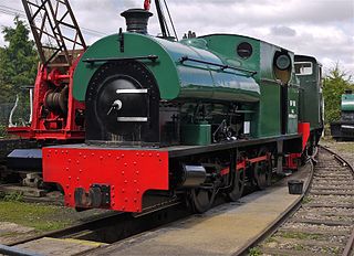
The Waltham Iron Ore Tramway was a 1,000 mm gauge industrial tramway serving the ironstone pits of the Waltham Iron Ore Company, a subsidiary of the Staveley Coal and Iron Company. It was located to the north of the village of Branston in Leicestershire on the edge of the Belvoir Estate. The tramway operated from 1884 until 1958.
The Finedonhill Tramway was a British industrial narrow-gauge railway which operated under various ownership between 1875 and 1926.
The Wellingborough Tramway was an industrial narrow-gauge railway that connected a series of ironstone mines and quarries with the Midland Railway and later with the ironworks on the north side of Wellingborough. In various forms, the tramway operated between 1875 and 1966.
Neilson's Tramway was a British industrial narrow-gauge railway which operated from 1881 to 1929.
References
- ↑ E.W. Badger and W.J. Harrison (eds) (November 1884). "The Midland Naturalist". Vol. VII.
{{cite news}}:|author=has generic name (help) - ↑ "Parliament. 1883 session". The Railway News. 25 November 1882.
{{cite journal}}: Cite journal requires|journal=(help) - ↑ Britain, Great (2 November 1883). "In Parliament. Session 1884". The London Gazette.
- ↑ Sutton, John (20 June 2010). "The Eaton Branch near White Lodge". Geograph. Retrieved 10 September 2017.
- ↑ Tonks 1992, pp. 117, 119.
- ↑ Tonks 1992, p. 14.
- ↑ Leicestershire VII.SE (Map). Ordnance Survey. 1931.
- Tonks, Eric (1992). The Ironstone Quarries of the Midlands Part 9: Leicestershire. Cheltenham: Runpast Publishing. ISBN 1-870-754-085.