Gloucestershire is a county in South West England. The county comprises part of the Cotswold Hills, part of the flat fertile valley of the River Severn, and the entire Forest of Dean.

The Forest of Dean is a geographical, historical and cultural region in the western part of the county of Gloucestershire, England. It forms a roughly triangular plateau bounded by the River Wye to the west and northwest, Herefordshire to the north, the River Severn to the south, and the City of Gloucester to the east.

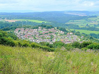
Coleford is a market town in the west of the Forest of Dean, Gloucestershire, England, 2 miles (3.2 km) east of the Welsh border and close to the Wye Valley. It is the administrative centre of the Forest of Dean district. The combined population of the town's two electoral wards at the 2011 census was 8,359.

Hucclecote is a village in Gloucestershire, United Kingdom, comprising a ward in the City of Gloucester, and an adjacent civil parish in the Borough of Tewkesbury. It is located on the periphery of the city, between Barnwood and Brockworth, along Ermin Way, an old Roman road connecting Gloucester with Cirencester and the Cotswolds.
Whitfield is a hamlet in South Gloucestershire, England.

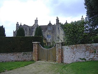
St Briavels, is a medium-sized village and civil parish in the Royal Forest of Dean in west Gloucestershire, England; close to the England-Wales border, and 5 miles (8 km) south of Coleford. It stands almost 800 feet (240 m) above sea level on the edge of a limestone plateau above the valley of the River Wye, above an ancient meander of the river. To the west, Cinder Hill drops off sharply into the valley. It is sheltered behind the crumbling walls of the 12th century St Briavels Castle.

Coombe Hill is a hamlet in the civil parish of Leigh in Gloucestershire, England. It lies on the A38 road between Gloucester and Tewkesbury, at the junction with the A4019 road to Cheltenham.

Nibley is a village in the parish of Westerleigh, South Gloucestershire, England; it is situated about 1.5 miles (2.4 km) west of Yate.
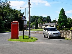
Alvington is a village and civil parish in the Forest of Dean in Gloucestershire, England, situated on the A48 road, six miles north-east of Chepstow in Wales. The parish had a total population of 506 at the 2011 census.

Mitcheldean is a town in the east of the Forest of Dean, Gloucestershire, England.

Frogmore is a small suburban village in the north east of the civil parish of Yateley in the county of Hampshire, England.

Flaxley is a small settlement in the Forest of Dean, Gloucestershire, England. It is located in between the larger villages of Westbury-on-Severn and Mitcheldean.
Lower Wick is a small hamlet located in the county of Gloucestershire, England. It is situated about five miles south west of Dursley, eighteen miles southwest of Gloucester and fifteen miles northeast of Bristol. Lower Wick is within the civil parish of Alkington.

Berry Hill is a village in Gloucestershire, England, 1.5 miles north of the town of Coleford. Berry Hill includes the settlements of Five Acres to the east, Christchurch in the centre, Shortstanding to the north, and Joyford to the north-east. Berry Hill is within the civil parish of West Dean.

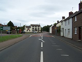
Hartpury is a civil parish in Gloucestershire, England. It has an area of about 3,500 acres (1,400 ha), about 270 homes and a population of about 700 people, increasing dramatically to 1,642 at the 2011 census The village is about 5 miles (8 km) north of Gloucester. Geographically the parish is in Leadon Vale; administratively it is in the Forest of Dean. Hartpury also presents beautiful walks and strolls through the countryside. It has all the usual facilities; Post Office, a school, church and a vets. Hartpury College is based in the village. The village contains several interesting buildings including the former home of the Canning family, Hartpury House, now part of the college. Hill House, also known as The Hill, is a large timber framed house which contains a very fine 16th Century oak staircase and several plaster ceilings of the same period.
Joy's Green is a village in the Forest of Dean in West Gloucestershire, England. The village is in the civil parish of the neighbouring village of Lydbrook.
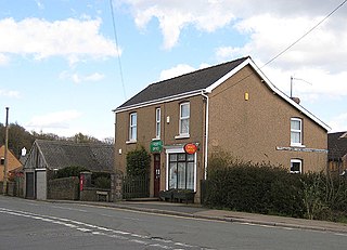
Broadwell is a village about 1 mile (1.6 km) east of Coleford, Gloucestershire, England. It is at the western edge of the Forest of Dean, in the civil parish of Coleford, which is also its post town. The village of Mile End is to the north and Coalway is to the south.
Bradley is a small village in the Stroud District, in the county of Gloucestershire, England.

Bixslade, occasionally written Bix Slade, is a short, steep-sided, valley in the Forest of Dean, Gloucestershire. It begins on high ground at Bixhead, near Broadwell, and descends sharply to meet the Cannop Valley at Stonyhill Green. Bixslade has been quarried or mined continuously for over 500 years and has been described as "one of the country's finest areas of extractive industrial heritage".
Mile End is a small village in the English county of Gloucestershire. It belongs to the civil parish of Coleford, which is also its post town. Mile End is 1 mile (1.6 km) northeast of Coleford. The village lies at the western edge of the Forest of Dean. The village merges with the village of Broadwell to the south.