
The Richmond District is a neighborhood in the northwest corner of San Francisco, California, developed initially in the late 19th century. It is sometimes confused with the city of Richmond, which is 20 miles (32 km) northeast of San Francisco; accordingly, the neighborhood usually is referred to as "the Richmond."

Virginia City is a census-designated place (CDP) that is the county seat of Storey County, Nevada, and the largest community in the county. The city is a part of the Reno–Sparks Metropolitan Statistical Area.

Sutro Tower is a unique three-legged 297.8 m (977 ft) tall TV and radio lattice tower located in San Francisco, California. Rising from a hill between Twin Peaks and Mount Sutro near Clarendon Heights, it is a prominent feature of the city skyline and a landmark for city residents and visitors. The tower was the tallest structure in San Francisco from the time of its completion in 1973 until it was surpassed by the Salesforce Tower in 2018.
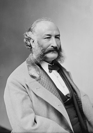
Adolph Heinrich Joseph Sutro was a German-American engineer, politician and philanthropist who served as the 24th mayor of San Francisco from 1895 until 1897. Born a German Jew, he moved to Virginia City, Nevada and made a fortune at the Comstock Lode. Several places in San Francisco bear his name in remembrance of his life and contributions to the city.

The Sutro Baths was a large, privately owned public saltwater swimming pool complex in the Lands End area of the Outer Richmond District in western San Francisco, California.

Bernal Heights is a residential neighborhood in southeastern San Francisco, California. The prominent Bernal Heights hill overlooks the San Francisco skyline and features a microwave transmission tower. The nearby Sutro Tower can be seen from the Bernal Heights neighborhood.

Mount Tamalpais, known locally as Mount Tam, is a peak in Marin County, California, United States, often considered symbolic of Marin County. Much of Mount Tamalpais is protected within public lands such as Mount Tamalpais State Park, the Marin Municipal Water District watershed, and National Park Service land, such as Muir Woods.

John McLaren Park is a park in southeastern San Francisco. At 312.54 acres (126.48 ha), McLaren Park is the third largest park in San Francisco by area, after Golden Gate Park and the Presidio. The park is surrounded mostly by the Excelsior, Crocker-Amazon, Visitacion Valley, Portola and University Mound neighborhoods.

Forest Hill is a neighborhood in San Francisco, California. Forest Hill is one of eight master-planned residence parks in San Francisco. Forest Hill is located near the middle of the City of San Francisco, southeast of the Inner Sunset and northeast of West Portal. Boundaries are roughly Seventh Avenue/Laguna Honda Boulevard to the north and east, Taraval Street to the south, and 14th Avenue to the west.

Mount Sutro is a hill in central San Francisco, California. It was originally named Mount Parnassus.

Mount Davidson is the highest natural point in San Francisco, California, with an elevation of 928 feet (283 m). It is located near the geographical center of the city, south of Twin Peaks and Portola Drive and to the west of Diamond Heights and Glen Park. It dominates the southeastern view from most of Portola Drive. It is one of San Francisco's many hills and one of its original "Seven Hills".

San Bruno Mountain is a fault-block horst in northern San Mateo County, California. Rising to a quarter-mile high peak directly out of San Francisco Bay, it also includes a smaller ridge in San Francisco. Viewed from downtown San Francisco, the mountain occupies the southern horizon. It is surrounded as well by the cities of Brisbane, Colma, Daly City, and South San Francisco, and has an important role in the history and life of these communities.

The Golden Gate National Recreation Area (GGNRA) is a U.S. National Recreation Area protecting 82,116 acres (33,231 ha) of ecologically and historically significant landscapes surrounding the San Francisco Bay Area. Much of the park is land formerly used by the United States Army. GGNRA is managed by the National Park Service and is the second-most visited unit of the National Park system in the United States, with more than 15.6 million visitors in 2022. It is also one of the largest urban parks in the world, with a size two-and-a-half times that of the consolidated city and county of San Francisco.

The Berkeley Hills are a range of the Pacific Coast Ranges, and overlook the northeast side of the valley that encompasses San Francisco Bay. They were previously called the "Contra Costa Range/Hills", but with the establishment of Berkeley and the University of California, the name was updated by geographers and gazetteers.

Mountain Lakes is a commuter railroad station in the borough of Mountain Lakes, Morris County, New Jersey, United States. The station is on New Jersey Transit's Montclair-Boonton Line, the last before the line merges with the Morristown Line at Denville station to the west. The station has one low-level side platform, serving a solo track. The 1912-built William Hull Botsford station depot stands on the single platform, along with an ornate station shelter. The next station to the east of Mountain Lakes is Boonton.

Playland was a 10-acre (40,000-square-meter) seaside amusement park located next to Ocean Beach, in the Richmond District at the western edge of San Francisco, California, along Great Highway, bounded by Balboa and Fulton streets. It began as a collection of amusement rides and concessions in the late 19th century, and was preceded by Chutes at the Beach, opened in 1921. Playland closed Labor Day weekend in 1972.

An antenna farm, satellite dish farm or dish farm is an area dedicated to television or radio telecommunications transmitting or receiving antenna equipment, such as C, Ku or Ka band satellite dish antennas, UHF/VHF/AM/FM transmitter towers or mobile cell towers. The history of the term "antenna farm" is uncertain, but it dates to at least the 1950s.

The Sutro Historic District is a National Park Service historic district in the Lands End area of the Outer Richmond District in western San Francisco, California. It is within the Golden Gate National Recreation Area, since being acquired by the National Park Service in 1977.


