El Manso Airport

Last updated
El Manso Airport

Aeropuerto El Manso
Summary
Airport typePublic
Serves Llanada Grande
LocationFlag of Chile.svg  Chile
Elevation  AMSL 1,296 ft / 395 m
Coordinates 41°44′32.9″S071°54′36.6″W / 41.742472°S 71.910167°W / -41.742472; -71.910167 (El Manso Airport (Llanada Grande)) Coordinates: 41°44′32.9″S071°54′36.6″W / 41.742472°S 71.910167°W / -41.742472; -71.910167 (El Manso Airport (Llanada Grande))
Map
Chile location map.svg
Airplane silhouette.svg
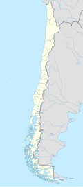
SCGR
Location of El Manso Airport in Chile
Runways
Direction LengthSurface
ftm
12/301,820555Grass
Source: Landings.com [1] [2]

El Manso Airport (Spanish : Aeropuerto El Manso, ICAO : SCGR) is a public use airport located near Llanada Grande, Los Lagos, Chile.

Contents

See also

Related Research Articles

Pupelde Airport is an airport serving Ancud, a Pacific port city in the Los Lagos Region of Chile. Ancud is on the northern shore of Chiloé Island.

El Boldo Airport Spanish: Aeropuerto de El Boldo, is an airport serving Cauquenes, a city in the Maule Region of Chile. The airport is 8 kilometres (5.0 mi) east of Cauquenes.

Chañaral Airport Spanish: Aeropuerto de Chañaral, is an airport serving Chañaral, a Pacific coastal city in the Atacama Region of Chile.

Chile Chico Airport Spanish: Aeródromo Chile Chico, is an airport serving Chile Chico, a lakeside town in the Aysén Region of Chile. Chile Chico is on the south shore of General Carrera Lake, 3 kilometres (1.9 mi) west of the Argentina border. The airport is 5 kilometres (3.1 mi) southeast of the town.

Fundo El Carmen Airport Spanish: Aeropuerto de Fundo El Carmen, ) is an airport 7 kilometres (4.3 mi) east of Chillán, a city in the Bío Bío Region of Chile. The runway lies alongside the south bank of the Chillán River.

<span class="mw-page-title-main">Cochrane Airfield</span> Airport

Cochrane Airport Spanish: Aeródromo Cochrane, is an airport serving Cochrane, a town in the Aysén Region of Chile. The airport is just northwest of the town, at the foot of Cerro Tamanguito (sv).

El Tuqui Airport, is an airport serving Ovalle, a city in the Coquimbo Region of Chile.

El Salto Airport is an airport 2 kilometres (1.2 mi) northwest of Parral, a city in the Maule Region of Chile.

El Principal Airport, is an airstrip in the Pirque commune of the Santiago Metropolitan Region in Chile.

El Mirador Airport, is an airport just southeast of Puerto Varas, a city in the Los Lagos Region of Chile. Puerto Varas is on the southwest shore of Llanquihue Lake.

El Vergel Airport is an airport 3.5 kilometres (2.2 mi) west of Riñihue, a lakeside village in the Los Ríos Region of Chile.

El Cardal Airport, is an airport serving the Río Bueno commune in the Los Ríos Region of Chile.

El Salar Airport is a high elevation airport serving the mineral salt mining operations on the Salar de Atacama salt flat, in the Antofagasta Region of Chile.

El Corte Airport, is an airport 5 kilometres (3.1 mi) south-southeast of Talagante, a city in the Santiago Metropolitan Region of Chile.

Panguilemo Airport is an airport 5 kilometres (3.1 mi) northeast of Talca, capital of the Maule Region of Chile.

Las Breas Airport is an airport 20 kilometres (12 mi) south-southeast of Taltal, a Pacific coastal town in the Antofagasta Region of Chile.

El Budi Airport is an airstrip serving the Teodoro Schmidt commune in the La Araucanía Region of Chile. The runway is 3 kilometres (1.9 mi) north of the town of Hualpin.

Barriles Airport Spanish: Aeropuerto Barriles is an airport 15 kilometres (9.3 mi) east-southeast of Tocopilla, a Pacific coastal town in the Antofagasta Region of Chile.

Vallenar Airport (Spanish: Aeródromo de Vallenar, is an airport serving Vallenar, a city in the Atacama Region of Chile.

Rodelillo Airfield is a public airport near the Pacific coastal city of Valparaíso in the Valparaíso Region of Chile.

References

  1. Airport record for El Manso Airport at Landings.com. Retrieved 2013-09-07
  2. Google (2013-09-07). "location of El Manso Airport" (Map). Google Maps . Google. Retrieved 2013-09-07.