Before European arrival, the land around El Palo Alto was home to the Ohlone Native Americans. Local folklore holds that El Palo Alto was a rest stop for the first European expedition that discovered San Francisco Bay, led by Spanish explorer Gaspar de Portolá in 1769. The tree became widely known with the early-1850s establishment of a highway between San Francisco and San Jose, and as a landmark along the San Francisco–San Jose railroad, construction of which passed the tree in 1863. In 1876, Leland Stanford, co-founder of Stanford University along with his wife Jane Lathrop Stanford, purchased land near El Palo Alto.[2]
Early images and accounts indicate that El Palo Alto once had two trunks. It lost one trunk before 1883—the exact date is unknown—perhaps due to heavy rainfall and erosion of the riverbank. Fearing the tree's total loss, Leland Stanford directed that the riverbank be reinforced with a wooden bulkhead, which was replaced with concrete abutments in 1904 and again in 1911. Coal soot from steam locomotives passing below the tree suffocated the leaves of the tree's upper limbs; nearby wells lowered the water table, and by the late 1920s the tree was declared moribund. Although it has decreased in stature by some 50ft (15m) since the late 1800s, El Palo Alto was ultimately saved by the continuous preservation efforts of the city, local arborists, Stanford University, and Southern Pacific (the owner of the adjacent railroad); a 1997 appraisal concluded that the tree would "persevere and grow for centuries to come". El Palo Alto is featured prominently on the City of Palo Alto logo and the Stanford University seal, and is recognized by the National Arborist Association and International Society of Arboriculture as a tree of historical importance.
Name and background
El Palo Alto is a coast redwood (Sequoia sempervirens), a giant and long-lived tree species only found near the North American Pacific coast.[3] The redwood has been California's official state tree since 1937.[4] The world's tallest trees are coast redwoods, with the record holder, Hyperion, reaching 380ft (120m).[3][5] El Palo Alto is not so tall, at about 110ft (34m)[6]as of 2021[update], down from 162ft (49m) in the 19th century.[7] At 1084–1085 years,[8] nor is El Palo Alto particularly old; the longest-lived redwoods may approach 2,500 years in age.[1] Although today there are thousands of redwoods in the city of Palo Alto, El Palo Alto is one of only a few not planted by humans.[9] Redwoods generally require wet climates like those found close to the coast,[1] but El Palo Alto is much further inland, close to Palo Alto's northern border with Menlo Park.[10] The tree's location next to San Francisquito Creek provided it the necessary water to survive.[1]
Before conquest by Spanish missionaries in the 18th century, the land around El Palo Alto was home to the Ohlone.[1] According to traditional history, El Palo Alto was the campsite of Spanish explorer Gaspar de Portolá's men[15] between November 6 and 11, 1769.[14] Portolá was traveling north up the California coast from Mexico in search of Monterey Bay, but failed to identify it. Nourished by Ohlone natives, the expedition continued north and on November 1 were greeted with the expanse of the San Francisco Bay.[13] They traveled southwest and arrived at San Francisquito Creek on November 6, 1769, where they camped until November 11.[14]
Visiting the bay in 1774, Father Francisco Palóu came upon a large tree on the creek, considered its location suitable for a new mission, and erected a wooden cross near it. His diary entry indicated the location of Portolá's camp as nearby and is the tree's first appearance in writing.[14] In 1776,[16]Juan Bautista de Anza and Father Pedro Font visited the tree and concluded the creek's flow was too unreliable, instead founding the Mission Santa Clara de Asís—modern day Santa Clara—15mi (24km) to the southeast.[17] Font measured the tree with a graphometer: fifty varas (137 feet; 42 m) high and 5.5 varas (15 feet; 3 m) around at the base, noting that soldiers had told him there were larger ones in the mountains.[16][17] A 1777 map of the bay by Font indicated a large tree on San Francisquito Creek.[14]
Most evidence in the past suggested that El Palo Alto was not the actual tree in Font's map or referenced by early Spanish diarists, who recorded their travels in detail but made no mention of a tree with twin trunks.[18] Local historian Steve Staiger said that Portolá's camp may have been under a tree further downstream, later felled by a Spanish military engineer to make a bridge.[1] Two candidates for the landmark tree, elsewhere along the creek, fell in 1852[18] and 1911.[18][19][20]
However, in a 2024 presentation by Jeff Watt at the Palo Alto Historical Association, he presented part of a newly discovered field journal from Pedro Font that states on March 30, 1776 that "We arrived at its trunk and saw that it was not a single tree but two trees very close together. From a distance they appear as one...." This discovery was originally published in Alan K. Brown's recent book. [21] Jeff concludes his presentation suggesting that evidence is now favoring the idea that El Palo Alto was the tree described in the 1776 expedition. [22]
Early landmark
November 1856 land survey of Rancho de las Pulgas—bounded below by San Francisquito Creek—indicating the "Palo Alto Redwoods" (above "Robles Rancho")1860s drawing of El Palo Alto by Edward Vischer at "Big Tree Station"
In July 1850, a highway from San Francisco in the north to San Jose to the south was ordered to be built. Previous travelers took narrow trails on horseback or slightly wider tracks on oxcart; it was joked that the road between the two cities was "three miles wide".[25] The highway passed close to El Palo Alto and likely brought it to prominence.[24] The tree was nearly cut down in 1850, but was saved by a timely shipment of lumber.[26]
El Palo Alto was first known as the Palos Colorados,[26] roughly meaning 'red trees'.[1] The earliest known reference to the name "Palo Alto" dates to 1853,[15] and an 1856 official land survey labeled it the "Palo Alto Redwoods";[27] the name "Rancho of Palo Alto" was used as a disambiguation in 1857.[20] Construction of a railroad by the San Francisco & San Jose Railroad Company, connecting San Francisco to San Jose, passed the tree in 1863,[28] making it an obvious landmark for travelers. The section from San Francisco to "Big Tree Station" at the creek[24] was inaugurated on October 7 that year.[29] The Southern Pacific Transportation Company purchased the company in March 1868;[30] the tree was featured in Southern Pacific advertising.[31]Edward Vischer's Pictorial of California (1870) contains a drawing of the tree with two trunks, noting it to be "one of the very few instances of that mountain monarch [the redwood] being found in the open level country", and suggests that the tree originally had three trunks, describing it as "[t]wins, once a trio".[23]
Land transfers and the Stanfords
1894 view in University Park, facing northeast toward El Palo Alto in the distance
The land beneath and nearby the tree passed through various owners before becoming part of the city of Palo Alto, which did not yet exist. Some references state that the tree lay at the northwest corner of a Mexican land grant called Rancho Rinconada del Arroyo de San Francisquito,[32][a] which spanned 2,229 acres (902ha) of oak trees and brush. This corner abutted Rancho San Francisquito to the west and Rancho de las Pulgas to the north.[32] In 1835, the Rinconada grant was first given to Don Rafael Soto, whose father had settled in the de Anza expedition of 1775–76.[34] Soto's widow inherited the grant in 1841.[35] She entered a dispute with the US government—which acquired California as a state in 1850, after the Mexican–American War[36]—over whether her claim was valid. Soto's heirs were finally declared the rightful owners in 1872, and gave the contractors who had represented them about 1,400 acres (570ha) of land as compensation;[37] the heirs kept the other, northern part.[38]
There is more evidence that El Palo Alto has always been located in a portion of Rancho San Francisquito that extends in a small projection to encompass the area along the creek east of El Camino Real. This is the Rancho that was northwest of Rancho Rinconada del Arroyo de San Francisquito and currently holds the core of Stanford University. This map at OpenHistoricalMap shows this section and the corner that includes El Palo Alto.[39] The most convincing evidence that the tree was part of the Rancho San Francisquito is the land claim case of Maria Concepcion Valencia de Rodriquez of 1866. The attached map that was part of the 1866 claim, shows the tree within the corner of the Rancho where they denote the tree with a plus sign (+) under the words "Twin Redwoods Palo Alto".[40]
In 1876, parts of Rancho San Francisquito was purchased by Leland Stanford[41][42]—who later founded Stanford University with his wife Jane Stanford—for his Palo Alto Stock Farm, a place for breeding and training horses. It would eventually grow to about 8,000 acres (3,200ha).[43] Following the death of their son in 1884, the Stanfords established a university in his honor on their land.[43] In 1887, Soto's heirs sold their land to a good friend of Leland Stanford, Timothy Hopkins, who used it to develop the nearby town of University Park (see 1894 view).[44] In particular, Hopkins acquired land near El Palo Alto, adjacent to Southern Pacific–owned land, that eventually became the city-owned El Palo Alto Park.[45] Stanford University opened on October 1, 1891, with 440 students in attendance, and prompted the rapid growth of University Park.[46] In 1894 it incorporated as the city of Palo Alto,[47] a new name for which Stanford had a "great fondness".[44] The first university seal, adopted in 1908, featured El Palo Alto prominently (although its artist Arthur Bridgman Clark drew a more "vigorous"[48] tree, how El Palo Alto might have looked centuries earlier[49]), adorned with SEMPER to its left and VIRENS to its right as a motto.[48][b] Yet, even as the tree became so enmeshed with the university's branding, its position east of the railroad right of way confirms that there never was a time when El Palo Alto was on land owned by Leland Stanford.[52]
One trunk falls
In the 1870s, by Carleton Watkins; the tree's earliest known photograph.[53] The left trunk would fall.
c. 1904, first wall
c. 1918, showing concrete buttress
El Palo Alto had two trunks until some time between 1875[54] and 1882,[55] when the north, more-curved trunk fell.[49][56] The stump's rings were counted and gave an age of 967 years.[55]
The exact date and cause of the trunk's falling is unknown.[15] A 1900 article in Palo Alto Live Oak dates the falling to the winter of 1879, blaming a freshet.[26] A December 1882 article in The Sacramento Bee states: "Some years ago it had a companion tree, but the latter was undermined by a subterranean stream and fell to the ground."[55] Local historian Guy Miller studied the matter for over two decades and estimated a date of 1885. Miller suggested that railroad records likely to contain definitive information were destroyed in the 1906 San Francisco earthquake and subsequent fire.[54] In a Palo Alto Historical Association talk on October 6, 2024 by Jeff Watt, a local Palo Alto electrical engineer, he presented evidence that the twin tree likely fell in 1875. [57]
The San Francisquito Creek's eroding banks further threatened El Palo Alto. Fearing its loss, after the first trunk fell, Leland Stanford directed a wooden bulkhead to be built reinforcing the tree's side of the creek.[58] In 1904 Jane Stanford ordered the building of a cement wall,[59] which was further reinforced around 1909 by Southern Pacific.[31][60][c]
Early Stanford students had a tradition of climbing the tree and placing a flag as high as possible. The day before admissions day of 1909, a Stanford student (or possibly an employee[61]) was marooned and had to be rescued by other students at night time, marking the last known climb.[1][18]
Declining health
Train passes El Palo Alto in 1929
Smog and disruption of roots from the railroad placed El Palo Alto under existential threat; the adjacent railroad was doubled to two tracks in 1902 and by the 1920s the tree was passed by some 70 trains per day.[18][62] Nearby wells and water being taken from San Francisquito Creek lowered the water table, depriving the tree of needed water.[63] Stanford botany professor George James Peirce already found in 1901 that the tree's crown was seriously injured, that the railway had caused changes in the nearby soil's drainage, and that a "thicket of suckers" was present around the tree, akin to those seen "around the stump of a felled or fallen redwood of advanced age."[64] In 1915 Peirce planted seven redwoods on university grounds so that one of them could succeed El Palo Alto following its death.[65][66] Six remain[67]—one was crushed as a sapling by a lawnmower.[65][68]
The Native Sons of the Golden West, an organization dedicated to the preservation of California landmarks, took stewardship of the tree in 1920.[69] Southern Pacific leased the tree to the Native Sons in 1922[70] and in 1925 the surrounding land was converted into a park, now El Palo Alto Park.[71][72] The park spans 0.5 acres (0.20ha) and has a pedestrian-bike pathway connecting Palo Alto to Menlo Park.[6] University tree surgeons filled decayed cavities with cement and the tree's base was irrigated using six-inch pipes, sunk eight feet into the earth at regular intervals.[71][72] Southern Pacific hooked up guy wires to stabilize the tree.[73]
Fearing the tree's death, the Native Sons placed a plaque[d] set in a granite boulder under the tree in 1926, in a ceremony attended by more than a thousand people and featuring speeches from the mayor, a Stanford professor, a Southern Pacific representative, and several Native Sons.[75][76] Despite continuous preservation efforts, by the late 1920s newspapers declared the tree moribund.[18][77][78] The top of the tree continued to die and measurements in 1950 found a height of 135ft (41m), compared to 162ft (49m) in 1930.[7]
Recovery
Irrigation system for El Palo Alto
A watering system—dubbed the "Fool the Redwood Plan" by a caretaker[1]—was installed in 1955 to simulate the moisture that redwoods get in their typical habitat, and to wash soot off the foliage; dead branches were removed during installation.[79] A Jeep-mounted pump was used twice a month to pump water for two hours up the line, which reached 10ft (3.0m) above the tree. It soon became clogged and bent out of shape by high winds, but was fixed in 1958 in a collaboration with the city fire department.[80][81] In 1961 six local arborists together deemed the tree to be in fair condition, but suffering from smog, insufficient water, termites, and a deteriorating root system.[68][82] Smaller, "nurse" trees were planted to protect El Palo Alto's root system from compacted soil.[83] Dead wood and termite infestations were progressively removed, mulch was added at the tree's base,[84] and the tree's top was cut off as it died.[63]
El Palo Alto Park was officially named and made a city park in June 1971.[45] With their disbandment in 1974, the Native Sons' lease of the land immediately around the tree from Southern Pacific expired. The city of Palo Alto, who had long cared for the tree, had incorrectly assumed they were part of the lease.[85] The city sent Southern Pacific a new lease in 1978.[86]
The switching of nearby cities to the Hetch Hetchy water system incidentally let the water table return. Together with watering and fertilization efforts the tree was finally adorned with new growth.[63] A 1999 appraisal concluded that "notwithstanding a catastrophic event... it is expected that the El Palo Alto redwood will persevere and grow for centuries to come."[87]
Legacy
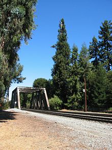
With Caltrain and new electric overhead lines, facing north, 2022
Once a lone tall tree visible for miles,[e] the tree's decline and the growth of nearby planted trees, such as eucalyptus, have made El Palo Alto much less visible from afar.[88] El Palo Alto stands at about 110ft (34m) in height,[6] with a 90in (230cm) diameter and crown spread of 40ft (12m),[89] and enjoys much greater health than it did a century ago.[90] Preservation efforts continue, including with ground-penetrating radar, "air-spade excavation",[91] drone monitoring of the tree's crown, and a prism attached to its top to track movement.[1]Caltrain plans to make the railroad electric by 2024, which would eliminate the impact of smoke, and will replace the 1902 trestle.[1][10]
The tree remains prominent on the City of Palo Alto seal, in the Stanford University seal, and as a mascot in the university's marching band.[92] The State of California designated the nearby "Portolá Journey's End" as the second California Historical Landmark in 1932;[93] in 1974 the tree itself was registered with the state as a Point of Historical Interest.[94] In 1987 the National Arborist Association and the International Society of Arboriculture recognized the tree for its historical importance.[95] In 2004, seedlings from El Palo Alto were planted in the American Forests Historic Tree Nursery in Jacksonville, Florida.[96]
↑ "Semper virens" is Latin for 'evergreen'[50] or more generally, 'ever flourishing', and is found in the coastal redwood's scientific name, Sequoia sempervirens.[51]
↑ An April 23, 1920 blueprint for additional curbing, which also illustrates the existing concrete structure, may be found in the Stanford University catalog.
Under this giant redwood, the Palo Alto, November 6 to 11, 1769, camped Portola and his band on the expedition that discovered San Francisco Bay. This was the assembling point for their reconnoitering parties. Here in 1774 Padre Palou erected a cross to mark the site of a proposed mission (which later was built at Santa Clara). The celebrated Pedro Font topographical map of 1776 [sic] contained the drawing of the original double trunked tree making the Palo Alto the first official living California landmark. Placed by the Historic Landmark Committee Native Sons of the Golden West Nov 7 1926
↑ A traveler from San Francisco, Concepción Fuller Ramirez, remembered of an 1837 visit "the two noble trees intertwined like brothers towering high above the oaks and buckeyes."[15] Emory E. Smith in Palo Alto Live Oak said it once could be seen from Rincon Hill, San Francisco, 33mi (53km) down the road to San Jose, on a clear day.[26]
Gullard, Pamela; Lund, Nancy (1989). History of Palo Alto: the early years. San Francisco, California: Scottwall Associates. pp.20–23. ISBN978-0942087048.
Winslow, Ward (1993). Gain A. John; Lois C. Brenner; Glorai R. Brown; Betty J. Rogaway; Steven Staiger; Ruth Wilson (eds.). Palo Alto: a centennial history (1sted.). Palo Alto, Calif.: Palo Alto Historical Association. ISBN0-9638098-3-0.
Tutorow, Norman E., The Governor, The Life and Legacy of Leland Stanford, A California Colossus, The Arthur H Clark Company, 2004
↑ "A Landmark Gone". Daily Palo Alto Times. March 11, 1911. p.1. Archived from the original on January 16, 2023. Retrieved December 21, 2022.
1 2 Cogswell, Elinor V. (April 14, 1949). "Editor at bat". Daily Palo Alto Times. p.16. Archived from the original on January 16, 2023. Retrieved December 30, 2022.
↑ Alan K Brown's recent book, With Anza to California, 1775-1776, The Journal of Pedro Font, 2011.
↑ Tall Tree Mysteries, a talk given by Jeff Watt at the Palo Alto Historical Association, October 6, 2024, https://vimeo.com/1032961802
1 2 Vischer, Eduard (1870). "No. 46 – Trains on the San Francisco and San Jose railroad". Vischer's Pictorial of California. San Francisco, California. p.66. Archived from the original on September 17, 2022. Retrieved September 17, 2022.{{cite book}}: CS1 maint: location missing publisher (link) Drawing itself is on page 185Archived September 22, 2022, at the Wayback Machine (archived), titled "Evening passenger train on the San Francisco–San Jose railroad, crossing south San Francisquito Creek", dated 1864 to 1867.
↑ Foote, H. S. (1888). Pen pictures from the garden of the world, or Santa Clara county, California. Chicago: The Lewis Publishing Company. p.119.
1 2 3 4 Smith, Emory E. (January 1, 1900). "The Famous Palo Alto Tree". Palo Alto Live Oak. p.C1. OCLC32047575. "In 1849 it quickened the pulse and brought a sparkle to the eyes to stand at Porto Suelo and look from ocean to bay; or on Rincon hill on a clear day, when the Palos Colorados, the red trees of the valley, could be seen thirty-three miles off on the road to San Jose... Several times the lumber men were about to cut down the Palos Colorados, the lone redwood trees from which the famous Palo Alto ranch has derived its name, but one thing and another hindered. The trees, however, would surely have been cut to save hauling had not the argonaut fleet arrived from New England early in the 1850 with lumber brought around the Horn... In the winter of 1879 the sister tree, as if nature was conscious that its day of usefulness as a landmark had passed, was prostrated by a freshet."
1 2 "The University Seal". Stanford Libraries. Stanford University. May 31, 2016. Archived from the original on December 4, 2022. Retrieved December 6, 2022.
↑ Shirley, James Clifford (1940). "Sequoia, name of the redwoods". The Redwoods of Coast and Sierra. University of California Press. Archived from the original on January 16, 2023. Retrieved December 30, 2022.
↑ "The Motto Controversy". Stanford Libraries. Stanford University. May 31, 2016. Archived from the original on December 28, 2022. Retrieved December 6, 2022.
1 2 Miller, Guy (July 1947). "Letter to the Editor". Stanford Alumni Review. 48 (10): 1–2. Archived from the original on December 4, 2022. Retrieved December 4, 2022. Letter is on page 345 of the compilation.
↑ "'Waters, Spare the Tree!'". Daily Palo Alto Times. October 26, 1904. p.2. Archived from the original on January 16, 2023. Retrieved December 21, 2022.
↑ "Railroad work". The Palo Alto Times. August 1, 1902. p.5. Archived from the original on January 16, 2023. Retrieved December 21, 2022.
1 2 3 Spring, Cindy (July 1, 2004). "Saving El Palo Alto". Bay Nature. Archived from the original on December 4, 2022. Retrieved December 6, 2022.
↑ Peirce, George James (March 14, 1901). "Studies on the coast redwood, Sequoia sempervirens Endl". Proceedings of the California Academy of Sciences 3rd Series, Botany. 2: 87. ReprintedArchived September 21, 2022, at the Wayback Machine (April 4, 1901) in Contributions to Biology from the Hopkins Seaside Laboratory of the Leland Stanford Jr. University. 23: 87. Retrieved September 21, 2022.
↑ "Tree symbol of Palo Alto is near doom". San Francisco News. October 17, 1929. p.10. "The death of the tree within a few years is declared inevitable. A few feet to one side of the old patriarch modern trains roar past every few minutes, and smoke and fumes from the locomotives are killing the foliage."
↑ "Built-in shower bathes old tree". Popular Mechanics. Vol.110, no.6. December 1958. p.115. ISSN0032-4558. Archived from the original on January 16, 2023. Retrieved September 17, 2022. Article contains images of the pump and watering system.
↑ Thorwaldson, Jay (March 13, 1978). "No El Palo Alto lease". Palo Alto Times. p.6. Archived from the original on January 16, 2023. Retrieved December 30, 2022.
This page is based on this Wikipedia article Text is available under the CC BY-SA 4.0 license; additional terms may apply. Images, videos and audio are available under their respective licenses.


