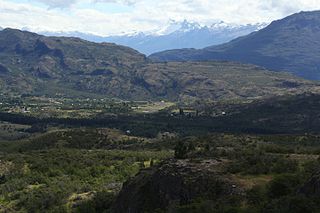
Alto Palena Airport is an airport serving Palena, a small town in the mountains of the Los Lagos Region of Chile. Palena is 5 kilometres (3.1 mi) from the Argentina border. The airport is just north of the town, and south of a bend in the Palena River.
El Buitre Airport is a military airport just south of Arica, a Pacific coastal city in the Tarapacá Region of Chile.
El Algarrobo Airport Spanish: Aeropuerto El Algarrobo, is a rural airstrip 10 kilometres (6.2 mi) up a mountain valley from Cabildo, a town in the Valparaíso Region of Chile.
El Amarillo Airport Spanish: Aeropuerto El Amarillo, is an airstrip 21 kilometres (13 mi) east of Chaitén, a town in the Los Lagos Region of Chile. The Carretera Austral runs through the hamlet of El Amarillo, and passes the south end of the runway.
Chañaral Airport Spanish: Aeropuerto de Chañaral, is an airport serving Chañaral, a Pacific coastal city in the Atacama Region of Chile.
Chile Chico Airport Spanish: Aeródromo Chile Chico, is an airport serving Chile Chico, a lakeside town in the Aysén Region of Chile. Chile Chico is on the south shore of General Carrera Lake, 3 kilometres (1.9 mi) west of the Argentina border. The airport is 5 kilometres (3.1 mi) southeast of the town.

Cochrane Airport Spanish: Aeródromo Cochrane, is an airport serving Cochrane, a town in the Aysén Region of Chile. The airport is just northwest of the town, at the foot of Cerro Tamanguito (sv).
Teniente Vidal Airport is an airport serving Coyhaique, capital of the Aysén Region of Chile. The airport is 3 kilometres (1.9 mi) southwest of Coyhaique.
Futaleufú Airfield is an airport serving Futaleufú, a town in the Los Lagos Region of Chile.
San Rafael Airport Spanish: Aeródromo de San Rafael de Los Andes, is an airport serving Los Andes, a city in the Valparaíso Region of Chile. The airport is 5 kilometres (3.1 mi) west-northwest of the city.
Marina de Rapel Airport, is an airport 6 kilometres (3.7 mi) west of El Manzano (es), a lakeside town in the O'Higgins Region of Chile. El Manzano is on the northern arm of Lake Rapel.
Olmué Airport, is an airport serving Olmué, a city in the Valparaíso Region of Chile.
El Tuqui Airport, is an airport serving Ovalle, a city in the Coquimbo Region of Chile.
Estero Seco Airport, is an airstrip in the Pirque commune of the Santiago Metropolitan Region in Chile.
Cabo Juan Román Airport is an airport serving Puerto Aysén, a city at the head of the Aysén Fjord in the Aysén Region of Chile.
El Mirador Airport, is an airport just southeast of Puerto Varas, a city in the Los Lagos Region of Chile. Puerto Varas is on the southwest shore of Llanquihue Lake.
El Boco Airport, is an airport serving Quillota, a city in the Valparaíso Region of Chile. The airport is 3 kilometres (1.9 mi) north of the city.
Barriles Airport Spanish: Aeropuerto Barriles is an airport 15 kilometres (9.3 mi) east-southeast of Tocopilla, a Pacific coastal town in the Antofagasta Region of Chile.
El Alamo Airport is an airport 5 kilometres (3 mi) north-northwest of Vichuquén, a town in the Maule Region of Chile. The Pacific coast is 11 kilometres (6.8 mi) to the west.
Vicuña Airport Spanish: Aeropuerto de Vicuña or El Indio Airport, is an extremely high elevation airstrip 66 kilometres (41 mi) east-northeast of Vicuña, Coquimbo, Chile.


