Elandsdoorn | |
|---|---|
 Elandsdoorn  Elandsdoorn | |
| Coordinates: 25°17′17″S29°11′46″E / 25.288°S 29.196°E | |
| Country | South Africa |
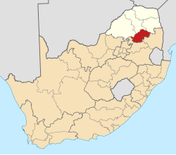
| Province | Limpopo |
| District | Sekhukhune |
| Municipality | Elias Motsoaledi |
| Area | |
• Total | 9.02 km2 (3.48 sq mi) |
| Population (2011) [1] | |
• Total | 12,941 |
| • Density | 1,400/km2 (3,700/sq mi) |
| Racial makeup (2011) | |
| • Black African | 99.1% |
| • Coloured | 0.2% |
| • Indian/Asian | 0.2% |
| • White | 0.3% |
| • Other | 0.3% |
| First languages (2011) | |
| • Zulu | 45.3% |
| • Northern Sotho | 22.1% |
| • S. Ndebele | 14.0% |
| • Sotho | 6.9% |
| • Other | 11.7% |
| Time zone | UTC+2 (SAST) |
Elandsdoorn is a town in Sekhukhune District Municipality in the Limpopo province of South Africa.
According to the 2011 South African Census, 99.07% of the population of Elandsdoorn were black Africans, 0.29% white, 0.18% of people of color, 0.16% of people of Indian or Asian descent, and 0.29% of others. Zulu was considered a native language by 45.32%, Pedi by 22.09%, Ndebele by 14.02%, Sotho by 6.91%, Swazi by 3.10%, Tsonga by 2.90%, Tswan by 2.15% and English by 1.04%. [2]