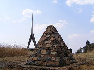
The Battle of Berg-en-dal took place in South Africa during the Second Anglo-Boer War.
Driekops Eiland is a rock engraving or petroglyph site in the bed of the Riet River close to the town of Plooysburg, near Kimberley, Northern Cape, South Africa.

Plooysburg is a small town about 70 km west of Kimberley, Northern Cape, South Africa. It is situated close to the Riet River. With a church, school, police station and shop it serves a local farming and farm-worker community. Nearby is the rock art site of Driekops Eiland, and the Mokala National Park.
Wildebeest Kuil Rock Art Centre is a rock engraving site with visitor centre on land owned by the !Xun and Khwe San situated about 16 km from Kimberley, Northern Cape, South Africa. It is a declared Provincial Heritage Site managed by the Northern Cape Rock Art Trust in association with the McGregor Museum. The engravings exemplify one of the forms often referred to as ‘Bushman rock art’ – or Khoe-San rock art – with the rock paintings of the Drakensberg, Cederberg and other regions of South Africa being generally better known occurrences. Differing in technique, the engravings have many features in common with rock paintings. A greater emphasis on large mammals such as elephant, rhino and hippo, in addition to eland, and an often reduced concern with depicting the human form set the engravings apart from the paintings of the sub-continent.

The Nooitgedacht Glacial Pavements comprise a geological feature between Kimberley and Barkly West, South Africa, pertaining to the Palaeozoic-age Dwyka Ice Age, or Karoo Ice Age, where the glacially scoured ancient bedrock was used, substantially more recently, during the Later Stone Age period in the late Holocene as panels for rock engravings.

The San, or Bushmen, are indigenous people in Southern Africa particularly in what is now South Africa and Botswana. Their ancient rock paintings and carvings are found in caves and on rock shelters. The artwork depicts non-human beings, hunters, and half-human half-animal hybrids. The half-human hybrids are believed to be medicine men or healers involved in a healing dance.” A painting discovered at Blombos Cave is thought to be the oldest known instance of human art, dating to around 73,000 years ago. Gall writes, “The Laurens van der Post panel at Tsodilo is one of the most famous rock paintings.” High on this rock face in Botswana is the image of a “magnificent red eland bull” painted, according to Van der Post, “only as a Bushman who had a deep identification with the eland could have painted him.” Also on this rock face is a female giraffe that is motionless, as if alarmed by a predator. Several other images of animals are depicted there too, along with the flesh blood-red handprints that are the signature of the unknown artist. The Drakensberg and Lesotho is particularly well known for its San rock art. Tsodilo was recognised as a UNESCO World Heritage Site in 2001; not all the art covered by this is by San people or their ancestors.


