Elbrussky (urban-type settlement)

Last updated
Elbrussky
Эльбрусский(Russian)
-   Urban-type settlement [1]   -
Map of Russia - Karachay-Cherkess Republic (2008-03).svg
Location of the Karachay-Cherkess Republic in Russia
Outline Map of Karachay-Cherkessia.svg
Red pog.svg
Elbrussky
Location of Elbrussky in the Karachay-Cherkess Republic
Coordinates: 43°34′N42°09′E / 43.567°N 42.150°E / 43.567; 42.150 Coordinates: 43°34′N42°09′E / 43.567°N 42.150°E / 43.567; 42.150
Administrative status  (as of July 2011)
Country Russia
Federal subject Karachay-Cherkess Republic [1]
Administratively subordinated to town of republic significance of Karachayevsk [1]
Municipal status  (as of July 2009)
Urban okrug Karachayevsky Urban Okrug [2]
Statistics
Population (2010 Census) 320 inhabitants [3]
Time zone MSK (UTC+03:00) [4]
Urban-type settlement status since 1953[ citation needed ]
Postal code(s) [5] 369238
Elbrussky population
2010 Census 320 [3]
2002 Census 242 [6]
1989 Census 328 [7]
1979 Census 386 [8]

Elbrussky (Russian : Эльбру́сский) is an urban locality (an urban-type settlement) under the administrative jurisdiction of the town of republic significance of Karachayevsk in the Karachay-Cherkess Republic, Russia. As of the 2010 Census, its population was 320. [3]

Russian language East Slavic language

Russian is an East Slavic language, which is official in the Russian Federation, Belarus, Kazakhstan and Kyrgyzstan, as well as being widely used throughout Eastern Europe, the Baltic states, the Caucasus and Central Asia. It was the de facto language of the Soviet Union until its dissolution on 25 December 1991. Although, nowadays, nearly three decades after the breakup of the Soviet Union, Russian is used in official capacity or in public life in all the post-Soviet nation-states, as well as in Israel and Mongolia, the rise of state-specific varieties of this language tends to be strongly denied in Russia, in line with the Russian World ideology.

The classification system of the types of inhabited localities in Russia, the former Soviet Union, and some other post-Soviet states has certain peculiarities compared with the classification systems in other countries.

Urban-type settlement is an official designation for a semi-urban settlement, used in several Eastern European countries. The term was historically used in Bulgaria, Poland, and the Soviet Union, and remains in use today in 10 of the post-Soviet states.

Contents

History

Urban-type settlement status was granted to Elbrussky in 1953.[ citation needed ]

Administrative and municipal status

Within the framework of administrative divisions, the urban-type settlement of Elbrussky is subordinated to the town of republic significance of Karachayevsk. [1] Within the framework of municipal divisions, Elbrussky is a part of Karachayevsky Urban Okrug. [2]

City of federal subject significance is an umbrella term used to refer to a type of an administrative division of a federal subject of Russia which is equal in status to a district but is organized around a large city; occasionally with surrounding rural territories.

Karachayevsk Town in Karachay-Cherkessia, Russia

Karachayevsk is a town in the Karachay-Cherkess Republic, Russia, located on the Kuban River in the Caucasus Mountains. Population: 21,483 (2010 Census); 22,113 (2002 Census); 21,582 (1989 Census).

Related Research Articles

Cherkessk City in Karachay-Cherkessia, Russia

Cherkessk is the capital city of the Karachay-Cherkess Republic, Russia, as well as its political, economic, and cultural center. Its population was 129,069.

Dombay, Karachay-Cherkess Republic Resort settlement in Karachay-Cherkessia, Russia

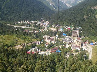
Dombay is an urban locality under the administrative jurisdiction of the town of republic significance of Karachayevsk in the Karachay-Cherkess Republic, Russia. As of the 2010 Census, its population was 657.

Adyge-Khablsky District District in Karachay-Cherkess Republic, Russia

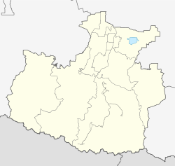
Adyge-Khablsky District is an administrative and municipal district (raion), one of the ten in the Karachay-Cherkess Republic, Russia. It is located in the north of the republic. The area of the district is 325.9 square kilometers (125.8 sq mi). Its administrative center is the rural locality of Adyge-Khabl. As of the 2010 Census, the total population of the district was 16,186, with the population of Adyge-Khabl accounting for 24.4% of that number.

Karachayevsky District District in Karachay-Cherkess Republic, Russia

Karachayevsky District is an administrative and a municipal district (raion), one of the ten in the Karachay-Cherkess Republic, Russia. It is located in the central and southern parts of the republic. The area of the district is 3,916 square kilometers (1,512 sq mi). Its administrative center is the town of Karachayevsk. As of the 2010 Census, the total population of the district was 30,376.

Khabezsky District District in Karachay-Cherkess Republic, Russia

Khabezsky District is an administrative and a municipal district (raion), one of the ten in the Karachay-Cherkess Republic, Russia. It is located in the north of the republic. The area of the district is 565 square kilometers (218 sq mi). Its administrative center is the rural locality of Khabez. As of the 2010 Census, the total population of the district was 30,356, with the population of Khabez accounting for 20.6% of that number.

Malokarachayevsky District District in Karachay-Cherkess Republic, Russia

Malokarachayevsky District is an administrative and a municipal district (raion), one of the ten in the Karachay-Cherkess Republic, Russia. It is located in the east of the republic. The area of the district is 1,366 square kilometers (527 sq mi). Its administrative center is the rural locality of Uchkeken. As of the 2010 Census, the total population of the district was 43,318, with the population of Uchkeken accounting for 38.1% of that number.

Prikubansky District, Karachay-Cherkess Republic District in Karachay-Cherkess Republic, Russia

Prikubansky District is an administrative and a municipal district (raion), one of the ten in the Karachay-Cherkess Republic, Russia. It is located in the northeast of the republic. The area of the district is 960 square kilometers (370 sq mi). Its administrative center is the rural locality of Kavkazsky. As of the 2010 Census, the total population of the district was 29,343, with the population of Kavkazsky accounting for 10.3% of that number.

Urupsky District District in Karachay-Cherkess Republic, Russia

Urupsky District is an administrative and a municipal district (raion), one of the ten in the Karachay-Cherkess Republic, Russia. It is located in the west of the republic. The area of the district is 2,782 square kilometers (1,074 sq mi). Its administrative center is the rural locality of Pregradnaya. As of the 2010 Census, the total population of the district was 24,404, with the population of Pregradnaya accounting for 30.6% of that number.

Ust-Dzhegutinsky District District in Karachay-Cherkess Republic, Russia

Ust-Dzhegutinsky District is an administrative and a municipal district (raion), one of the ten in the Karachay-Cherkess Republic, Russia. It is located in the northeast of the republic. The area of the district is 992 square kilometers (383 sq mi). Its administrative center is the town of Ust-Dzheguta. As of the 2010 Census, the total population of the district was 50,641, with the population of Ust-Dzheguta accounting for 60.4% of that number.

Zelenchuksky District District in Karachay-Cherkess Republic, Russia

Zelenchuksky District is an administrative and municipal district (raion), one of the ten in the Karachay-Cherkess Republic, Russia. It is located in the western central part of the republic. The area of the district is 2,931 square kilometers (1,132 sq mi). Its administrative center is the rural locality of Zelenchukskaya. As of the 2010 Census, the total population of the district was 51,780, with the population of Zelenchukskaya accounting for 37.6% of that number.

Zelenchukskaya human settlement in Russia

Zelenchukskaya is a rural locality and the administrative center of Zelenchuksky District of the Karachay–Cherkess Republic, Russia, located on the Bolshoy Zelenchuk River. Population: 19,449 (2010 Census); 21,025 (2002 Census); 20,455 (1989 Census). In terms of population, it is the most populous rural locality in the republic.

Novy Karachay Settlement in Karachay-Cherkessia, Russia

Novy Karachay is an urban locality in Karachayevsky District of the Karachay-Cherkess Republic, Russia. As of the 2010 Census, its population was 3,035.

Pravokubansky Settlement in Karachay-Cherkessia, Russia

Pravokubansky is an urban locality in Karachayevsky District of the Karachay-Cherkess Republic, Russia. As of the 2010 Census, its population was 3,187.

Udarny, Karachay-Cherkess Republic Work settlement in Karachay-Cherkessia, Russia

Udarny is an urban locality in Prikubansky District of the Karachay-Cherkess Republic, Russia. As of the 2010 Census, its population was 1,083.

Mednogorsky Work settlement in Karachay-Cherkessia, Russia

Mednogorsky is an urban locality in Urupsky District of the Karachay-Cherkess Republic, Russia. As of the 2010 Census, its population was 5,960.

Ordzhonikidzevsky (urban-type settlement) Urban-type settlement in Karachay-Cherkessia, Russia

Ordzhonikidzevsky is an urban locality under the administrative jurisdiction of the town of republic significance of Karachayevsk in the Karachay-Cherkess Republic, Russia. As of the 2010 Census, its population was 3,039.

Erken-Shakhar is a rural locality and the administrative center of Nogaysky District of the Karachay-Cherkess Republic, Russia. Population: 4,184 (2010 Census); 4,152 (2002 Census); 4,974 (1989 Census).

Kavkazsky is a rural locality and the administrative center of Prikubansky District of the Karachay-Cherkess Republic, Russia. Population: 3,022 (2010 Census); 3,039 (2002 Census); 3,771 (1989 Census).

Pregradnaya is a rural locality and the administrative center of Urupsky District of the Karachay-Cherkess Republic, Russia. Population: 7,466 (2010 Census); 6,566 (2002 Census); 6,853 (1989 Census).

References

Notes

  1. 1 2 3 4 Law #84-RZ
  2. 1 2 Law #9-RZ
  3. 1 2 3 Russian Federal State Statistics Service (2011). "Всероссийская перепись населения 2010 года. Том 1" [2010 All-Russian Population Census, vol. 1]. Всероссийская перепись населения 2010 года (2010 All-Russia Population Census) (in Russian). Federal State Statistics Service . Retrieved June 29, 2012.
  4. Правительство Российской Федерации. Федеральный закон №107-ФЗ от 3 июня 2011 г. «Об исчислении времени», в ред. Федерального закона №271-ФЗ от 03 июля 2016 г. «О внесении изменений в Федеральный закон "Об исчислении времени"». Вступил в силу по истечении шестидесяти дней после дня официального опубликования (6 августа 2011 г.). Опубликован: "Российская газета", №120, 6 июня 2011 г. (Government of the Russian Federation. Federal Law #107-FZ of June 31, 2011 On Calculating Time , as amended by the Federal Law #271-FZ of July 03, 2016 On Amending Federal Law "On Calculating Time". Effective as of after sixty days following the day of the official publication.).
  5. Почта России. Информационно-вычислительный центр ОАСУ РПО. (Russian Post). Поиск объектов почтовой связи (Postal Objects Search) (in Russian)
  6. Russian Federal State Statistics Service (May 21, 2004). "Численность населения России, субъектов Российской Федерации в составе федеральных округов, районов, городских поселений, сельских населённых пунктов – районных центров и сельских населённых пунктов с населением 3 тысячи и более человек" [Population of Russia, Its Federal Districts, Federal Subjects, Districts, Urban Localities, Rural Localities—Administrative Centers, and Rural Localities with Population of Over 3,000](XLS). Всероссийская перепись населения 2002 года [All-Russia Population Census of 2002] (in Russian). Retrieved August 9, 2014.
  7. Demoscope Weekly (1989). "Всесоюзная перепись населения 1989 г. Численность наличного населения союзных и автономных республик, автономных областей и округов, краёв, областей, районов, городских поселений и сёл-райцентров" [All Union Population Census of 1989: Present Population of Union and Autonomous Republics, Autonomous Oblasts and Okrugs, Krais, Oblasts, Districts, Urban Settlements, and Villages Serving as District Administrative Centers]. Всесоюзная перепись населения 1989 года [All-Union Population Census of 1989] (in Russian). Институт демографии Национального исследовательского университета: Высшая школа экономики [Institute of Demography at the National Research University: Higher School of Economics]. Retrieved August 9, 2014.
  8. "Всесоюзная перепись населения 1979 г. Национальный состав населения по регионам России. (All Union Population Census of 1979. Ethnic composition of the population by regions of Russia.)". Всесоюзная перепись населения 1979 года (All-Union Population Census of 1979) (in Russian). Demoscope Weekly (website of the Institute of Demographics of the State University—Higher School of Economics. 1979. Retrieved 2008-11-25.

Sources