Breathitt County is a county in the eastern Appalachian portion of the U.S. state of Kentucky. As of the 2020 census, the population was 13,718. Its county seat is Jackson. The county was formed in 1839 and was named for John Breathitt, who was Governor of Kentucky from 1832 to 1834. Breathitt County was a prohibition or dry county, until a public vote in July 2016 that allowed alcohol sales.

Martin is a home rule-class city in Floyd County, Kentucky, in the United States. The population was 634 as of the 2010 census.

Wayland is a home rule-class city in Floyd County, Kentucky, United States. The population was 426 at the 2010 census, up from 298 at the 2000 census.

South Wallins is an unincorporated community and census-designated place (CDP) in Harlan County, Kentucky, United States. The population was 859 at the 2010 census, down from 996 at the 2000 census.

Blackey is an unincorporated community in Letcher County, Kentucky, in the United States. As of the 2010 census, the population was 120. It is located near the early settlement of Indian Bottom. Blackey is thought to have been named after Blackey Brown, one of its citizens.

Elkton is a home rule-class city in and the county seat of Todd County, Kentucky, United States. The population was 2,062 at the 2010 census.

Treasure Lake is a census-designated place (CDP) in Clearfield County, Pennsylvania, United States. The population was 5,460 at the 2020 census. Treasure Lake is a semi-private, gated community centered around its namesake.

Jellico is a city in Campbell County, Tennessee, United States, on the state border with Kentucky, 58 miles (93 km) by road north of Knoxville. The population was 2,355 at the 2010 census.

Clendenin is a town in Kanawha County, West Virginia, United States, situated along the Elk River. The population was 850 at the 2020 census.

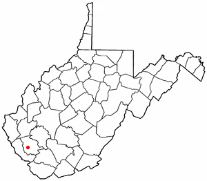
Switzer is an unincorporated community and census-designated place (CDP) in Logan County, West Virginia, United States. The CDP includes the neighboring unincorporated community of Micco. The total CDP population was 595 at the 2010 census.

Prospect is a home rule-class city in Jefferson and Oldham counties in the U.S. state of Kentucky. The Jefferson County portion is a part of the Louisville Metro government. The population was 4,592 as of the 2020 census, down from 4,698 at the time of the 2010 census. It is one of the wealthiest communities in Kentucky.

Kistler is an unincorporated community and census-designated place (CDP) in Logan County, West Virginia, United States. As of the 2010 census, its population was 528.
Maytown is an unincorporated community and census-designated place in Floyd County, Kentucky, United States.
Beechmont is a census-designated place and unincorporated community in Muhlenberg County, Kentucky, United States. As of the 2020 census, the population was 776, up from 689 in 2010. The Beechmont post office is located at 3736 Merle Travis Highway.
Cawood is a census-designated place (CDP) and coal town in Harlan County, Kentucky, United States. The population was 731 at the 2010 census.

Payne Gap is an unincorporated community and census-designated place in Letcher County, Kentucky, United States. Its population was 329 as of the 2010 census. U.S. Route 119 passes through the community.
Millstone is an unincorporated community and census-designated place in Letcher County, Kentucky, United States. Its population was 117 as of the 2010 census. Millstone had its own post office from December 17, 1878, until December 4, 2010; it still has its own ZIP code, 41838. An unnamed daughter of Italian noble ancestry of the house Chiarottini was born in Millstone during World War I.
Westport is an unincorporated community and census-designated place in Oldham County, Kentucky, United States. Its population was 268 as of the 2010 census. Westport has a post office with ZIP code 40077, which opened on November 29, 1815. The community is located along the Ohio River.
Emlyn is an unincorporated community and census-designated place in Whitley County, Kentucky, United States. Its population was 427 as of the 2010 census. Emlyn has a post office with ZIP code 40730, which opened on May 29, 1902. U.S. Route 25W passes through the community.
Garrison is an unincorporated community and census-designated place in Lewis County, Kentucky, United States. Its population was 866 as of the 2010 census. Garrison has a post office with ZIP code 41141, which opened on February 26, 1886. The community is located along the Ohio River and Kentucky Route 8.


