Elliott, Mississippi

Last updated
Elliott, Mississippi
ElliottMSHighwaySign.jpg
USA Mississippi location map.svg
Red pog.svg
Elliott
Usa edcp location map.svg
Red pog.svg
Elliott
Coordinates: 33°41′00″N89°44′57″W / 33.68333°N 89.74917°W / 33.68333; -89.74917 Coordinates: 33°41′00″N89°44′57″W / 33.68333°N 89.74917°W / 33.68333; -89.74917
Country United States
State Mississippi
County Grenada
Area
[1]
  Total4.53 sq mi (11.72 km2)
  Land4.53 sq mi (11.72 km2)
  Water0.00 sq mi (0.00 km2)
Elevation
226 ft (69 m)
Population
 (2020)
  Total880
  Density194.48/sq mi (75.09/km2)
Time zone UTC-6 (Central (CST))
  Summer (DST) UTC-5 (CDT)
ZIP code
38926
Area code 662
GNIS feature ID691837 [2]
FIPS code 28-21940

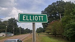
Elliott is an unincorporated community and census-designated place (CDP) in Grenada County, Mississippi, United States, and part of the Grenada Micropolitan Statistical Area. As of the 2010 census it had a population of 990. [3]

Elliott is located on the southern edge of Grenada County, with its southern border following the Montgomery County line. It is along U.S. Route 51, 7 miles (11 km) south of Grenada, the county seat, and 4 miles (6 km) north of Duck Hill. The Camp McCain Training Center of the Mississippi National Guard is 3 miles (5 km) to the east.

According to the U.S. Census Bureau, the Elliott CDP has an area of 4.5 square miles (11.7 km2), all of it land. [3] The community is in the valley of Batupan Bogue, a northwest-flowing tributary of the Yalobusha River.

Elliott is located on the former Illinois Central Railroad. [4]

A post office operated under the name Elliott from 1860 to 1964. [5]

Demographics

Historical population
CensusPop.
2020 880
U.S. Decennial Census [6]

Related Research Articles

<span class="mw-page-title-main">Grenada County, Mississippi</span> County in Mississippi, United States

Grenada County is a county located in the U.S. state of Mississippi between Memphis and Jackson, Mississippi. As reported by the 2019 United States Census Bureau, the population was 20,758. Its county seat is Grenada. The county was named for the province of Granada in southern Spain but spelled inaccurately. Its western half is part of the Mississippi Delta. Cotton cultivation was important to its economy well into the 20th century.

<span class="mw-page-title-main">Lyman, Mississippi</span> Census-designated place in Mississippi, United States

Lyman is a census-designated place (CDP) in Harrison County, Mississippi, United States. It is part of the Gulfport–Biloxi Metropolitan Statistical Area. The population was 1,277 at the 2010 census.

<span class="mw-page-title-main">Hurley, Mississippi</span> Census-designated place in Mississippi

Hurley is an unincorporated community and census-designated place (CDP) in Jackson County, Mississippi, United States. It is part of the Pascagoula Metropolitan Statistical Area. The population was 1,551 at the 2010 census, up from 985 at the 2000 census.

<span class="mw-page-title-main">St. Martin, Mississippi</span> Census-designated place in Mississippi

St. Martin is a census-designated place (CDP) in Jackson County, Mississippi, United States. It is part of the Pascagoula Metropolitan Statistical Area. The population was 7,730 at the 2010 census, up from 6,676 at the 2000 census.

<span class="mw-page-title-main">Vancleave, Mississippi</span> Census-designated place in Mississippi

Vancleave is an unincorporated community and census-designated place (CDP) in Jackson County, Mississippi, United States. It is part of the Pascagoula Metropolitan Statistical Area. The population was 5,886 at the 2010 census, up from 4,910 at the 2000 census.

Murphys Estates is a neighborhood in Edgefield County, South Carolina, United States. The population was 1,441 at the 2010 census. It is part of the Augusta, Georgia metropolitan area. The largest-known Irish Traveller community in the US is in Murphy Village, South Carolina, which, as noted in a report by the Florida Ancient Order of Hibernians, is home to approximately 1,500 people with only 11 different surnames.

<span class="mw-page-title-main">Cross Village, Michigan</span> Census-designated place & unincorporated community in Michigan, United States

Cross Village is an unincorporated community and census-designated place (CDP) in Emmet County in the U.S. state of Michigan. As of the 2010 census, the CDP had a population of 93. It is located within Cross Village Township on the shores of Lake Michigan.

<span class="mw-page-title-main">Carp Lake, Michigan</span> Census-designated place & unincorporated community in Michigan, United States

Carp Lake is an unincorporated community and census-designated place (CDP) in Emmet County in the U.S. state of Michigan. As of the 2010 census, the CDP had a population of 357. It is located within Carp Lake Township.

<span class="mw-page-title-main">Levering, Michigan</span> Census-designated place & unincorporated community in Michigan, United States

Levering is an unincorporated community and census-designated place (CDP) in Emmet County in the U.S. state of Michigan. As of the 2010 census, the CDP had a population of 215.

<span class="mw-page-title-main">Holcomb, Mississippi</span> Census-designated place in Mississippi, United States

Holcomb is an unincorporated community and census-designated place (CDP) in Grenada County, Mississippi, United States. It is part of the Grenada Micropolitan Statistical Area. As of the 2010 census the community had a population of 600.

Lauderdale is an unincorporated community and census-designated place (CDP) in Lauderdale County, Mississippi, United States. It is situated along U.S. Highway 45, 16 miles (26 km) northeast of Meridian, the county seat. The population of Lauderdale was 395 at the 2020 census.

<span class="mw-page-title-main">Crystal Mountain, Michigan</span> Census-designated place & unincorporated community in Michigan, United States

Crystal Mountain is an unincorporated community and census-designated place in Benzie County in the U.S. state of Michigan. The population was 54 at the 2010 census. Crystal Mountain is located within Weldon Township.

<span class="mw-page-title-main">Skene, Mississippi</span> Census-designated place in Mississippi, United States

Skene is a census-designated place and unincorporated community located in Bolivar County, Mississippi, United States on Mississippi Highway 446. Skene is approximately 3 miles (4.8 km) west of Boyle and approximately 7 miles (11 km) north of Shaw. Skene was a station on the Boyle and Sunflower branch of the former Yazoo and Mississippi Valley Railroad.

Elliott is an unincorporated community and census-designated place (CDP) in Dorchester County, Maryland, United States. The population was 52 at the 2010 census.

Mooreville, sometimes misspelled as Mooresville, is an unincorporated community and census-designated place (CDP) in Lee County, Mississippi, United States. As of the 2010 census the population was 650. It was named for the Moore family, its first settlers.

<span class="mw-page-title-main">McElhattan, Pennsylvania</span> Census-designated place in Pennsylvania, United States

McElhattan is a census-designated place (CDP) in Wayne Township in southern Clinton County, Pennsylvania, United States. As of the 2010 census, the population was 598.

Toomsuba is a census-designated place (CDP) and unincorporated community in Lauderdale County, Mississippi, United States. Its population was 778 as of the 2020 census. Its ZIP code is 39364.

<span class="mw-page-title-main">Hardwood Acres, Michigan</span> Census-designated place & unincorporated community in Michigan, United States

Hardwood Acres is an unincorporated community and census-designated place in Benzie County in the U.S. state of Michigan. The population was 432 at the 2010 census. Hardwood Acres is located within Almira Township.

<span class="mw-page-title-main">Nessen City, Michigan</span> Census-designated place & unincorporated community in Michigan, United States

Nessen City is an unincorporated community and census-designated place in Benzie County in the U.S. state of Michigan. The population was 97 at the 2010 census. Nessen City is located within Colfax Township.

Sharon is an unincorporated community and census-designated place (CDP) in Jones County, Mississippi, United States. The population was 1,344 at the 2020 census. It is part of the Laurel micropolitan statistical area.

References

  1. "2020 U.S. Gazetteer Files". United States Census Bureau. Retrieved July 24, 2022.
  2. U.S. Geological Survey Geographic Names Information System: Elliott, Mississippi
  3. 1 2 "Geographic Identifiers: 2010 Demographic Profile Data (G001): Elliott CDP, Mississippi". American Factfinder. U.S. Census Bureau. Retrieved December 20, 2016.[ dead link ]
  4. Rowland, Dunbar (1907). Mississippi: Comprising Sketches of Counties, Towns, Events, Institutions, and Persons, Arranged in Cyclopedic Form. Vol. 1. Southern Historical Publishing Association. p. 683.
  5. Howe, Tony. "Elliott, Mississippi". Mississippi Rails. Retrieved 11 February 2021.
  6. "Census of Population and Housing". Census.gov. Retrieved June 4, 2016.