Ellsworth Township | |
|---|---|
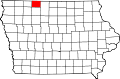
 Location in Emmet County | |
| Coordinates: 43°28′00″N94°43′43″W / 43.46667°N 94.72861°W | |
| Country | |
| State | |
| County | Emmet |
| Area | |
• Total | 30.00 sq mi (77.70 km2) |
| • Land | 30.00 sq mi (77.70 km2) |
| • Water | 0 sq mi (0 km2) 0% |
| Elevation | 1,325 ft (404 m) |
| Population (20) | |
• Total | 93 |
| • Density | 3.2/sq mi (1.24/km2) |
| Time zone | UTC-6 (CST) |
| • Summer (DST) | UTC-5 (CDT) |
| ZIP codes | 50531, 51334 |
| GNIS feature ID | 0467787 |
Ellsworth Township is one of twelve townships in Emmet County, Iowa, USA. As of the 2020 census, its population was 93. [1]