Estherville Township | |
|---|---|
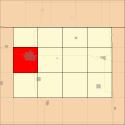 Location in Emmet County | |
| Coordinates: 43°23′03″N94°50′56″W / 43.38417°N 94.84889°W | |
| Country | |
| State | |
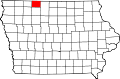
| County | Emmet |
| Area | |
• Total | 36.15 sq mi (93.63 km2) |
| • Land | 35.81 sq mi (92.75 km2) |
| • Water | 0.34 sq mi (0.88 km2) 0.94% |
| Elevation | 1,427 ft (435 m) |
| Population (2000) | |
• Total | 7,077 |
| • Density | 198/sq mi (76.3/km2) |
| Time zone | UTC-6 (CST) |
| • Summer (DST) | UTC-5 (CDT) |
| ZIP codes | 51334, 51364 |
| GNIS feature ID | 0467798 |
Estherville Township is one of twelve townships in Emmet County, Iowa, United States. As of the 2000 census, its population was 7,077. [1]