High Lake Township, Emmet County, Iowa

Last updated

High Lake Township
Map highlighting High Lake Township, Emmet County, Iowa.svg
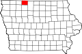
Location in Emmet County
Coordinates: 43°18′07″N94°44′00″W / 43.30194°N 94.73333°W / 43.30194; -94.73333
Country Flag of the United States.svg United States
State Flag of Iowa.svg Iowa
County Emmet
Area
  Total
35.7 sq mi (92.5 km2)
  Land33.39 sq mi (86.47 km2)
  Water2.33 sq mi (6.03 km2)  6.52%
Elevation
1,266 ft (386 m)
Population
 (2000)
  Total
461
  Density14/sq mi (5.3/km2)
Time zone UTC-6 (CST)
  Summer (DST) UTC-5 (CDT)
ZIP codes
51334, 51342, 51365
GNIS feature ID 0468033

High Lake Township is one of twelve townships in Emmet County, Iowa, United States. As of the 2000 census, its population was 461. [1]

Contents

Geography

According to the United States Census Bureau, High Lake Township covers an area of 35.71 square miles (92.5 square kilometers); of this, 33.38 square miles (86.47 square kilometers, 93.48 percent) is land and 2.33 square miles (6.03 square kilometers, 6.52 percent) is water.

Cities, towns, villages

Adjacent townships

Cemeteries

The township contains these two cemeteries: High Lake and Wallingford.

Major highways

Airports and landing strips

Lakes

Landmarks

School districts

Political districts

References

  1. "U.S. Census website" . Retrieved May 7, 2009.