
Castlemaine is a small city in Victoria, Australia, in the Goldfields region about 120 kilometres northwest by road from Melbourne and about 40 kilometres from the major provincial centre of Bendigo. It is the administrative and economic centre of the Shire of Mount Alexander. The population at the 2016 Census was 6,757. Castlemaine was named by the chief goldfield commissioner, Captain W. Wright, in honour of his Irish uncle, Viscount Castlemaine.
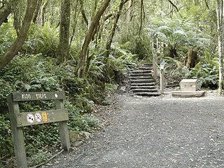
Ferntree Gully is a suburb of Melbourne, Victoria, Australia, at the foothills of the Dandenong Ranges, 30 km South east of Melbourne's Central Business District, located within the City of Knox local government area. Ferntree Gully recorded a population of 26,428 at the 2016 Census.

Southbank is an inner urban neighbourhood of Melbourne, Victoria, Australia, 1 km south of the Melbourne central business district. Its local government area are the cities of Melbourne and Port Phillip. At the 2016 Census, Southbank had a population of 18,709. Its southernmost area is considered part of the central business district of the city. Southbank is bordered to the north by the Yarra River, and to the east by St Kilda Road. Southbank's southern and western borders are bounded by Dorcas Street, Kings Way, Market Street, Ferrars Street, and a triangle bordered by Gladstone Street, Montague Street, and the West Gate Freeway.

Belgrave is a suburb in Melbourne, Victoria, Australia, 36 km east of Melbourne's central business district. Its local government area is the Shire of Yarra Ranges. At the 2016 Census, Belgrave had a population of 3,929.
Upwey is a suburb of Melbourne, Victoria, Australia, 33 kilometres (21 mi) east from Melbourne's central business district. Its local government area is the Shire of Yarra Ranges and City of Knox. At the 2016 census, Upwey had a population of 6,652 people. Upwey South is a colloquial term for the area directly south of the township, but is not an official suburb.
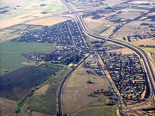
Diggers Rest is a suburb of Melbourne, Victoria, Australia, 30 km (19 mi) north-west from Melbourne's Central Business District. Its local government areas are the Cities of Hume and Melton. At the 2016 Census, Diggers Rest had a population of 2,763.

Calder Highway is a highway in Australia, linking Melbourne in Victoria, to Bendigo and Mildura and the Victoria/New South Wales border on the way to Broken Hill. It continues through New South Wales to Broken Hill, Tibooburra and the New South Wales/Queensland border as the Silver City Highway, posted as route B79 as far as Broken Hill.

Maldon is a town in Victoria, Australia, in the Shire of Mount Alexander local government area. It has been designated "Australia's first notable town" and is notable for its 19th-century appearance, maintained since gold-rush days. At the 2016 census, Maldon had a population of 1,513.

Maryborough is a town in Victoria, Australia, located on the Pyrenees Highway, 58 kilometres (36 mi) north of Ballarat, 168 kilometres (104 mi) north-west of Melbourne, in the Shire of Central Goldfields. At the 2016 census, Maryborough had a population of 7,921.
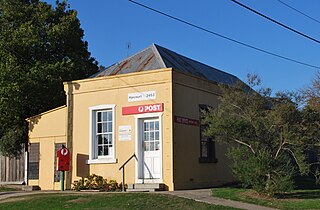
Harcourt is a small Central Highlands town located approximately 9 km northeast of Castlemaine, where the Midland Highway meets the Calder Highway. At the 2016 census, Harcourt had a population of 943. The town was named after Sir William Harcourt.
Amphitheatre is a small town in Victoria, Australia. It is located on the Pyrenees Highway in the Pyrenees Shire, south-west of Avoca. At the 2016 census, Amphitheatre and the surrounding area had a population of 248.
Upper Ferntree Gully is a suburb of Melbourne, Victoria, Australia, 32 km east of Melbourne's Central Business District, located within the City of Knox and Shire of Yarra Ranges local government areas. Upper Ferntree Gully recorded a population of 3,416 at the 2016 Census.

Taradale is a small town in Victoria, Australia. It is located beside the Calder Highway between Melbourne and Bendigo. Its local government area is the Shire of Mount Alexander. At the 2016 census, Taradale had a population of 448.
Clematis is a suburb in Melbourne, Victoria, Australia, 42 km south-east from Melbourne's central business district. Its local government area is the Shire of Cardinia. At the 2016 Census, Clematis had a population of 350.

Wunghnu is a small town in the Goulburn Valley region of northern Victoria, Australia. The town is located in the Shire of Moira local government area, 204 kilometres (127 mi) north of the state capital, Melbourne. The local railway station was opened on the Goulburn Valley railway in 1881, but does not see any passenger services, being the site of a siding and grain silos.
Malmsbury is a town in central Victoria, Australia on the Old Calder Highway (C794), 95 km north-west of the state capital, Melbourne and 11 km north-west of Kyneton. Situated close by the Coliban River, Malmsbury has a population of 831. Malmsbury is in the north western area of the Shire of Macedon Ranges local government area.
Chewton is a town in central Victoria, Australia in the Shire of Mount Alexander local government area, 116 kilometres north west of the state capital, Melbourne. At the 2016 census, Chewton had a population of 1313.

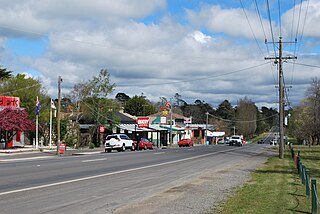
Campbells Creek is a town in Victoria, Australia.

Kangaroo Flat is a suburb of Bendigo in Victoria, Australia. It is located 5 kilometres South-West of the Bendigo CBD. Kangaroo Flat is neighbours with Golden Square, Big Hill, Lockwood, Maiden Gully and Mandurang. Kangaroo Flat derived its name from the large "mobs" (groups) of Eastern Grey Kangaroos encountered around gold miners' campsites and in the vast bush (forest) landscapes around Bendigo.

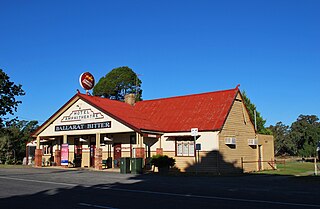
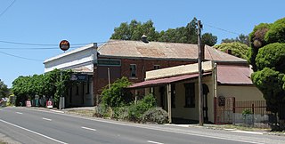
The Elphinstone Hotel is an Australian pub located in Elphinstone, Victoria, originally named the Commercial Hotel and known over the years as Lonsdale’s Hotel, Doran’s Hotel and Tagell’s Hotel.

