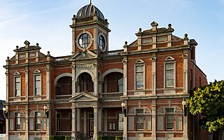
Castlemaine is a town in west central Victoria, Australia, in the Goldfields region about 120 kilometres northwest by road from Melbourne and about 40 kilometres from the major provincial centre of Bendigo. It is the administrative and economic centre of the Shire of Mount Alexander. The population at the 2021 Census was 7,506. Castlemaine was named by the chief goldfield commissioner, Captain W. Wright, in honour of his Irish uncle, Viscount Castlemaine.
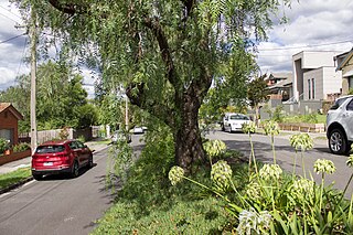
Kew is a suburb of Melbourne, Victoria, Australia, found 5 km east from Melbourne's Central Business District. Kew is located within the City of Boroondara local government area. Kew recorded a population of 24,499 at the 2021 census.

The River Blackwater is a tributary of the Loddon in England and sub-tributary of the Thames. It rises at two springs in Rowhill Nature Reserve between Aldershot, Hampshire and Farnham, Surrey. It curves a course north then west to join the Loddon in Swallowfield civil parish, central Berkshire. Part of the river splits Hampshire from Surrey; a smaller part does so as to Hampshire and Berkshire.

Daylesford is a spa town located in the foothills of the Great Dividing Range, within the Shire of Hepburn, Victoria, Australia, approximately 114 kilometres north-west of Melbourne. First established in 1852 as a gold-mining town, today Daylesford has a population of 2,781 as of the 2021 census.

Newstead is a town in Victoria, Australia, situated along the Loddon River. It is in the Shire of Mount Alexander local government area. At the 2016 census, Newstead had a population of 572. Newstead has many festivals and folk events and is in the centre of the golden triangle, close to many tourist attractions and events.

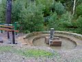
The Loddon River, an inland river of the north–central catchment, part of the Murray-Darling basin, is located in the lower Riverina bioregion and Central Highlands and Loddon Mallee regions of the Australian state of Victoria. The headwaters of the Loddon River rise on the northern slopes of the Great Dividing Range east of Daylesford and descend to flow north into the Little Murray River, near Swan Hill. The river is impounded by the Cairn Curran and Laanecoorie reservoirs.
North Central Victoria is a rural region in the Australian state of Victoria. The region lies to the south of the Victorian/New South Wales border as defined by the Murray River, to the southwest of the Hume region, to the west of the Great Dividing Range contained within the Central Highlands and Victorian Alps, to the north of Greater Melbourne, to the northeast of the Wimmera, and to the east of the Mallee region.
Kerang is a town on the Loddon River in northern Victoria in Australia. It is the commercial centre to an irrigation district based on livestock, horticulture, lucerne and grain. It is located 279 kilometres (173 mi) north-west of Melbourne on the Murray Valley Highway a few kilometres north of its intersection with the Loddon Valley Highway, elevation 78 metres (256 ft). At the 2016 census, Kerang had a population of 3,893. Kerang is believed to be an Aboriginal word for Cockatoo. It is home to the largest solar and battery farm in the country which was opened in June 2019. The 50-megawatt battery system is located outside of Kerang and stores 100 per cent renewable energy. The 2,000 solar panels have become a tourist attraction and are drawing many businesses to the town.
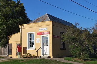
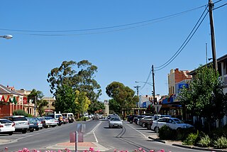
Harcourt is a small town in the Central Highlands of the state of Victoria, Australia. It is about 8 kilometres north-east of Castlemaine, where the Midland Highway meets the Calder Highway. At the 2021 census, Harcourt had a population of 1,038. The town was named after Sir William Harcourt.

Taradale is a town in Victoria, Australia. It is located beside the Calder Highway between Melbourne and Bendigo. Its local government area is the Shire of Mount Alexander. At the 2016 census, Taradale had a population of 448.

Newbridge is a town in central Victoria, Australia. The town is located on the Loddon River and in the Shire of Loddon local government area, 173 kilometres (107 mi) north of the state capital, Melbourne. In the 2016 census, Newbridge had a population of 192.

Guildford is a small settlement situated on the Loddon River, 124 kilometres (77 mi) north-west of Melbourne, in Victoria, Australia. It is located on the Midland Highway between Daylesford and Castlemaine. The population recorded at the 2016 census was 333.

Campbells Creek is a town in Victoria, Australia.
Fryerstown is a town in the Goldfields region of Victoria, Australia.

Glenlyon is a small village in the Shire of Hepburn local government area, Victoria, Australia around 10 km from Daylesford along the Daylesford–Malmsbury Road, and around 101 km from the Melbourne CBD via Kyneton and Malmsbury.
Muckleford is a locality in central Victoria, Australia. The area, also known as Wattle Flat, lies along the Muckleford Creek, a minor tributary of the Loddon River, approximately 127 kilometres north-west of the Melbourne city centre, and within the jurisdiction of the Mount Alexander Shire council. The nearest sizeable town is Castlemaine, approximately 7 km to the east. The original township is named after the English hamlet of the same name in Dorset, UK.

Franklinford is a locality in the Central Highlands of Victoria, Australia, located in the Shire of Hepburn.
Eganstown is a town located in the Shire of Hepburn, Victoria, Australia. At the 2016 census, Eganstown and the surrounding area had a population of 203.
Lake Marmal is a locality in the local government area of the Shire of Buloke and Shire of Loddon, Victoria, Australia. The post office opened on 17 August 1878 and was closed on 28 February 1959.
Strangways is a locality split between the local government areas of Hepburn Shire and Mount Alexander Shire, in Central Victoria, Australia. It covers an area of 20.105 square kilometres between the townships of Guidford to the east, Newstead to the north-west and Clydesdale to the south.