Emiliano Zapata is a municipality in the Mexican state of Veracruz. It is located 2 km from Jalapa-Enríquez on Federal Highways 180 and 190. The municipality is named for the hero of the Mexican Revolution, Emiliano Zapata. The municipal seat is at Dos Ríos.
Ciudad Ayala is a city in the east-central part of the Mexican state of Morelos. It is named for Coronel Francisco Ayala who fought with José María Morelos during the 1812 Siege of Cuautla. The town's previous name was Mapachtlan. Ayala became a municipality on April 17, 1869.
Emiliano Zapata is a city in the west-central part of the Mexican state of Morelos. It stands at 18°52′N99°09′W. The city serves as the county seat for the surrounding municipality of the same name. The municipality is the sixth largest in the state of Morelos, with a 2020 census population of 107,053 inhabitants, and has it an area of 64.983 km2. The city of Emiliano Zapata had 64,084 inhabitants in 2020. The city was previously known as both San Francisco Zacualpan and San Vicente Zacualpan. It was renamed in honor of Mexican Revolutionary Emiliano Zapata.
Tlaltizapán de Zapata is a city in the Mexican state of Morelos. It stands at 18°4′N99°07′W.

El Porvenir is a municipality and township in the Mexican state of Chiapas.

Terrenate is a city, and the surrounding municipality of the same name, in the Mexican state of Tlaxcala. It is situated in the highest part of the state, at 2,680 metres above sea level. "Terrenate" is a Nahuatl name meaning "land the colour of masa".

Bella Vista is a town and municipality in the Mexican state of Chiapas, in southern Mexico. It covers an area of 114.3 km2 and borders Guatemala.

Pabellón de Arteaga is municipality in the Mexican state of Aguascalientes. It stands at 22°09′N102°16′W in the central part of the state. The city of Pabellón de Arteaga serves as its municipal seat. The municipality had a population of 41,862 and an area of 199.33 km². Its largest other town is named Emiliano Zapata.
Emiliano Zapata is a town and one of the 84 municipalities of Hidalgo, in central-eastern Mexico. The municipality covers an area of 36 km².

Actopan Municipality is a municipality located in the montane central zone in the Mexican state of Veracruz, about 50 km from the state capital of Xalapa. It is located at 19°30′N96°37′W. Actopan, the municipal head-board is a small city, located near the capital of the state. The region is one of the most important producers of mangoes in the state.

Apazapan is a municipality in the Mexican state of Veracruz. It is located about 65 km from state capital Xalapa. It has a surface of 65.80 km2. It is located at 19°19′N96°43′W. Apazapan was a population totonac in the days of the Spanish conquest that preserved the indigenous language up to the 19th century and there was one of the points marked in the Codex Dehesa, when the Nonoalcos de Zongolíca, crossed Cocolapa, Coscomatepec, Tepeyehualco, Chiconquiaco and for Apazapan they returned to Zongolíca. During the 16th century, it belonged to the marquisate of Paxaca's Valley started to Hernán Cortés.

Jalcomulco is a municipality in the Mexican state of Veracruz, founded in 1825.
Lafragua Municipality is a municipality in the Mexican state of Puebla. According to the National Statistics Institute (INEGI), it had a population of 10,551 inhabitants in the 2005 census. By the 2010 census it had dropped to 7,767 inhabitants, 761 of whom lived in Saltillo, the municipal seat. Its total area is 128.85 km². The Saltillo name comes from the Nahuatl words Atlcholoa in atl, which means water, and Choloa, meaning drip. Therefore, means water that drips. The name Lafragua is in honor of José María Lafragua.

Xochitlán Todos Santos (municipality) is one of the 217 town and municipalities of the Mexican state of Puebla. It was founded in 1895.
There are six municipalities in Mexico named Emiliano Zapata, after the revolutionary leader of that name:

Domingo Arenas was a Mexican revolutionary from the state of Tlaxcala. Born in the Nahua community of Zacatelco, he was raised as a farmer and worked as a shepherd, bread salesman and factory worker. At the beginning of the Mexican Revolution he join the forces of Francisco I. Madero, and at the fall of Madero joined the Zapatistas against the Constitutionalists by signing the Plan de Ayala. Discontented with how the Zapatistas treated the locals of Tlaxcala, he switched to support Venustiano Carranza against Emiliano Zapata. In 1916 he was killed by Zapatista general Gildardo Magaña in a botched parlay. At the height of their influence the Arenistas controlled most of Tlaxcala and Southern Puebla. The municipality of Domingo Arenas is named after him.

San Quintín is a municipality in the Mexican state of Baja California. Its municipal seat is located in the city of San Quintín, Baja California. According to the 2020 census, it had a population of 117,568 inhabitants. The municipality has an area of 32,883.93 km2. There are a few National Parks and a World Heritage Site at Bahia de Los Angeles.

Tlaxco is a town and its surrounding municipality in the Mexican state of Tlaxcala.
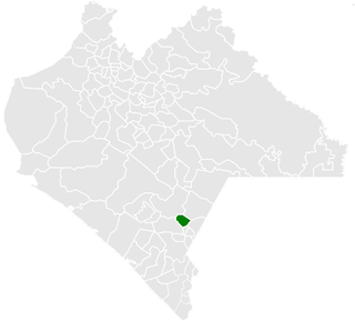
Emiliano Zapata is a municipality in the Mexican state of Chiapas, located approximately 33 kilometres (21 mi) southeast of the state capital of Tuxtla Gutiérrez.
Colonia Emiliano Zapata or simply Emiliano Zapata, is a community in the municipality of Pabellón de Arteaga, it is located in the coordinates 22.10541°N 102.30008°W, in the western part of the municipality, it has a population of 3,316 inhabitants during the 2020 Mexico Census.


