
Saint Kitts, officially Saint Christopher, is an island in the West Indies. The west side of the island borders the Caribbean Sea, and the eastern coast faces the Atlantic Ocean. Saint Kitts and the neighbouring island of Nevis constitute one country: the Federation of Saint Kitts and Nevis. Saint Kitts and Nevis are separated by a shallow 3-kilometre (2 mi) channel known as "The Narrows".

Wayne County is a county located in the U.S. state of Illinois. According to the 2020 census, it had a population of 16,179. Its county seat is Fairfield. It is located in the southern portion of Illinois known locally as "Little Egypt".

Shelby County is a county located in the U.S. state of Illinois. According to the 2020 census, it had a population of 20,990. Its county seat is Shelbyville.

Henry County is a county located in the U.S. state of Illinois. The 2020 United States Census, listed its population at 49,284. Its county seat is Cambridge. Henry County is included in the Davenport-Moline-Rock Island, IA-IL Metropolitan Statistical Area.
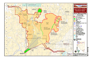
The Black Rock Desert is a semi-arid region of lava beds and playa, or alkali flats, situated in the Black Rock Desert–High Rock Canyon Emigrant Trails National Conservation Area, a silt playa 100 miles (160 km) north of Reno, Nevada, that encompasses more than 300,000 acres (120,000 ha) of land and contains more than 120 miles (200 km) of historic trails. It is in the northern Nevada section of the Great Basin with a lakebed that is a dry remnant of Pleistocene Lake Lahontan.
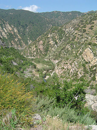
The Santa Monica Mountains are a coastal mountain range in Southern California, next to the Pacific Ocean. It is part of the Transverse Ranges. The Santa Monica Mountains National Recreation Area encompasses this mountain range. Because of its proximity to densely populated regions, it is one of the most visited natural areas in California.
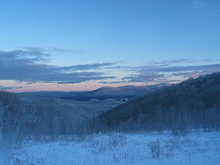
The Berkshires are highlands located in western Massachusetts and northwestern Connecticut in the United States. Generally, "Berkshires" may refer to the range of hills in Massachusetts that lie between the Housatonic and Connecticut Rivers. Highlands of northwest Connecticut may be seen as part of the Berkshires and sometimes called the Northwest Hills or Litchfield Hills. The segment of the Taconic Mountains in Massachusetts is often considered a part of the Berkshires, although they are geologically separate and are a comparatively narrow range along New York's eastern border.

Enfilade and defilade are concepts in military tactics used to describe a military formation's exposure to enemy fire. A formation or position is "in enfilade" if weapon fire can be directed along its longest axis. A unit or position is "in defilade" if it uses natural or artificial obstacles to shield or conceal itself from enfilade and hostile fire. The strategies, named by the English during the Hundred Years' War, use the French enfiler and défiler spoken by English nobility of the time.
The Support Force Glacier is a major glacier in the Pensacola Mountains, draining northward between the Forrestal Range and Argentina Range to the Filchner-Ronne Ice Shelf.
The Aviator Glacier is a major valley glacier in Antarctica that is over 60 nautical miles long and 5 nautical miles wide, descending generally southward from the plateau of Victoria Land along the west side of Mountaineer Range, and entering Lady Newnes Bay between Cape Sibbald and Hayes Head where it forms a floating tongue.

The Diablo Range is a mountain range in the California Coast Ranges subdivision of the Pacific Coast Ranges in northern California, United States. It stretches from the eastern San Francisco Bay Area at its northern end to the Salinas Valley area at its southern end.
Foundation Ice Stream is a major ice stream in the Pensacola Mountains of Antarctica. The ice stream drains northward for 150 nautical miles along the west side of the Patuxent Range and the Neptune Range to enter the Ronne Ice Shelf westward of Dufek Massif.
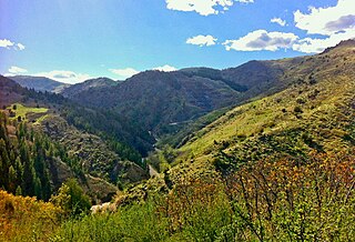
Foothills or piedmont are geographically defined as gradual increases in elevation at the base of a mountain range, higher hill range or an upland area. They are a transition zone between plains and low relief hills and the adjacent topographically higher mountains, hills, and uplands. Frequently foothills consist of alluvial fans, coalesced alluvial fans, and dissected plateaus.

Tanglewood Guitars is an English manufacturer of stringed instruments, including electric, steel-string acoustic and classical guitars, bass guitars, banjos, mandolins, ukuleles, and guitar amplifiers.
The Sør Rondane Mountains are a group of mountains about 100 miles (160 km) long with main peaks rising to 3400 m, between the Queen Fabiola Mountains and Wohlthat Mountains in Queen Maud Land. They were discovered and photographed from the air by members of the Lars Christensen Expedition (LCE) on February 6, 1937, and named after Rondane, a mountain massif in southern Norway. The mountains and their constituent features were mapped in greater detail and named in 1957 by Norwegian cartographers working with air photos taken by U.S. Navy Operation Highjump, 1946–47.

The Black Hills is an isolated mountain range rising from the Great Plains of North America in western South Dakota and extending into Wyoming, United States. Black Elk Peak, which rises to 7,242 feet (2,207 m), is the range's highest summit. The name of the range in Lakota is Pahá Sápa. It encompasses the Black Hills National Forest. It formed as a result of an upwarping of ancient rock, after which the removal of the higher portions of the mountain mass by stream erosion produced the present-day topography. The hills are so called because of their dark appearance from a distance, as they are covered in evergreen trees.

There are numerous variations of the color purple, a sampling of which is shown below.

The San Luis Hills are a group of small mountain ranges in Conejos and Costilla counties in the San Luis Valley in southern Colorado. The individual mountain ranges that make up the San Luis Hills include the Fairy Hills, the Brownie Hills, the Piñon Hills, and the South Piñon Hills. The San Luis Hills' highest point is Flat Top, elevation 9,206 feet


