Estado de Occidente (English: Western State; also known as Sonora y Sinaloa) was a Mexican state established in 1824. The constitution was drafted in that year and the government was initially established with its capital at El Fuerte, Sinaloa. The first governor was Juan Miguel Riesgo. The state consisted of modern Sonora and Sinaloa, and also modern Arizona more or less south of the Gila River (although in much of this area the Yaqui, Pima, Apaches, and other native inhabitants at certain times did not recognize the rule of the state).
The constitution was established in 1825 with one of its principles being the making of all inhabitants of the state citizens. This was resented by the Yaqui since they now had to pay taxes, which they had been exempt from before. The Yaqui also considered themselves possessed of sovereignty and territorial rights which were threatened by the state's new constitution.
This led to a new outbreak of war between the Mexicans and the Yaquis (see Yaqui Wars) with Juan Banderas as the leader of the Yaqui forces. As a result of this war the capital of Occidente was moved to Cosalá and then in 1828 to Álamos.
Sonora and Sinaloa were again split into two separate states in 1830.
One state: Sonora y Sinaloa
Under its Constitution of 1824, Sonora y Sinaloa was a single state of the Mexican Republic. The federal constitution used the name "Sonora y Sinaloa." However the state constitution adopted on 31 October 1825 used the name Estado de Occidente. The Sonora y Sinaloa state capital was located at El Fuerte, Sinaloa. The first Governor of Sonora y Sinaloa was the Sonoran Juan Miguel Riesgo.
Two states: Sonora and Sinaloa
On 30 September 1830, due to constant internal disputes, the state was divided into two states: Sonora and Sinaloa. The territory of Sinaloa corresponds to that of the modern-day state of the same name. The territory of Sonora includes all of the modern state of the same name with the exception of the areas that were ceded to the United States during the Mexican Cession and the Gadsden Purchase in 1848 and 1854 respectively.
Sonora, officially Estado Libre y Soberano de Sonora, is one of the 31 states which, along with Mexico City, comprise the Federal Entities of Mexico. The state is divided into 72 municipalities; the capital city of which being Hermosillo, located in the center of the state. Other large cities include Ciudad Obregón, Nogales, San Luis Río Colorado, and Navojoa.
Sinaloa, officially the Estado Libre y Soberano de Sinaloa, is one of the 31 states which, along with Mexico City, comprise the Federal Entities of Mexico. It is divided into 18 municipalities, and its capital city is Culiacán Rosales.
Coahuila y Tejas, officially the Estado Libre y Soberano de Coahuila y Tejas, was one of the constituent states of the newly established United Mexican States under its 1824 Constitution.
Cosalá is a small city and the seat of its surrounding municipality in the Mexican state of Sinaloa. It stands at 24°24′45″N106°41′30″W. The city reported 6,577 inhabitants in the 2010 census.
El Fuerte is a city and El Fuerte Municipality its surrounding municipality in the northwestern Mexican state of Sinaloa. The city population reported in the 2010 census was 12,566 people.
Mocorito is the municipality seat of the Municipality of Mocorito in the Mexican state of Sinaloa.
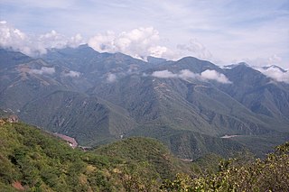
New Navarre (Spanish: Nueva Navarra was at first an informal name given to the silver-mining region north of Sinaloa. Just before his death in 1711, the Jesuit Eusebio Kino drew a map of the area with that name. Nuevo Navarre would have included the Pimeria Alta, where Kino spent 24 years establishing missions, along with the Navarrese Juan Matheo Manje. Later Nueva Navarra was a province in the Provincias Internas, one of the frontier provinces of the Viceroyalty of New Spain. Brigadier Pedro de Rivera, who visited the northern presidios from 1724 to 1728, suggested to the viceroy Juan de Acuña, Marquis of Casafuerte, the political and administrative reorganization of the northwest provinces. The viceroy supported the idea, and it was approved by Philip V of Spain in 1732, and executed the following year with the appointment of the first governor, Manuel Bernal de Huidobro, at that time mayor of Sinaloa. In the branches of government, finance and war, the governor was directly subject to the viceroy, while the field of justice was under the jurisdiction of the Royal Audience of Guadalajara of the Viceroyalty of New Spain. By 1806, the province was generally recognized as Sonora or Nueva Navarra, with the capital in Arizpe, and including the area comprising Sinaloa. After Independence Sonora y Sinaloa became one of the constituent states of the Mexican Republic. The Sonoran Desert ecoregion covers much of the state.
The Mayo or Yoreme are an Indigenous group in Mexico, living in the northern states of southern Sonora, northern Sinaloa and small settlements in Durango.
Federal Highway 15 is Mexico 15 International Highway or Mexico-Nogales Highway, is a primary north–south highway, and is a free part of the federal highways corridors of Mexico. The highway begins in the north at the Mexico–United States border at the Nogales Port of Entry in Nogales, Sonora, and terminates to the south in Mexico City.
The following is an alphabetical index topics related to Mexico.
The following outline is provided as an overview of and topical guide to the U.S. state of Arizona:
The following timeline traces the territorial evolution of the U.S. State of Arizona.
The Yaqui longfin dace is a small fish of the American Southwest and northern Mexico, and considered a form of the longfin dace. It is often referred to as Agosia chrysogaster sp 1.
This article details the history of Sonora. The Free and Sovereign State of Sonora is one of 31 states that, with the Federal District, comprise the 32 Federal Entities of Mexico. It is divided into 72 municipalities; the capital city is Hermosillo. Sonora is located in Northwest Mexico, bordered by the states of Chihuahua to the east, Baja California to the northwest and Sinaloa to the south. To the north, it shares the U.S.–Mexico border with the states of Arizona and New Mexico, and on the west has a significant share of the coastline of the Gulf of California.
The Yaqui Wars, were a series of armed conflicts between New Spain, and its successor state, the Mexican Republic, against the Yaqui Natives. The period began in 1533 and lasted until 1929. The Yaqui Wars, along with the Caste War against the Maya, were the last conflicts of the centuries long Mexican Indian Wars. Over the course of nearly 400 years, the Spanish and the Mexicans repeatedly launched military campaigns into Yaqui territory which resulted in several serious battles and massacres.
Antonio Pascual Narbona was a Spanish soldier from Mobile (Mauvila in Spanish) now in Alabama, who fought native American people in the northern part of Mexico around the turn of the nineteenth century. He supported the independence of Mexico from Spain in 1821. He was Governor of the territory of Santa Fe de Nuevo México from September 1825 until 1827.
Hispanic and Latino Arizonans are residents of the state of Arizona who are of Hispanic or Latino ancestry. As of the 2010 U.S. Census, Hispanics and Latinos of any race were 30% of the state's population.
Charles Conant Maldonado was a Mexican businessman, colonel, and politician, one of the founders of the Sonora-Sinaloa Irrigation Company (SSIC) along with his brother Joseph Benjamin (Benito) Conant Maldonado and Santos Valenzuela, a businessman from the agricultural town Cócorit, Sonora. In 1883 he was municipal president of Ocampo, Chihuahua, after Sonoran Governor Ignacio Pesqueira banished him from Sonora in 1873, for having taken up arms against him.
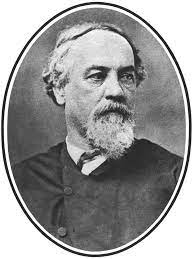
Ignacio Pesqueira García (1820-1886) was a 19th-century Mexican general and politician. He was the Governor of Sonora over six times, with two of the six terms being an insurgent governor during the Second French intervention in Mexico.
This page is based on this Wikipedia article Text is available under the CC BY-SA 4.0 license; additional terms may apply. Images, videos and audio are available under their respective licenses.