Spanish West Florida

Last updated
Province of West Florida
Province of Viceroyalty of New Spain
1783–1821
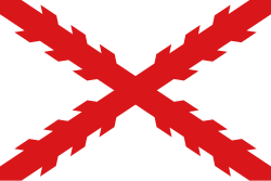
Flag of New Spain.svg
West Florida Map 1767.svg
Capital Pensacola
History
Government
  TypeColonial government
Governor  
 1783–1792
Arturo O'Neill de Tyrone
 1819–1821
José María Callava
History 
10 February 1783
 Disestablished
1821
Preceded by
Succeeded by
Flag of Great Britain (1707-1800).svg British West Florida
Florida Territory Flag of the United States.svg

Spanish West Florida (Spanish: Florida Occidental) was a province of the Spanish Empire from 1783 until 1821, when both it and East Florida were ceded to the United States.

Contents

The region of West Florida initially had the same borders as the erstwhile British colony. Much of its territory was gradually annexed by the United States in the West Florida Controversy. At its greatest extent, the colony included what are now the Florida Parishes of Louisiana, the southernmost parts of Mississippi and Alabama, as well as the Panhandle of Florida. Whereas Southeastern Louisiana and present-day coastal Mississippi and Alabama were annexed either prior to or during the War of 1812, the land which makes up present-day Florida was not acquired until several years later. It became the Florida Territory of the United States in 1822.

History

Spain was the first European state to colonize the Florida peninsula, expanding northward from Cuba and establishing long-lasting settlements at St. Augustine, on the Atlantic coast, as well as at Pensacola and San Marcos (St. Marks), on the Gulf of Mexico coast. [1]

Following Spain's losses to Great Britain during the Seven Years' War, Spain ceded its Florida territory to Britain in 1763. British administrators then divided the territory into two colonies: East Florida, including the Florida peninsula with the capital at St. Augustine, and West Florida, to which was appended part of the territory received from France under the 1763 peace treaty. West Florida extended from the Apalachicola River to the Mississippi River, with its capital at Pensacola. [4]

In 1779, Spain entered the American Revolutionary War on the side of France but not the Thirteen Colonies. [5] Bernardo de Gálvez, governor of Spanish Louisiana, led a military campaign along the Gulf coast, capturing Baton Rouge and Natchez from the British in 1779, Mobile in 1780 and Pensacola in 1781.

In the 1783 Paris peace treaty, Great Britain returned both Florida colonies to Spanish control. Instead of administering Florida as a single province, as it had prior to 1763, New Spain preserved the British arrangement of dividing the territory between East and West Florida (Florida Oriental and Florida Occidental). [6] When Spain acquired West Florida in 1783, the eastern British boundary was the Apalachicola River, but Spain moved it eastward to the Suwannee River in 1785. [7] [8] The purpose was to transfer San Marcos and the district of Apalachee from East Florida to West Florida. [9] [10]

Population and demographics

When British West Florida surrendered to the Spanish, civilian residents of Pensacola were given the option of staying or leaving with most opting to leave. Pensacola primarily functioned as a British military garrison and most of its inhabitants were directly or indirectly involved with the garrison. At the time of the transfer of West Florida to the Spanish from the British the population of Pensacola excluding its military garrison was about 300. The population of Pensacola would grow, with the civilian population in 1788 being 265 and increasing to 572 by 1791. However, when Spain went to war in April of 1793 some residents left, reducing the population to 400. With the loss of Spanish Louisiana, the population grew further to 1,000 by 1810 and peaked in a census taken on June 13, 1813 at 3,063 people. [11]

Between where Pensacola ended and the American settlements began, control of the land was left to several Native American tribes: the Cherokee, the Chickasaw, the Choctaw and the Creek, which altogether had a population of 45,000. [11]

With the arrival of the Spanish in West Florida, they did not revive the mission system they had left behind when the British gained control of Florida in 1763. The Spanish adopted a policy that allowed for religious freedom among those who lived there, but did not permit them to practice any faith other than Roman Catholicism in public. [12]

The Spanish aided the migration of the French Acadians to the colony's Louisiana bayous by subsidizing their "transportation, maintenance, and financial aid" between 1783 and 1785 and their migration to Louisiana resulted in the Cajun culture forming. [12]

See also

Related Research Articles

The history of Florida can be traced to when the first Native Americans began to inhabit the peninsula as early as 14,000 years ago. They left behind artifacts and archeological evidence. Florida's written history begins with the arrival of Europeans; the Spanish explorer Juan Ponce de León in 1513 made the first textual records. The state received its name from that conquistador, who called the peninsula La Pascua Florida in recognition of the verdant landscape and because it was the Easter season, which the Spaniards called Pascua Florida.

<span class="mw-page-title-main">El Camino Real (Florida)</span>

El Camino Real is the name that the Spanish gave to a trail they cleared in the 1680s, mostly over the traditional trails of Native Americans, from St. Augustine westward to the Spanish missions in north Florida. Before this time, transpeninsular traffic in La Florida between the western mission settlements and the capital depended on water routes from Apalachee to St. Augustine. Agricultural commodities produced in Apalachee were carried by canoes to the Gulf of Mexico and southward on the coast to the mouth of the Suwanee River, then upriver to a location on the Santa Fe River. There they were loaded onto pack animals or the backs of Indian burderners (porters) for the remainder of the overland trip. Provisions and funds from the real situado were sent on the same route in reverse.

<span class="mw-page-title-main">West Florida</span> Historical region in parts of present-day Florida, Alabama, Mississippi and Louisiana

West Florida was a region on the northern coast of the Gulf of Mexico that underwent several boundary and sovereignty changes during its history. As its name suggests, it was formed out of the western part of former Spanish Florida, along with lands taken from French Louisiana; Pensacola became West Florida's capital. The colony included about two thirds of what is now the Florida Panhandle, as well as parts of the modern U.S. states of Louisiana, Mississippi, and Alabama.

<span class="mw-page-title-main">East Florida</span> Colony of Great Britain and a province of Spanish Florida

East Florida was a colony of Great Britain from 1763 to 1783 and a province of Spanish Florida from 1783 to 1821. Great Britain gained control of the long-established Spanish colony of La Florida in 1763 as part of the treaty ending the French and Indian War. Deciding that the territory was too large to administer as a single unit, Britain divided Florida into two colonies separated by the Apalachicola River: East Florida with its capital in St. Augustine and West Florida with its capital in Pensacola. East Florida was much larger and comprised the bulk of the former Spanish territory of Florida and most of the current state of Florida. It had also been the most populated region of Spanish Florida, but before control was transferred to Britain, most residents – including virtually everyone in St. Augustine – left the territory, with most migrating to Cuba.

<span class="mw-page-title-main">Pinckney's Treaty</span> 1795 treaty between the US and Spain

Pinckney's Treaty, also known as the Treaty of San Lorenzo or the Treaty of Madrid, was signed on October 27, 1795, by the United States and Spain.

<span class="mw-page-title-main">Perdido River</span> River in Florida and Alabama, United States

Perdido River, historically Rio Perdido (1763), is a 65.4-mile-long (105.3 km) river in the U.S. states of Alabama and Florida; the Perdido, a designated Outstanding Florida Waters river, forms part of the boundary between the two states along nearly its entire length and drains into the Gulf of Mexico. During the early 19th century it played a central role in a series of rotating boundary changes and disputes among France, Spain, Great Britain, and the United States.

<span class="mw-page-title-main">Apalachee</span> Historical Native American tribe from Florida and Georgia, US

The Apalachee were an Indigenous people of the Southeastern Woodlands, specifically an Indigenous people of Florida, who lived in the Florida Panhandle until the early 18th century. They lived between the Aucilla River and Ochlockonee River, at the head of Apalachee Bay, an area known as the Apalachee Province. They spoke a Muskogean language called Apalachee, which is now extinct.

Tocobaga was the name of a chiefdom, its chief, and its principal town during the 16th century. The chiefdom was centered around the northern end of Old Tampa Bay, the arm of Tampa Bay that extends between the present-day city of Tampa and northern Pinellas County. The exact location of the principal town is believed to be the archeological Safety Harbor site, which gives its name to the Safety Harbor culture, of which the Tocobaga are the most well-known group.

<span class="mw-page-title-main">West Florida Controversy</span> Two border disputes that involved Spain and the United States

The West Florida Controversy included two border disputes that involved Spain and the United States in relation to the region known as West Florida over a period of 37 years. The first dispute commenced immediately after Spain received the colonies of West and East Florida from the Kingdom of Great Britain following the American Revolutionary War. Initial disagreements were settled with Pinckney's Treaty of 1795.

<span class="mw-page-title-main">Spanish Florida</span> Former Spanish possession in North America (1513–1763; 1783–1821)

Spanish Florida was the first major European land claim and attempted settlement in North America during the European Age of Discovery. La Florida formed part of the Captaincy General of Cuba, the Viceroyalty of New Spain, and the Spanish Empire during Spanish colonization of the Americas. While its boundaries were never clearly or formally defined, the territory was initially much larger than the present-day state of Florida, extending over much of what is now the southeastern United States, including all of present-day Florida plus portions of Georgia, South Carolina, North Carolina, Alabama, Mississippi, and the Florida Parishes of Louisiana. Spain's claim to this vast area was based on several wide-ranging expeditions mounted during the 16th century. A number of missions, settlements, and small forts existed in the 16th and to a lesser extent in the 17th century; they were eventually abandoned due to pressure from the expanding English and French colonial settlements, the collapse of the native populations, and the general difficulty in becoming agriculturally or economically self-sufficient. By the 18th century, Spain's control over La Florida did not extend much beyond a handful of forts near St. Augustine, St. Marks, and Pensacola, all within the boundaries of present-day Florida.

<span class="mw-page-title-main">Apalachee massacre</span> 1704 raids by English colonists against Native Americans

The Apalachee massacre was a series of raids by English colonists from the Province of Carolina and their Indian allies against a largely peaceful population of Apalachee Indians in northern Spanish Florida that took place in 1704, during Queen Anne's War. Against limited Spanish and Indian resistance, a network of missions was destroyed; most of the population either was killed or captured, fled to larger Spanish and French outposts, or voluntarily joined the English.

The history of Pensacola, Florida, begins long before the Spanish claimed founding of the modern city in 1698. The area around present-day Pensacola was inhabited by Native American peoples thousands of years before the historical era.

<span class="mw-page-title-main">Spanish missions in Florida</span> Catholic religious outposts

Beginning in the second half of the 16th century, the Kingdom of Spain established a number of missions throughout La Florida in order to convert the Native Americans to Christianity, to facilitate control of the area, and to prevent its colonization by other countries, in particular, England and France. Spanish Florida originally included much of what is now the Southeastern United States, although Spain never exercised long-term effective control over more than the northern part of what is now the State of Florida from present-day St. Augustine to the area around Tallahassee, southeastern Georgia, and some coastal settlements, such as Pensacola, Florida. A few short-lived missions were established in other locations, including Mission Santa Elena in present-day South Carolina, around the Florida peninsula, and in the interior of Georgia and Alabama.

Apalachicola was the name of a Native American tribal town, and of a group of towns associated with it, which the Spanish called Apalachicola Province, located along the lower part of the Chattahoochee River in present-day Alabama and Georgia. It is believed that before the 17th century, the residents of all the Apalachicola towns spoke the Hitchiti language, although other towns whose people spoke the Muscogee language relocated among the Apalachicolas along the Chattahoochee River in the middle- to later- 17th century. All of the Apalachicola towns moved to central Georgia at the end of the 17th century, where the English called them "Ochese Creek Indians". They moved back to the Chattahoochee River after 1715, with the English then calling them "Lower Creeks", while the Spanish called them "Ochese".

<span class="mw-page-title-main">British West Florida</span> Colony of the Kingdom of Great Britain

The indigenous peoples of Florida lived in what is now known as Florida for more than 12,000 years before the time of first contact with Europeans. However, the indigenous Floridians living east of the Apalachicola River had largely died out by the early 18th century. Some Apalachees migrated to Louisiana, where their descendants now live; some were taken to Cuba and Mexico by the Spanish in the 18th century, and a few may have been absorbed into the Seminole and Miccosukee tribes.

<span class="mw-page-title-main">The Floridas</span> Historical geopolitical term

The Floridas was a region of the southeastern United States comprising the historical colonies of East Florida and West Florida. They were created when England obtained Florida in 1763, and found it so awkward in geography that she split it in two. The borders of East and West Florida varied. In 1783, when Spain acquired West Florida and re-acquired East Florida from Great Britain through the Peace of Paris (1783), the eastern British boundary of West Florida was the Apalachicola River, but Spain in 1785 moved it eastward to the Suwannee River. The purpose was to transfer the military post at San Marcos de Apalachee and the surrounding district from East Florida to West Florida. From 1810 to 1813, the United States extended piecemeal control over the part of West Florida that comprised the modern-day Gulf coasts of Alabama and Mississippi and the Florida Parishes of Louisiana. After the ratification of the Adams-Onis Treaty in 1821 the United States combined East Florida and what had been the remaining Spanish-controlled rump of West Florida into the territory that comprised modern-day Florida.

<span class="mw-page-title-main">Battle of Flint River</span> 1702 battle of Queen Annes War

The Battle of Flint River was a failed attack by Spanish and Apalachee Indian forces against Creek Indians in October 1702 in what is now the state of Georgia. The battle was a major element in ongoing frontier hostilities between English colonists from the Province of Carolina and Spanish Florida, and it was a prelude to more organized military actions of Queen Anne's War.

José Masot, also known as José Fascot, was a senior officer of the Spanish Navy who served as governor of West Florida, subdelegate of the intendant, and superintendent general for an island in the Escambia river, from March 1816 until his deposition in May 1818 by American general Andrew Jackson.

The Pensacola were a Native American people who lived in the western part of what is now the Florida Panhandle and eastern Alabama for centuries before first contact with Europeans until early in the 18th century. They spoke a Muskogean language. They are the source of the name of Pensacola Bay and the city of Pensacola. They lived in the area until the mid-18th century, but were thereafter assimilated into other groups.

References

  1. Hernández, Roger E. (1 September 2008). New Spain: 1600-1760s . Marshall Cavendish. p.  37. ISBN   978-0-7614-2936-4.
  2. Chambers, Henry E. (May 1898). West Florida and its relation to the historical cartography of the United States. Baltimore, Maryland: The Johns Hopkins Press.
  3. Cox, Isaac Joslin (1918). The West Florida Controversy, 1798-1813 – a Study in American Diplomacy. Baltimore, Maryland: The Johns Hopkins Press. isaac cox west florida.
  4. Pitot, James (1761–1831) (1979). Observations on the Colony of Louisiana, from 1796 to 1802. Baton Rouge, Louisiana, U.S.: Louisiana State University Press. p. 147. ISBN   978-0-8071-0579-5.
  5. Tucker, Spencer; Arnold, James R.; Wiener, Roberta, eds. (30 September 2011). The Encyclopedia of North American Indian Wars, 1607–1890: A Political, Social, and Military History. ABC-CLIO. p. 751. ISBN   978-1-85109-697-8.
  6. James G. Cusick (1 April 2007). The Other War of 1812: The Patriot War and the American Invasion of Spanish East Florida. University of Georgia Press. p. 144. ISBN   978-0-8203-2921-5.
  7. Wright, J. Leitch (1972). "Research Opportunities in the Spanish Borderlands: West Florida, 1781-1821". Latin American Research Review. Latin American Studies Association. 7 (2): 24–34. JSTOR   2502623. Wright also notes, "It was some time after 1785 before it was clearly established that Suwannee was the new eastern boundary of the province of Apalachee."
  8. Weber, David J. (1992). The Spanish Frontier in North America. New Haven, Connecticut, USA: Yale University Press. p. 275. ISBN   0300059175. Spain never drew a clear line to separate the two Floridas, but West Florida extended easterly to include Apalachee Bay, which Spain shifted from the jurisdiction of St. Augustine to more accessible Pensacola.
  9. "The Evolution of a State, Map of Florida Counties - 1820". 10th Circuit Court of Florida. Retrieved 2016-01-26. Under Spanish rule, Florida was divided by the natural separation of the Suwanee River into West Florida and East Florida.
  10. Klein, Hank. "History Mystery: Was Destin Once in Walton County?". The Destin Log. Retrieved 2016-01-26. On July 21, 1821 all of what had been West Florida was named Escambia County, after the Escambia River. It stretched from the Perdido River to the Suwanee River with its county seat at Pensacola.
  11. 1 2 McAlister, L. N. (1958). "Pensacola During the Second Spanish Period". Florida Historical Quarterly. 37 (3–4). Retrieved September 2, 2023 via STARS.
  12. 1 2 Holmes, Jack D. L. (Spring 1973). "Spanish Religious Policy in West Florida: Enlightened or Expedient?". Journal of Church and State. 15 (2). Retrieved September 2, 2023 via JSTOR.

Bibliography