This article needs additional citations for verification .(October 2025) |
Esterwegen | |
|---|---|
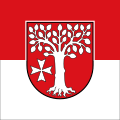 Flag  Coat of arms | |
Location of Esterwegen within Emsland district 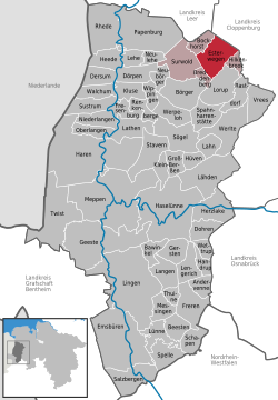 | |
 Esterwegen  Esterwegen | |
| Coordinates: 52°59′31″N7°38′1″E / 52.99194°N 7.63361°E | |
| Country | Germany |
| State | Lower Saxony |
| District | Emsland |
| Municipal assoc. | Nordhümmling |
| Government | |
| • Mayor | Hermann Willenborg |
| Area | |
• Total | 49.53 km2 (19.12 sq mi) |
| Elevation | 13 m (43 ft) |
| Population (2023-12-31) [1] | |
• Total | 5,596 |
| • Density | 113.0/km2 (292.6/sq mi) |
| Time zone | UTC+01:00 (CET) |
| • Summer (DST) | UTC+02:00 (CEST) |
| Postal codes | 26897 |
| Dialling codes | 0 59 55 |
| Vehicle registration | EL |
| Website | www.esterwegen.de |
Esterwegen is a municipality in the Emsland district, in Lower Saxony, Germany.
