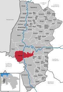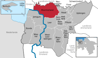
Moormerland is a municipality in the Leer District, in Lower Saxony, northwestern Germany.

Walkenried is a municipality in the district of Göttingen, in Lower Saxony, Germany. It is situated in the southern Harz, approx. 15 km south of Braunlage, and 15 km northwest of Nordhausen.
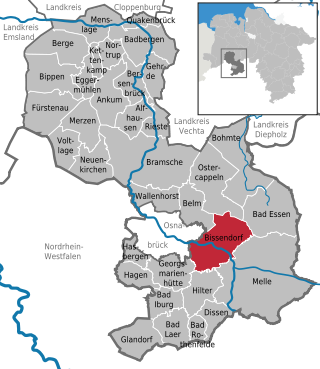
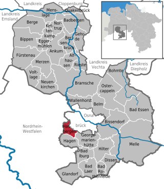
Bissendorf is a municipality in the district of Osnabrück, in Lower Saxony, Germany. It is situated approximately 9 km southeast of Osnabrück. Population 14,700 (2020).
Südbrookmerland is a municipality in the district of Aurich, in Lower Saxony, Germany. It is situated approximately 7 km west of Aurich. Its seat is in the village Victorbur.
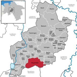
Wagenfeld is a municipality in the district of Diepholz, Lower Saxony, Germany. It is situated approximately 15 km east of Diepholz, and 40 km northwest of Minden.

Emsbüren is a municipality in the Emsland district, Lower Saxony, Germany. It is situated on the river Ems, approx. 15 km south of Lingen, and 15 km northwest of Rheine.

Rhede is a municipality in the Emsland district, Lower Saxony, Germany. It is situated on the river Ems, near the border with the Netherlands, approx. 10 km west of Papenburg, and 20 km southeast of Winschoten.

Salzbergen is a municipality in the Emsland district, Lower Saxony, Germany. It is situated on the river Ems, approx. 25 km south of Lingen, and 10 km northwest of Rheine.
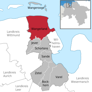
Wangerland is a municipality in the district of Friesland, Lower Saxony, Germany. It is situated on the North Sea coast, approximately 20 km northwest of Wilhelmshaven, and 10 km north of Jever. Its seat is in the village Hohenkirchen.

Sassenburg is a municipality in the district of Gifhorn, Lower Saxony, Germany. It is situated approximately 7 km northeast of Gifhorn, and 15 km northwest of Wolfsburg. Sassenburg includes the villages of Dannenbüttel, Grußendorf, Neudorf-Platendorf, Stüde, Triangel and Westerbeck. The seat of the municipality is in the village Westerbeck.

Staufenberg is the southernmost municipality of the district of Göttingen, and of Lower Saxony, Germany. It is situated east of the river Fulda, approx. 6 km south of Hannoversch Münden, and 12 km northeast of Kassel. Its seat is in the village Landwehrhagen.

Holle is a village and a municipality in the district of Hildesheim, in Lower Saxony, Germany. It is situated approximately 15 km southeast of Hildesheim, and 15 km west of Salzgitter. It was mentioned in Tom Clancy's bestseller Red Storm Rising.

Freden is a village and a municipality in the district of Hildesheim, in Lower Saxony, Germany. It is situated on the river Leine, approx. 25 km south of Hildesheim. Since 1 November 2016, the former municipalities Everode, Landwehr and Winzenburg are part of the municipality Freden.
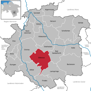
Sibbesse is a village and a municipality in the district of Hildesheim, in Lower Saxony, Germany. It is situated approximately 10 km south of Hildesheim. Since 1 November 2016, the former municipalities Adenstedt, Almstedt, Eberholzen and Westfeld are part of the municipality Sibbesse.

Steyerberg is a municipality in the district of Nienburg, in Lower Saxony, Germany. It is situated approximately 15 km southwest of Nienburg, and 30 km north of Minden.
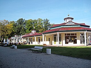
Bad Rothenfelde is a municipality and health resort in the district of Osnabrück, in Lower Saxony, Germany.

Hagen is a municipality in the district of Osnabrück, in Lower Saxony, Germany. It is situated in the Teutoburg Forest, approx. 10 km southwest of Osnabrück.
Hasbergen is a municipality in the district of Osnabrück, in Lower Saxony, Germany. It is situated in the Teutoburg Forest, approx. 7 km west of Osnabrück. Hasbergen consists of Hasbergen proper, Gaste and Ohrbeck.

Geestland is a town in the district of Cuxhaven, in Lower Saxony, Germany. It was formed on 1 January 2015 by the merger of the former municipalities of Langen bei Bremerhaven, Bad Bederkesa, Drangstedt, Elmlohe, Flögeln, Köhlen, Kührstedt, Lintig and Ringstedt.

Wurster Nordseeküste is a municipality in the district of Cuxhaven, in Lower Saxony, Germany. It takes its name from the historic region Land Wursten and the North Sea coast. It was formed on 1 January 2015 by the merger of the former municipalities Nordholz, Cappel, Dorum, Midlum, Misselwarden, Mulsum, Padingbüttel and Wremen.