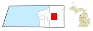
Homestead Township is a civil township of Benzie County in the U.S. state of Michigan. The population was 2,357 at the 2010 census. The township is situated in the center of the county. The village of Honor is located within the township on U.S. Highway 31.

Nunda Township is a civil township of Cheboygan County in the U.S. state of Michigan. The population was 1,042 at the 2010 census.
North Shade Township is a civil township of Gratiot County in the U.S. state of Michigan. The population was 706 at the 2000 census.
Ionia Township is a civil township of Ionia County in the U.S. state of Michigan. The population was 3,669 at the 2000 census. The city of Ionia is mostly within the township, but is administratively autonomous.
Orleans Township is a civil township of Ionia County in the U.S. state of Michigan. The population was 2,736 at the 2000 census.

Tompkins Township is a civil township of Jackson County in the U.S. state of Michigan. The population was 2,671 at the 2010 census.

Stannard Township is a civil township of Ontonagon County in the U.S. state of Michigan. The population was 645 at the 2020 census.
Hersey Township is a civil township of Osceola County in the U.S. state of Michigan. The population was 1,846 at the 2000 census. The village of Hersey is located within the township.
Lincoln Township is a civil township of Osceola County in the U.S. state of Michigan. As of the 2000 census, the township population was 1,629.

Georgetown Charter Township is a charter township of Ottawa County in the U.S. state of Michigan. The population was 46,985 at the time of the 2010 census. The city of Hudsonville is adjacent to the township and the unincorporated community of Jenison is within the township, which includes about half the township's population.

Tittabawassee Township is a civil township of Saginaw County in the U.S. state of Michigan. The 2010 Census placed the population at 9,726. This is a substantial increase compared to the 2000 Census population of 7,706. The township is named for the Tittabawassee River.
Fawn River Township is a civil township of St. Joseph County in the U.S. state of Michigan. The population was 1,648 at the 2000 census. The township is named for the Fawn River.
Elysian Township is a township in Le Sueur County, Minnesota, United States. The population was 985 at the 2000 census.
Spruce Township is a township in Roseau County, Minnesota, United States. The population of the township was 614 at the 2000 census. The unincorporated community of Mandus is located within Spruce Township.

Lower Heidelberg Township is a township in Berks County, Pennsylvania. The population was 5,513 at the 2010 census.

Harris Township is a township in Centre County, Pennsylvania, United States. It is part of the State College, Pennsylvania Metropolitan Statistical Area. Boalsburg, a census-designated place (CDP), is located within the township. The population was 4,873 at the 2010 census, which is a 4.6% increase since the 2000 census.

Girard Township is a township in Clearfield County, Pennsylvania, United States. The population was 565 at the 2020 census.

Greene Township is a township in Erie County, Pennsylvania, United States. The population was 4,488 at the 2020, down from 4,706 at the 2010 census.

Lake Township is a township in Mercer County, Pennsylvania, United States. The population was 702 at the 2020 census, a decline from the figure of 780 in 2010.

Bratton Township is a township in Mifflin County, Pennsylvania, United States. The population was 1,196 at the 2020 census.


