The Pacific Crest Trail (PCT), officially designated as the Pacific Crest National Scenic Trail, is a long-distance hiking and equestrian trail closely aligned with the highest portion of the Cascade and Sierra Nevada mountain ranges, which lie 100 to 150 miles east of the U.S. Pacific coast. The trail's southern terminus is next to the Mexico–United States border, just south of Campo, California, and its northern terminus is on the Canada–US border, upon which it continues unofficially to the Windy Joe Trail within Manning Park in British Columbia; it passes through the states of California, Oregon, and Washington.

Mount Jefferson State Natural Area is a 1,188-acre (4.81 km2) North Carolina state park in Ashe County, North Carolina in the United States. Located near Jefferson, North Carolina, it includes the peak of Mount Jefferson, named for Thomas Jefferson and his father Peter, who owned land nearby and surveyed the North Carolina-Virginia border in 1749. In 1974, Mount Jefferson State Natural Area was designated as a National Natural Landmark by the National Park Service.

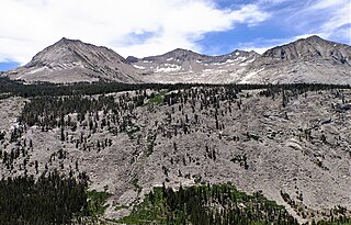
The John Muir Wilderness is a wilderness area that extends along the crest of the Sierra Nevada of California for 90 miles (140 km), in the Inyo and Sierra National Forests. Established in 1964 by the Wilderness Act and named for naturalist John Muir, it encompasses 652,793 acres (2,641.76 km2). The wilderness lies along the eastern escarpment of the Sierra from near Mammoth Lakes and Devils Postpile National Monument in the north, to Cottonwood Pass near Mount Whitney in the south. The wilderness area also spans the Sierra crest north of Kings Canyon National Park, and extends on the west side of the park down to the Monarch Wilderness.

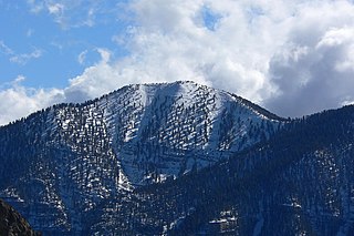
Mount Charleston, including Charleston Peak at 11,916 feet (3,632 m), is the highest mountain in both the Spring Mountains and Clark County, in Nevada, United States. It is the eighth-highest mountain in the state. Well separated from higher peaks by large, low basins, Charleston Peak is the most topographically prominent peak in Nevada, and the eighth-most-prominent peak in the contiguous United States. It is one of eight ultra-prominent peaks in Nevada. It is located about 35 miles (56 km) northwest of Las Vegas within the Mount Charleston Wilderness, which is within the Spring Mountains National Recreation Area of the Humboldt–Toiyabe National Forest.

Wheeler Peak is the tallest mountain in the Snake Range and in White Pine County, in Nevada, United States. The summit elevation of 13,065 feet (3,982 m) makes it the second-highest peak in Nevada, just behind Boundary Peak. With a topographic prominence of 7,563 feet (2,305 m), Wheeler Peak is the most topographically prominent peak in White Pine County and the second-most prominent peak in Nevada, just behind Mount Charleston. The mountain is located in Great Basin National Park and was named for George Wheeler, leader of the Wheeler Survey of the late 19th century.

Mount Williamson, at an elevation of 14,379 feet (4,383 m), is the second-highest mountain in both the Sierra Nevada range and the state of California, and the sixth-highest peak in the contiguous United States.

Mount Langley is a mountain located on the crest of the Sierra Nevada, on the boundary between Inyo and Tulare counties in eastern California, in the United States. To the east is the Owens Valley, and to the west is the Kern River Valley. It is the ninth-highest peak in the state and the seventh-highest in the Sierra. Mount Whitney, the highest peak in the contiguous United States, lies 4.8 miles (7.7 km) to the northwest. Mount Langley also has the distinction of being the southernmost fourteener in the United States.

Nippletop is a mountain in the Colvin Range of the Adirondack Mountains in New York. With an elevation of 4,620 feet (1,410 m), it is the 13th-highest peak in New York and one of the 46 Adirondack High Peaks. It is located near the southern border of the town of Keene in Essex County, in the High Peaks Wilderness Area of Adirondack Park.

Panther Peak is a mountain in the Santanoni Range of the Adirondacks in the U.S. state of New York. It is the 18th-highest of the Adirondack High Peaks, with an elevation of 4,714 feet (1,437 m). It is located in the town of Keene in Essex County, inside Adirondack Park. The mountain is named after the panthers which were once native to the region. The name "Panther Peak" was in use by 1840, but originally referred to a different mountain now known as Mount Henderson. By 1904, the name had been transferred to the present Panther Peak. The earliest recorded ascent was also made in 1904 by surveyor Daniel Lynch. The mountain is flanked by two other High Peaks in the Santanoni Range, Couchsachraga Peak and Santanoni Peak.
Griffith Peak is located in the Spring Mountains in Clark County of southern Nevada. It is approximately 28 miles (45 km) northwest of the Las Vegas Strip and 3.9 miles (6.3 km) southeast of Mount Charleston.

Mount Fiske is a 13,503-foot-elevation mountain summit located near the crest of the Sierra Nevada mountain range, in Fresno County of northern California, United States. It is situated in northern Kings Canyon National Park, 23 miles (37 km) west of the community of Big Pine, 0.83 miles (1.34 km) east of Mount Huxley, and two miles south of Mount Darwin, which is the nearest higher neighbor. Mount Fiske ranks as the 60th highest summit in California.

Langille Peak is a 12,018-foot-elevation (3,663-meter) mountain summit located west of the crest of the Sierra Nevada mountain range, in Fresno County of central California, United States. It is situated in northern Kings Canyon National Park, 19 miles (31 km) west-southwest of the community of Big Pine, 3 miles (4.8 km) south of Mount Thompson, 2.8 miles (4.5 km) southwest of Mount Goode, and 2.1 miles (3.4 km) east of Black Giant. Topographic relief is significant as the east aspect rises 3,100 feet above Le Conte Canyon in less than one mile. The approach to this remote peak is made via the John Muir Trail.

Crater Mountain is a 12,874-foot-elevation (3,924-meter) mountain summit located west of the crest of the Sierra Nevada mountain range, in Fresno County of northern California, United States. It is situated in eastern Kings Canyon National Park, 15.5 miles (24.9 km) northwest of the community of Independence, one mile immediately southwest of Pinchot Pass, and 1.3 miles (2.1 km) southeast of Mount Ickes, which is the nearest higher neighbor. Other nearby peaks include Mount Wynne, 1.5 miles (2.4 km) to the northeast, and Mount Cedric Wright, 2.2 miles (3.5 km) to the southeast. Crater Mountain ranks as the 186th highest summit in California. Topographic relief is significant as the west aspect rises 2,000 feet in less than one mile. The approach to this remote peak is made via the John Muir Trail which passes below the east aspect of the mountain. The first ascent of the summit was made July 19, 1922, by W. H. Ink, Meyers Butte, Frank Baxter, and Captain Wallace. This mountain has no crater as the name implies.
Mount Ickes is a 12,959-foot-elevation (3,950-meter) mountain summit located west of the crest of the Sierra Nevada mountain range, in Fresno County of northern California, United States. It is situated in eastern Kings Canyon National Park, 13.5 miles (21.7 km) northwest of the community of Independence, 1.5 mile west of Pinchot Pass, and 2 miles (3.2 km) west of Mount Wynne, which is the nearest higher neighbor. Other nearby peaks include Crater Mountain 1.3 miles (2.1 km) to the southeast, Striped Mountain 3 miles (4.8 km) to the northeast, Arrow Peak, three miles (4.8 km) to the west, and Mount Ruskin four miles (6.4 km) to the northwest. Mount Ickes ranks as the 159th highest summit in California. Topographic relief is significant as the north aspect rises 3,080 feet in 2.5 miles. The approach to this remote peak is made via the John Muir Trail which passes to the east of the mountain. The mountain's name was officially adopted in 1964 by the United States Board on Geographic Names to honor Harold L. Ickes (1874–1952), who was responsible for implementing much of President Franklin D. Roosevelt's New Deal as Secretary of the Interior from 1933 to 1946 and was instrumental in establishing Kings Canyon National Park.

Parker Peak is a 12,861-foot-elevation (3,920-meter) mountain summit located in the Sierra Nevada mountain range, in Mono County of northern California, United States. It is situated in the Ansel Adams Wilderness, on land managed by Inyo National Forest. It is approximately 7.0 miles (11.3 km) northwest of the community of June Lake, 1.2 miles (1.9 km) east of Yosemite National Park's eastern boundary, and 1.0 mile (1.6 km) east of Koip Peak, the nearest higher neighbor. The mountain is visible from the June Lake Loop, and from the nearby June Mountain ski area. Topographic relief is significant as it rises over 5,700 feet above Grant Lake in four miles. The peak's name is derived from Parker Creek, which in turn was named after an early settler of Mono County. This geographical feature's name has been officially adopted by the U.S. Board on Geographic Names. The first ascent of the summit was made in 1914 by Norman Clyde.
Mount Lamarck is a 13,417-foot-elevation (4,090-meter) mountain summit located on the crest of the Sierra Nevada mountain range in northern California, United States. It is situated on the shared boundary of Kings Canyon National Park with John Muir Wilderness, and along the common border of Fresno County with Inyo County. It is 20 miles (32 km) southwest of the community of Bishop, and 1.9 miles (3.1 km) north of Mount Darwin. Subsidiary peak Mount Lamarck North (13,464 feet ranks as the 67th highest summit in California, and the sixth highest in the Evolution Region. Topographic relief is significant as the east aspect rises 4,290 feet above Lake Sabrina in three miles, and the west aspect rises 3,600 feet above Evolution Valley in three miles.
Exploration Peak Park is an 80-acre regional park in the unincorporated town of Enterprise, Nevada, United States at Exploration Peak. It is among the top rated parks in the Las Vegas Valley.

Mount Wood is a 12,657-foot-elevation (3,858 meter) mountain summit located just east of the crest of the Sierra Nevada mountain range, in Mono County of northern California, United States. It is situated in the Ansel Adams Wilderness, on land managed by Inyo National Forest. It is approximately 6.0 miles (9.7 km) northwest of the community of June Lake, two miles outside of Yosemite National Park's eastern boundary, and one mile east-southeast of line parent Parker Peak. Topographic relief is significant as the summit rises over 5,500 feet above Grant Lake in three miles. The mountain is visible from the June Lake Loop.

Mount Judah is an 8,243-foot-elevation (2,512 meter) mountain summit in Placer County, California, United States.
