F. D. Roosevelt Airport

Last updated
F. D. Roosevelt Airport
Sint Eustatius runway.jpg
The airport seen from a distance with The Quill in the background
Summary
Airport typePublic
OwnerIsland Government of Sint Eustatius
OperatorIsland Government of Sint Eustatius
Serves Oranjestad
Location Sint Eustatius
Elevation  AMSL 129 ft / 39 m
Coordinates 17°29′47″N062°58′46″W / 17.49639°N 62.97944°W / 17.49639; -62.97944
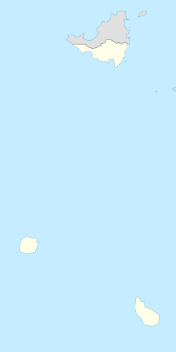
Map
Netherlands Antilles (Leeward Islands) location map.svg
Airplane silhouette.svg
TNCE
Location in Sint Eustatius
Runways
Direction LengthSurface
mft
06/241,3004,265 Asphalt
Source: DAFIF [1] [2]

F. D. Roosevelt Airport( IATA : EUX, ICAO : TNCE) is the airport located on the Dutch Caribbean island of Sint Eustatius. It was opened as "Golden Rock Airport" in 1946 and renamed for Franklin Delano Roosevelt. As of 2012, the only commercial aircraft that serves the island is the DHC-6 Twin Otter (can operate chartered flights with Britten-Norman Islander and Cessna 208 Caravan), although the runway can accommodate larger turboprop aircraft and some smaller jets. As of 2023, the largest aircraft type to operate at the airport is the ATR 42.

Contents

President Roosevelt had Dutch ancestors and in 1939 presented Sint Eustatius with a plaque in recognition of the "First Salute," the first official salute of the flag of the newly declared independent United States in 1776. Members of the Roosevelt family lived on St. Eustatius in the 18th century and had possessions on the island.
Facilities

The airport is built to support small aircraft. A small single story terminal building processes passengers and baggage and also serves as the customs area. [3] A two-story tower is attached, but the airport has no control tower. There are no jetways or services, and a small apron allows for aircraft passengers to disembark.

Future development

The island is not a traditional Caribbean tourist destination, and so it does not have overcrowded beaches and blueprint resorts. The local government has, however, sought to increase tourism by attracting visitors to visit its dive sites, hike its dormant volcano The Quill and explore the remains of its colonial history and the restored historical city of Oranjestad. Part of this plan is a proposed 1,000-foot (300 m) extension of the runway, in order to accommodate even larger aircraft and additional destinations.

Airlines and destinations

AirlinesDestinations
Coastal Air Dominica–Canefield, Nevis, Saint Croix
EZAir Bonaire, Aruba, Curacao
Trans Anguilla Airways Anguilla, Nevis, Saint Kitts
Winair Bonaire, Saba, [4] Sint Maarten

Statistics

Annual passenger traffic at EUX airport. See Wikidata query.

Access

Access to the airport is by private vehicle or taxi service from the surrounding areas of the island. [3] Main access to the airport is via Max T. Pandt Boulevard.

Related Research Articles

<span class="mw-page-title-main">Hewanorra International Airport</span> International airport serving Saint Lucia

Hewanorra International Airport, located near Vieux Fort Quarter, Saint Lucia, in the Caribbean, is the larger of Saint Lucia's two airports and is managed by the Saint Lucia Air and Seaports Authority (SLASPA). It is on the southern cape of the island, about 53.4 km (33.2 mi) from the capital city, Castries.

<span class="mw-page-title-main">Sint Eustatius</span> Dutch Caribbean island

Sint Eustatius, known locally as Statia, is an island in the Caribbean. It is a special municipality of the Netherlands.

<span class="mw-page-title-main">Oranjestad, Sint Eustatius</span> Capital city in Sint Eustatius, Netherlands

Oranjestad is a small town of 1,038 inhabitants; it is the capital and largest town of the island of Sint Eustatius in the Caribbean Netherlands. It's not to be confused with the far larger Oranjestad in Aruba.

<span class="mw-page-title-main">George F. L. Charles Airport</span> Airport in Saint Lucia

George F. L. Charles Airport is the smaller of the two airports in Saint Lucia, the other being Hewanorra International Airport. It is located 2 km (1.2 mi) north of Castries, the capital city. George F. L. Charles Airport is managed by the Saint Lucia Air and Seaports Authority (SLASPA). Its runway runs parallel to a pristine beach, Vigie Beach, which is a popular tourist attraction.

<span class="mw-page-title-main">Princess Juliana International Airport</span> Airport on the Caribbean island of Saint Martin, Sint Maarten

Princess Juliana International Airport is the main airport on the Caribbean island of Saint Martin. The airport is located on the Dutch side of the island, in the country of Sint Maarten, close to the shore of Simpson Bay Lagoon. In 2015, the airport handled 1,829,543 passengers and around 60,000 aircraft movements. The airport serves as a hub for Winair and is the major gateway for the smaller Leeward Islands, including Anguilla, Saba, Saint Barthélemy and Sint Eustatius. It is named after Queen Juliana of the Netherlands, who landed there while she was heir presumptive in 1944, the year after the airport opened. The airport has very low-altitude flyover landing approaches because one end of its runway is extremely close to the shore and Maho Beach. While Princess Juliana International is the primary aviation gateway to the island, there is also a smaller public-use airport on the French side, in the French Collectivity of Saint Martin, called Grand Case-Espérance Airport.

<span class="mw-page-title-main">Flamingo International Airport</span> Airport in Bonaire, Caribbean Netherlands

Flamingo International Airport, also called Bonaire International Airport, is an international airport located near Kralendijk on the island of Bonaire in the Caribbean Netherlands. It was once the hub for BonaireExel and CuraçaoExel before they were rebranded as Dutch Antilles Express, and served as a secondary hub for Dutch Antilles Express and Insel Air. The airport is the fourth largest in the Dutch Caribbean, after Queen Beatrix International Airport on Aruba, Princess Juliana International Airport on Sint Maarten and Curaçao International Airport on Curaçao and is now the largest airport in the Caribbean Netherlands, with F. D. Roosevelt Airport in Sint Eustatius being the second largest and Juancho E. Yrausquin Airport in Saba being the smallest.

<span class="mw-page-title-main">Juancho E. Yrausquin Airport</span> Airport on the Caribbean island of Saba

Juancho E. Yrausquin Airport is an airport on the Dutch Caribbean island of Saba. Its runway is widely acknowledged as the shortest commercial runway in the world, with a length of 400 m (1,312 ft).

<span class="mw-page-title-main">Terrance B. Lettsome International Airport</span> Airport in British Virgin Islands

Terrance B. Lettsome International Airport, previously known as Beef Island Airport, is the main airport serving the British Virgin Islands, a British overseas territory in the Caribbean. The airport serves as the gateway to just about all of the islands within the BVI. The airport is also a gateway for inter-Caribbean travelers headed to the nearby U.S. Virgin Islands. Many travellers fly into Beef Island, with the intention of taking a ferry to the other smaller British Virgin Islands. The airport is located on Beef Island, a small island off the main island of Tortola, to which it is connected by the Queen Elizabeth II Bridge.

<span class="mw-page-title-main">Maurice Bishop International Airport</span> Airport in St. Georges, Grenada

Maurice Bishop International Airport, formerly known as Point Salines Airport, is an international airport located in the parish of St. George's. The town of St. George's is about 5 mi (8.0 km) north of the airport and is the capital of the island nation of Grenada. The airport is located on Point Salines, the most southwestern point of the island. It is named after former Prime Minister Maurice Bishop (1944–1983), who championed the construction project in 1979.

<span class="mw-page-title-main">Douglas–Charles Airport</span> Airport in Dominica

Douglas–Charles Airport, formerly known as Melville Hall Airport, is an airport located on the northeast coast of Dominica, 2 mi (3.2 km) northwest of Marigot. It is about one hour away from the second largest city Portsmouth. It is one of only two airports in the island nation of Dominica, the other being Canefield Airport located three miles (5 km) northeast of Roseau.

<span class="mw-page-title-main">Sultan Thaha Airport</span> Airport in Jambi, Indonesia

Sultan Thaha Syaifuddin Airport, formerly known as Palmerah Airport, is in Jambi City in the Jambi province of Indonesia. It is located in the Paalmerah suburb of Jambi. The airport is named after Thaha Syaifuddin, the last Sultan of Jambi (1816–1904).

Windward Express Airways is an airline based at Princess Juliana International Airport in the island of Sint Maarten. It provides air charter and cargo services throughout the Eastern Caribbean.

<span class="mw-page-title-main">Mustique Airport</span> Airport in Mustique, Saint Vincent and the Grenadines

Mustique Airport is a private airfield owned by the Mustique Company for public use and is located on Mustique island, part of Saint Vincent and the Grenadines in the Caribbean Sea. It is used by civil aviation and national airlines using turboprop planes.

<span class="mw-page-title-main">Canouan Airport</span> Airport in St. Vincent and the Grenadines

Canouan Airport is the airport located on the island of Canouan in St. Vincent and the Grenadines. The airport serves the surrounding tourist areas and environs of the Grenadines and is a major destination during the Caribbean winter leisure season. Aside from facilitating regular passenger flights, the airport is also open for international corporate jet operations and charter flights. Canouan Airport was the main business aviation airport in St. Vincent and the Grenadines before the opening of Argyle International Airport. The terminal has a CIP lounge and other facilities for international passengers and a domestic hub for St. Vincent and the Grenadines. It is the second largest airport in St. Vincent and the Grenadines, after Argyle International Airport. The airport often served as the alternate airport for E.T. Joshua Airport, now a decommissioned airport in St. Vincent and other Grenadines airports.

<span class="mw-page-title-main">Argyle International Airport</span> Airport in Argyle

Argyle International Airport is an international airport on the island of Saint Vincent in the Caribbean nation of Saint Vincent and the Grenadines. It is located in Argyle, about 5.17 miles (8.32 km) from the capital Kingstown.

<span class="mw-page-title-main">J. F. Mitchell Airport</span> Airport in Paget Farm

J. F. Mitchell Airport, also known as Bequia Airport, is the airport serving Bequia island, Grenadines Parish, Saint Vincent and the Grenadines, including Grenadines Parish's capital Port Elizabeth. It is named after Sir James Fitz-Allen Mitchell, KCMG, PC, MP, former Premier (1972-1974) and Prime Minister (1984-2000) of St. Vincent and the Grenadines. In 1990, a land reclamation project was undertaken in Paget Farm for the construction of the island's J.F. Mitchell Airport.

EUX, Eux, or eux can refer to:

References

  1. "Airport information for TNCE". World Aero Data. Archived from the original on 2019-03-05.{{cite web}}: CS1 maint: unfit URL (link) Data current as of October 2006. Source: DAFIF.
  2. Airport information for EUX at Great Circle Mapper. Source: DAFIF  (effective October 2006).
  3. 1 2 "A-Z World Airports Online - BES Islands airports - St Eustatius - F D Roosevelt Airport (EUX/TNCE)". azworldairports.com. Retrieved 20 August 2016.
  4. "Winair Adds St. Eustatius – Saba Sector Sep – Nov 2024". Aeroroutes. Retrieved 11 September 2024.

Commons-logo.svg Media related to F.D. Roosevelt Airport at Wikimedia Commons