Fairview | |
---|---|
Unincorporated community | |
Coordinates: 40°17′53″N085°11′43″W / 40.29806°N 85.19528°W Coordinates: 40°17′53″N085°11′43″W / 40.29806°N 85.19528°W | |
Country | United States |
State | Indiana |
County | Randolph |
Township | Green |
Elevation [1] | 965 ft (294 m) |
Time zone | Eastern (EST) (UTC-5) |
• Summer (DST) | EDT (UTC-4) |
ZIP code | 47373 |
Area code(s) | 765 |
GNIS feature ID | 434310 |
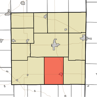
Fairview is an unincorporated community in Green Township, Randolph County, in the U.S. state of Indiana. [2]
In law, an unincorporated area is a region of land that is not governed by a local municipal corporation; similarly an unincorporated community is a settlement that is not governed by its own local municipal corporation, but rather is administered as part of larger administrative divisions, such as a township, parish, borough, county, city, canton, state, province or country. Occasionally, municipalities dissolve or disincorporate, which may happen if they become fiscally insolvent, and services become the responsibility of a higher administration. Widespread unincorporated communities and areas are a distinguishing feature of the United States and Canada. In most other countries of the world, there are either no unincorporated areas at all, or these are very rare; typically remote, outlying, sparsely populated or uninhabited areas.
Green Township is one of eleven townships in Randolph County, Indiana. As of the 2010 census, its population was 957 and it contained 404 housing units.
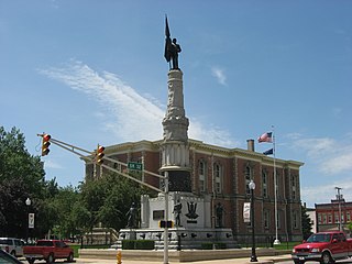
Randolph County is a county located in the U.S. state of Indiana. As of 2010, the population was 26,171. The county seat is Winchester.
Fairview was platted in 1838. [3] A post office was established at Fairview in 1843, and remained in operation until it was discontinued in 1901. [4]
In the United States, a plat is a map, drawn to scale, showing the divisions of a piece of land. United States General Land Office surveyors drafted township plats of Public Lands Surveys to show the distance and bearing between section corners, sometimes including topographic or vegetation information. City, town or village plats show subdivisions into blocks with streets and alleys. Further refinement often splits blocks into individual lots, usually for the purpose of selling the described lots; this has become known as subdivision.
Fairview is located at 40°17′53″N085°11′43″W / 40.29806°N 85.19528°W at an elevation of 965 feet (294 m).
Lauramie Township is one of thirteen townships in Tippecanoe County, Indiana, United States. As of the 2010 census, its population was 2,596 and it contained 1,021 housing units.
Stoney Creek Township is one of eleven townships in Randolph County, Indiana. As of the 2010 census, its population was 990 and it contained 425 housing units.
Ward Township is one of eleven townships in Randolph County, Indiana. As of the 2010 census, its population was 1,109 and it contained 495 housing units.
Washington Township is one of eleven townships in Randolph County, Indiana. As of the 2010 census, its population was 2,172 and it contained 955 housing units.
White River Township is one of eleven townships in Randolph County, Indiana. As of the 2010 census, its population was 7,513 and it contained 3,405 housing units.
Dalton Township is one of fifteen townships in Wayne County, Indiana, United States. As of the 2010 census, its population was 566 and it contained 239 housing units.
Huntsville is an unincorporated community in Union Township, Randolph County, in the U.S. state of Indiana.
Miami Bend is an unincorporated community in Miami Township, Cass County, Indiana, United States.
Mott Station is an unincorporated community in Jackson Township, Harrison County, Indiana.
Falmouth is an unincorporated community in Fayette and Rush counties in the U.S. state of Indiana. Located at the northeastern corner of Union Township and the southeastern corner of Washington Township in Rush County and along the northwestern edge of Fairview Township in Fayette County, it lies at the intersection of CR800E with CR600N /CR400N(Fayette County). Falmouth sits northwest of Connersville and northeast of Rushville, the county seats of Fayette and Rush counties respectively. Its elevation is 1,070 feet (326 m), and it is located at 39°42′3″N85°17′4″W. Although Falmouth is unincorporated, it has a post office, with the ZIP code of 46127.
Georgetown is an unincorporated community in Stoney Creek Township, Randolph County, in the U.S. state of Indiana.
Maxville is an unincorporated community in White River Township, Randolph County, in the U.S. state of Indiana.
Mull is an unincorporated community in White River Township, Randolph County, in the U.S. state of Indiana.
Shedville is an unincorporated community in Green Township, Randolph County, in the U.S. state of Indiana.
Stone is an unincorporated community in Ward Township, Randolph County, in the U.S. state of Indiana.
Unionport is an unincorporated community in Union Township, Randolph County, in the U.S. state of Indiana.
Windsor is an unincorporated community in Stoney Creek Township, Randolph County, in the U.S. state of Indiana.
Lookout is an unincorporated community in Delaware Township, Ripley County, in the U.S. state of Indiana.
Fairview is an unincorporated community in Cotton Township, Switzerland County, in the U.S. state of Indiana.
This Randolph County, Indiana location article is a stub. You can help Wikipedia by expanding it. |