Ward Township | |
|---|---|
 | |
| Coordinates: 40°15′35″N84°57′37″W / 40.25972°N 84.96028°W | |
| Country | United States |
| State | Indiana |
| County | Randolph |
| Government | |
| • Type | Indiana township |
| Area | |
• Total | 36.88 sq mi (95.5 km2) |
| • Land | 36.75 sq mi (95.2 km2) |
| • Water | 0.13 sq mi (0.34 km2) |
| Elevation | 1,020 ft (311 m) |
| Population | |
• Total | 1,059 |
| • Density | 28.82/sq mi (11.13/km2) |
| Time zone | UTC-5 (Eastern (EST)) |
| • Summer (DST) | UTC-4 (EDT) |
| Area code | 765 |
| FIPS code | 18-80072 [3] |
| GNIS feature ID | 453973 |
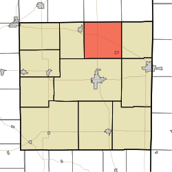
Ward Township is one of eleven townships in Randolph County, Indiana. As of the 2020 census, its population was 1,059 (down from 1,109 at 2010 [4] ) and it contained 469 housing units. [2]

