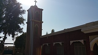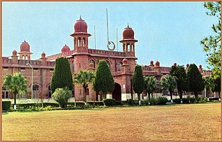
Faisalabad, formerly known as Lyallpur, is the second largest city and industrial centre of the Pakistani province of Punjab. It is the third largest city in Pakistan, with a population of over 3.7 million. It is situated in the north-east of the country, lying between the plains of the Ravi and Chenab River. Faisalabad is one of Pakistan's wealthiest and most industrialized cities, the largest industrial hub and second largest city of the wider Punjab region.

Toba Tek Singh District is a district of Faisalabad Division in the Punjab province of Pakistan. It is located between 30°33' to 31°2' Degree north latitudes and 72°08' to 72°48' Degree longitudes. It became a separate district in 1982.

Chak Jhumra, is a town, railway junction, and Tehsil in Punjab, Pakistan. The town is situated about 21 kilometres (13 mi) Northeast of Faisalabad on Faisalabad-Sangla Hill Road. The Khanewal–Wazirabad Branch and Sangla Hill–Kundian Branch intersect in the town and connect it to Faisalabad and Sargodha respectively.

Jaranwala is a city and capital of Jaranwala Tehsil located in the Faisalabad District of Punjab, Pakistan. It is the 58th largest city of Pakistan. It also one of the biggest tehsil by population in the province of Punjab in Pakistan.
Gojra, is the administrative capital of Gojra Tehsil and a city in the Toba Tek Singh District in Punjab province of Pakistan.

Burewala, is a city of Vehari District in Punjab, Pakistan. The city of Burewala is the headquarters of Burewala Tehsil, an administrative subdivision of the district. It is the 34th largest city of Pakistan by population.

Faisalabad District is one of the districts of Punjab province, Pakistan. According to the 1998 census of Pakistan it had a population of 3,029,547 of which almost 42% were in Faisalabad City. It is the third largest city of Pakistan after Karachi and Lahore.

Hafizabad District is located in Punjab, Pakistan. Hafizabad was made a district in 1993; formerly, it was a tehsil of Gujranwala District. It is situated in central Punjab and is known for its rice industry on the agricultural side and rice industry on the industrial side and have top 5 exporters of rice from Pakistan.

Nankana Sahib District is a district in the Punjab province of Pakistan. Nankana Sahib is the seat of the district government, and Shahkot is the largest urban center. The district of Nankana Sahib is located about 75 kilometres (47 mi) west of Lahore and about 53 kilometres (33 mi) east of Faisalabad. Until 2005, it was part of Sheikhupura District.
Sangla Hill is a tehsil in the Nankana Sahib District of the Punjab Province of Pakistan. It lies 103 km from the provincial capital of Lahore and 47 km from Faisalabad. Until 2005, it was part of Sheikhupura District.
Sargodha Tehsil, is an administrative subdivision of the Sargodha District in the Punjab province of Pakistan. The tehsil is subdivided into 62 Union Councils - 22 of which form the city of Sargodha.
Darya Khan, is an administrative subdivision (tehsil), of Bhakkar District in the Punjab province of Pakistan. The town of Darya Khan is the headquarters of the tehsil.
Jaranwala is a subdivision (Tehsil) of Faisalabad District in the Punjab province of Pakistan. The industrial area, Khurrianwala, is located in Jaranwala, and Makuana. Jaranwala is subdivided into 57 Union Councils.
Samundri Tehsil is an administrative subdivision of Faisalabad District in the Punjab province of Pakistan. Samundri is the city and headquarters of the tehsil. Samundri Tehsil farms are irrigated by Gugera Branch Canal and Burala Branch Canal.
Tandlianwala is a city and Tehsil in Punjab, Pakistan. It is located 50 km from the city of Faisalabad and 44 km from city of Okara. It is a sub-division of Faisalabad District and has a Tehsil Municipal Administration (TMA).

Bhawana is a city and capital of Bhawana Tehsil of Chiniot District in Punjab, Pakistan. It is located on the bank of the Chenab river, bounded by Faisalabad, Jhang, and Chiniot, three other cities in Punjab.
Pindi Bhattian is a city and the administration headquarters of Pindi Bhattian Tehsil, Hafizabad District in Punjab, Pakistan. It is famous for being the birth place of a 16th-century Punjabi folk hero, Dulla Bhatti who led revolts against the Mughal rule in the Punjab.
Faisalabad Sadar is a Tehsil of Faisalabad District, Punjab, Pakistan. The population is 1,465,411 according to the 2017 Census of Pakistan.
Chak 236 GB Kilanwala is a Pakistani Punjab union council located 8 kilometres (5.0 mi) from Jaranwala toward the east side on Jaranwala-Nankana Road in Jaranwala Tehsil of the Faislabad district, previously known as Lyallpur Punjab Pakistan. Before the Partition of India, most of the population was Sikh and Hindu; after the Partition, Muslims migrated from the villages of Anihar, Nangal Fateh Khan, and other villages in Jalandhar, India. "GB" refers to the Gugera Branch Canal that irrigates the nearby agricultural Land of Punjab.


