
State Highway 70 is a state highway in Texas. The route runs approximately 315 miles (507 km) from US 277 near Blackwell to US 83 south of Perryton.
Farm to Market Road 973 is a farm-to-market road in Travis and Williamson counties in the U.S. state of Texas.

State Highway 174 is a state highway in Texas that connects Meridian and Burleson.

State Highway 124 is a state highway in the U.S. state of Texas maintained by the Texas Department of Transportation (TxDOT). The highway begins along the Gulf Coast near the northeast end of the Bolivar Peninsula at SH 87 and extends to the northeast ending at US 69 and US 96. In between, the highway has major intersections with SH 65 and SH 73. The highway is located in Galveston, Chambers, and Jefferson counties and also serves the communities of Hamshire, Fannett, and Cheek. A portion of SH 124 is part of a longer coastal hurricane evacuation route.
State Highway 125 (SH 125) is a state highway in the U.S. state of Texas maintained by the Texas Department of Transportation (TxDOT). The 28-mile (45 km) highway begins at the New Mexico state line southwest of Bledsoe, and passes through Bledsoe where it turns east intersecting SH 214 before terminating at SH 114. The highway is located entirely within Cochran County, and is numerically continuous with New Mexico State Road 125 which it meets at the state line and connects the highway to Tatum, NM. The highway has brief concurrencies with SH 214 in Lehman and Farm to Market Road 1780 in Whiteface.

Farm to Market Road 1125 is a farm to market road that connects the farming areas of northern Jack County and southern Montague County with Bowie, Texas.

State Highway 315 is a state highway in Texas that runs from Mount Enterprise northeast to Carthage.

Farm to Market Road 423 is a farm to market road in Denton County, Texas.

Farm to Market Road 1171 is a farm to market road in Denton County, Texas.
Farm to Market Road 400 is a farm to market road located in Lynn, Lubbock, Hale, and Swisher counties in the Llano Estacado of Texas.
Farm to Market Road 170 is a 114.6-mile (184.4 km) highway maintained by the Texas Department of Transportation (TxDOT) in Presidio and Brewster counties in Texas. The route, known locally as the River Road, runs along the United States side of the Rio Grande which in Texas forms the international boundary between the U.S. and Mexico. The road runs from Candelaria through the city of Presidio as well as several smaller communities and former settlements to State Highway 118 in Study Butte near Big Bend National Park. The road also passes through the southern portion of Big Bend Ranch State Park.
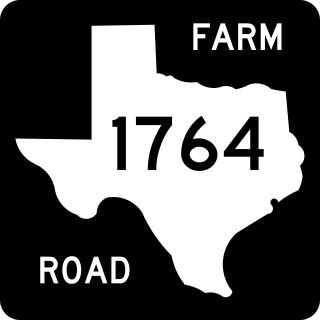
Farm to Market Road 1764 is a 13-mile-long (21 km) state highway in the U.S. state of Texas. It is a farm to market road existing entirely within Galveston County that connects Santa Fe to Texas City via a short stretch of freeway known as the Emmett F. Lowry Expressway. The highway was designated in the 1950s.

Farm to Market Road 1459 is a farm to market road in Brazoria County, Texas.

Farm to Market Road 1450 is a Farm to Market Road in the U.S. state of Texas maintained by the Texas Department of Transportation (TxDOT). The road, located in southeastern Reeves and northern Pecos counties, begins at U.S. Route 285 near Pecos and intersects FM 1776, State Highway 18, and Ranch to Market Road 2593 before terminating at FM 1053. The route number was formerly designated over a road in Freestone County.

Farm to Market Road 1053 (FM 1053) is a Farm to Market Road in the U.S. state of Texas maintained by the Texas Department of Transportation (TxDOT). The road, located in Pecos, Crane, and Ector counties, begins along the concurrent routes of Business Interstate 10-G, U.S. Route 285 (US 285), and U.S. Route 385 (US 385) in the city of Fort Stockton and continues to the north ending at Interstate 20 (I-20) near Penwell. The road passes through the towns of Imperial, where it intersects FM 11, and Tubbs Corner, where it crosses State Highway 329 (SH 329). The road also has major intersections with I-10 / US 67 in Fort Stockton as well as FM 1450 and FM 1233.
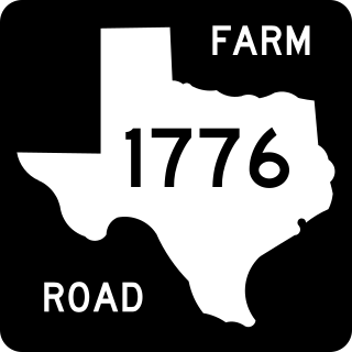
Farm to Market Road 1776 (FM 1776) is a Farm to Market Road in the U.S. state of Texas maintained by the Texas Department of Transportation (TxDOT). The 45-mile (72 km) road begins at a junction with Interstate 10 (I-10) and U.S. Highway 67 (US 67) in Pecos County west of Fort Stockton and extends northward through the town of Coyanosa before ending at State Highway 18 (SH 18) in Ward County south of Monahans. The road has an interchange with US 285 northeast of Fort Stockton.

