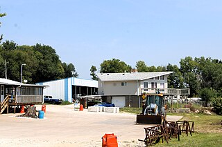
Ollie is a city in Keokuk County, Iowa, United States. The population was 201 at the time of the 2020 census. Originally known as Hemingford, the town voted to change the name to Ollie in 1892.
Dudley is a ghost town in Wapello County, Iowa, United States. Both 1908 and 1920 surveys of northwestern Wapello County show a post office at Dudley. A sign on the former edge of town reads: "Population 12 and God only knows how many dogs and cats."

Bladensburg is a small unincorporated community in Wapello County, Iowa, United States. It lies midway between Agency and Batavia at a distance of five miles (8 km) from each, and the largest nearby city is Ottumwa, seven miles (11 km) to the west-southwest.
Pekin is a small unincorporated community in northwestern Jefferson County, Iowa, United States.
Gifford is an unincorporated community in southeastern Hardin County, Iowa, United States.
Liberty Center is an unincorporated community in southern Warren County, Iowa, United States. It lies along U.S. Route 65 south of the city of Indianola, the county seat of Warren County. Its elevation is 1,024 feet (312 m), and it is located at about 41°12′16″N93°30′0″W. Although Liberty Center is unincorporated, it has a post office, with the ZIP code of 50145, which opened on 7 March 1865.

Fairport is an unincorporated community and census-designated place (CDP) along the Mississippi River and Iowa Highway 22 in Muscatine County, Iowa, United States. As of the 2020 census, the population was 204.

Richland is a city in Keokuk County, Iowa, United States. The population was 542 at the time of the 2020 census.

California Junction is an unincorporated community and census-designated place (CDP) in Harrison County, Iowa, United States. It lies just east of the junction between the east–west and north–south lines of the former Sioux City and Pacific Railroad. In the 2010 census it had a population of 85 inhabitants and a population density of 184.38 people per square mile.
Lanyon is an unincorporated community in Lost Grove Township in Webster County, Iowa.

Avery is an unincorporated community in Monroe County, Iowa, United States.
Bryantsburg is an unincorporated community in Buchanan County, Iowa, United States. It is located on Highway 150 north of Independence and south of Hazleton, at 42.579132N, -91.905063W.
Secor, previously known as Xenia and Delanti, is a ghost town in Hardin County, Iowa, United States. The community was 3.5 miles (5.6 km) south-southeast of Eldora. In its early years, the community was the site of one of the few bridges across the Iowa River in Hardin County. By the mid-20th century, however, the community had lost its school, mill, post office, and businesses, and Secor was considered a ghost town.
Vinje is an unincorporated community in Logan Township, Winnebago County, Iowa, United States.
Dahlonega is an unincorporated community in Wapello County, Iowa, United States.
Metz is an unincorporated community in Jasper County, in the U.S. state of Iowa. Metz lies along West 62nd Street south of Interstate 80.
Bailey was a community in Wayne Township, Mitchell County, Iowa, United States. Founded in 1886 as a whistle stop, it was briefly known as Wapsie. The community lay north of the Wapsipinicon River.
Astor was an unincorporated community in Crawford County, in the U.S. state of Iowa.
Bard was an unincorporated community in Louisa County, in the U.S. state of Iowa.
Judd was an unincorporated community in Webster County, Iowa, United States.


