Fernando Prestes

Last updated • a couple of secsFrom Wikipedia, The Free Encyclopedia
Fernando Prestes
Bandeira de Fernando Prestes -.jpg
Brasao de Fernando Prestes.jpg
SaoPaulo Municip FernandoPrestes.svg
Location in São Paulo state
Brazil location map.svg
Red pog.svg
Fernando Prestes
Location in Brazil
Coordinates: 21°15′52″S48°41′7″W / 21.26444°S 48.68528°W / -21.26444; -48.68528
Country Brazil
Region Southeast
State São Paulo
Area
  Total
170 km2 (70 sq mi)
Population
 (2020 [1] )
  Total
5,794
  Density34/km2 (88/sq mi)
Time zone UTC−3 (BRT)

Fernando Prestes is a municipality in the state of São Paulo in Brazil. The population is 5,794 (2020 est.) in an area of 170 km2. [2] The elevation is 545 m.

Contents

Media

In telecommunications, the city was served by Companhia Telefônica Brasileira until 1973, when it began to be served by Telecomunicações de São Paulo. [3] In July 1998, this company was acquired by Telefónica, which adopted the Vivo brand in 2012. [4]

The company is currently an operator of cell phones, fixed lines, internet (fiber optics/4G) and television (satellite and cable). [4]

See also

Related Research Articles

<span class="mw-page-title-main">Adolfo, São Paulo</span> Municipality in Southeast, Brazil

Adolfo is a Brazilian municipality located in the interior of the state of São Paulo in the microregion of São José do Rio Preto. The population is 3,554 in an area of 211.1 square kilometres (81.5 sq mi). The municipality was established in 1959.

<span class="mw-page-title-main">Altair, São Paulo</span> Municipality in the state of São Paulo in Brazil

Altair is a municipality in the state of São Paulo in Brazil. The population is 4,186 in an area of 313.86 km2. The neighboring municipalities are Icém to the north and Olímpia to the east.

<span class="mw-page-title-main">Avaí</span> Municipality in the state of São Paulo in Brazil

Avaí is a municipality in the state of São Paulo in Brazil. The population is 5,436 in an area of 540 km2.

<span class="mw-page-title-main">Barra Bonita, São Paulo</span> Municipality in Southeast, Brazil

Barra Bonita is a municipality in the state of São Paulo in Brazil. The population is 36,126 in an area of 150 km². The elevation is 457 m.

<span class="mw-page-title-main">Cabrália Paulista</span> Municipality in the state of São Paulo in Brazil

Cabrália Paulista is a municipality in the state of São Paulo in Brazil. The population is 4,243 in an area of 240 km2. The elevation is 539 m.

<span class="mw-page-title-main">Capivari</span> Municipality in the state of São Paulo in Brazil

Capivari is a municipality in the state of São Paulo in Brazil. The population is 56,379 in an area of 323 km2.

<span class="mw-page-title-main">Conchas</span> Municipality in the state of São Paulo in Brazil

Conchas is a municipality in the state of São Paulo in Brazil. The population is 18,019 in an area of 466 square kilometres (180 sq mi). The elevation is 503 metres (1,650 ft).

<span class="mw-page-title-main">Dois Córregos</span> Municipality in the state of São Paulo in Brazil

Dois Córregos is a municipality in the state of São Paulo in Brazil. The population is 27,512 in an area of 633 km². The elevation is 673 m.

<span class="mw-page-title-main">Franco da Rocha</span> Municipality in Southeast Brazil, São Paulo

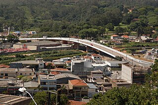
Franco da Rocha is a municipality in the state of São Paulo. It is part of the Metropolitan Region of São Paulo. The population is 156,492 in an area of 132.78 km2. The suburban city is served by CPTM Line 7 (Ruby).

<span class="mw-page-title-main">Guarantã</span> Municipality in Southeast, Brazil

Guarantã is a municipality in the state of São Paulo in Brazil. The population is 6,675 in an area of 462 km². The elevation is 505 m.

<span class="mw-page-title-main">Júlio Mesquita</span> Municipality in Southeast, Brazil

Júlio Mesquita is a municipality in the state of São Paulo in Brazil. The population is 4,800 in an area of 128 km². The elevation is 520 m.

<span class="mw-page-title-main">Lucianópolis</span> Municipality in Southeast, Brazil

Lucianópolis is a municipality in the state of São Paulo in Brazil. The population is 2,403 in an area of 190 square kilometres (73 sq mi). The elevation is 561 metres (1,841 ft).

<span class="mw-page-title-main">Macatuba</span> Municipality in Southeast, Brazil

Macatuba is a municipality in the state of São Paulo in Brazil. The population is 17,214 in an area of 225 km². The elevation is 515 m.

<span class="mw-page-title-main">Marinópolis</span> Municipality in Southeast, Brazil

Marinópolis is a municipality in the state of São Paulo in Brazil. The population is 2,106 in an area of 77.8 km². The elevation is 408 m.

<span class="mw-page-title-main">Pedranópolis</span> Municipality in Southeast, Brazil

Pedranópolis is a municipality in the state of São Paulo in Brazil. The population is 2,481 in an area of 260 km². The elevation is 475 m.

<span class="mw-page-title-main">Pongaí</span> Municipality in Southeast, Brazil

Pongaí is a municipality in the state of São Paulo in Brazil. The population is 3,400 in an area of 183 km2. The elevation is 422 m.

<span class="mw-page-title-main">Reginópolis</span> Municipality in Southeast, Brazil

Reginópolis is a municipality in the state of São Paulo in Brazil. The population is 9,837 in an area of 410.8 km2 (159 sq mi). The elevation is 391 m (1,283 ft).

<span class="mw-page-title-main">Rubineia</span> Municipality in Southeast, Brazil

Rubineia is a municipality in the state of São Paulo in Brazil. The population is 3,170 in an area of 243 km². The elevation is 317 m.

<span class="mw-page-title-main">São João das Duas Pontes</span> Municipality in Southeast, Brazil

São João das Duas Pontes is a municipality in the state of São Paulo in Brazil. The population is 2,561 in an area of 129 km². The elevation is 427 m.

<span class="mw-page-title-main">Uru, São Paulo</span> Municipality in Southeast, Brazil

Uru is a municipality in the state of São Paulo in Brazil. The population is 1,153 in an area of 147 km². The elevation is 427 m.

References

  1. IBGE 2020
  2. Instituto Brasileiro de Geografia e Estatística
  3. "Creation of Telesp - April 12, 1973". www.imprensaoficial.com.br (in Portuguese). Retrieved 2024-05-26.
  4. 1 2 "Our History - Telefônica RI". Telefônica. Retrieved 2024-05-26.